Download
1 / 41
420 likes | 483 Views
CHAPTER 6 Air-Sea Interaction. Seasons. Earth’s axis of rotation tilted with respect to ecliptic orbit around sun Tilt responsible for seasons Vernal (spring) equinox (3/21) sun overhead at equator Equal day/night periods Summer solstice (6/21)

E N D
Seasons • Earth’s axis of rotation tilted with respect to ecliptic orbit around sun • Tilt responsible for seasons • Vernal (spring) equinox (3/21) • sun overhead at equator • Equal day/night periods • Summer solstice (6/21) • sun overhead at Tropic of Cancer (23.5O N) • Longest day of the year in Northern hemisphere • Autumnal (fall) equinox (9/23) • sun overhead at equator • Equal day/night periods • Winter solstice (12/22) • sun overhead at Tropic of Capricorn (23.5O S) • Shortest day of the year in Northern hemisphere
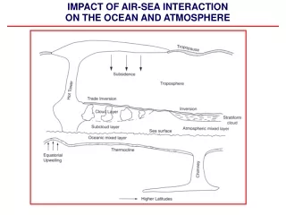
Arctic circle (66.5O N) • latitude receives direct sunlight all day on summer solstice • no direct sunlight during winter solstice • Antarctic circle – reverse of above Seasons • Seasonal changes and day/night cause unequal solar heating of Earth’s surface
Uneven solar heating • Angle of incidence of solar rays per area • Greater the angle, solar energy spread over more area • Equatorial regions more heat • Polar regions less heat • Thickness of atmosphere – absorbs or reflects energy • Think about South Florida compared to Maine
Uneven solar heating • Albedo • Albus = white • % incident radiation reflected back into space • Affected by angle of sun – more angle , more reflected • Affected by type of surface • Snow/ice reflects more • Water surface absorbs more • Land absorbs most • Day/night and seasonal cycles affect solar heating
Physical properties of atmosphere • Atmosphere is comprised of gases and dust • mostly nitrogen (N2) – 78% • Oxygen (O2) – 21% • CO2, water vapor, ozone (O3) are variable http://www.ux1.eiu.edu/~cfjps/1400
Physical properties of atmosphere • Warm air, less dense (rises) • Cool air, more dense (sinks) • Moist air, less dense (rises) • Dry air, more dense (sinks) Fig. 6.5
Winds, Wind Belts and Climate • Introductory geography • Equator = 0O latitude • Earth rotates from west to east • Wind direction indicated by direction winds are blowing from
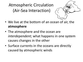
Movements in atmosphere • Air (wind) always moves from regions of high pressure to low • Cool dense air, higher surface pressure • Warm less dense air, lower surface pressure Fig. 6.6
Air movements over non-rotating Earth • Convectionorcirculation cell • Air heated at equator warm (less dense) air rises • Surface air moves in to replace rising air mass • Air expands & cools as it rises • As it cools, becomes more dense • Warm air holds more moisture than cooler air • As air cools moisture condenses & forms clouds/precipitation Fig. 6.7
Air movements over a rotating Earth • Coriolis effectcauses deflection in moving body due to Earth’s rotation to east • Most pronounced on objects that move long distances across latitudes • Deflection to right in Northern Hemisphere • Deflection to left in Southern Hemisphere • Maximum Coriolis effect at poles • No Coriolis effect at equator
Movements in air on a rotating Earth • Rotational velocity increases approaching equator Fig. 6.9
Global atmospheric circulation • Circulation cells as air changes density due to: • Changes in air temperature • Changes in water vapor content • Circulation cells • Hadley cells (0o to 30o N and S) • Ferrel cells (30o to 60o N and S) • Polar cells (60o to 90o N and S)
6 cells of windbelts and boundaries: • Intertropical convergence zone • Doldrums • Horse latitudes • Tradewinds • Westerlies • Polar front • Polar easterlies
1. Intertropical convergence zone (boundary) • Air warms and rises at equator • low surface pressure (rising air) poduce light winds = doldrums • Long ago sailing ships became stuck here because of lack of winds
Sink at about 30O N & S latitude • 2. Horse latitudes (boundary) – low winds, high pressure ridge • Dry, cool, sinking air • Sailors would also get “stuck” here and would through horses overboard to conserve water • Winds: • 3. Tradewinds return to Equator, deflected west • 4. Westerlies move toward poles, deflected east
Winds converge at 50-60O N & S with polar air • 5. Polar Front (boundary) - warm air rises (low press./clouds) • Upper air splits & cools sinks near poles • Winds: • 6. Polar Easterlies – air sinks near poles, moves from poles toward equator
Global atmospheric circulation • High pressure zones • Subtropical highs • Polar highs • Clear skies • Low pressure zones • Equatorial low • Subpolar lows • Overcast skies with lots of precipitation
Modifications to idealized 3-cell model of atmospheric circulation • Winds are more complex in nature due to… • Seasonal changes • Distribution of continents and ocean • Differences in heat capacity between continents and ocean • Monsoon winds
Ocean weather and climate patterns • Weather – conditions of atmosphere at particular time and place • Climate – long-term average of weather • Northern hemisphere winds move counterclockwise (cyclonic) around a low pressure region • Southern hemisphere winds move clockwise (anticyclonic) around a low pressure region http://www.wunderground.com/US/Region/US/2xFronts.html
Coastal winds • Caused by solar heating & different heat capacities of land and water • Sea breeze • From ocean to land • During day, land heats air rises draws cooler ocean air onto coast • Land breeze • From land to ocean • At night, warmer ocean water rises, draws cooler land air over coast Fig. 6.13
Fronts and storms • Air masses • Large volumes of air, meet at fronts • Storms • Disturbances with strong winds, precipitation, often with thunder and lightning • typically develop at fronts
Warm front • contact between moving warm air mass with cooler air mass • More extensive, lighter rains • Cold front • contact between moving cold air mass with warmer air mass • Usually steep front, with heavier, but briefer, rains • Clear skies follow behind
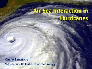
Tropical cyclones (hurricanes) • Caused by release of energy (latent heat of condensation) • Low-pressure system breaks off equatorial low-pressure belt • Surface winds feed moisture into storm • As water vapor condenses, heat released warms air • Rising warm air draws in more moist air fueling cyclone • Large rotating masses of low pressure with calm “eye” (< 25 mph winds) • Strong winds, torrential rain outside eye Fig. 6.16
Hurricane movement • At low latitudes, affected by trades move west • Curve toward right in No. hemisphere cooler water, influenced by westerlies Hurricane Wilma 10/25/2005 http://cimss.ssec.wisc.edu/tropic/archive/montage/atlantic/2005/WILMA-track.gif
Hurricane destruction • Fast winds • Flooding from torrential rains • Storm surgemost damaging • increased water levels from low pressure at eye • On top of tide, most damaging at high tides • Storm waves on top of storm surge Historical examples: Galveston, TX, 1900 Hurricane Andrew, 1992 Hurricane Mitch, 1998 Hurricane Katrina, 2005
Ocean climate patterns • Equatorial regions • Warm, lots of rain • Tropical regions • Warm, less rain, trade winds • South Florida is tropical, defined rainy and dry season • Subtropical regions • Warm, lots of wind and evaporation, find dessert areas • Temperate regions • Strong westerlies • Subpolar regions • Cool, winter sea ice, lots of snow • Polar regions • Cold, ice
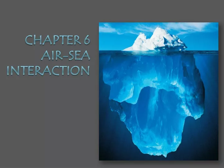
Polar oceans and sea ice • Sea iceor masses of frozen seawater form in high latitude oceans • Begins as small needle-like ice crystals • Pushes out dissolved salts dense brine • Ice is much lower salinity • Rate of formation depends on temperature
http://static.howstuffworks.com/gif/iceberg-calving.jpg Polar oceans and icebergs • Icebergs – fragments of glaciers or shelf ice
Global warming (Climate Change) • Average global temperature increased • Part of warming due to anthropogenic greenhouse (heat-trapping) gases such as CO2 http://earthobservatory.nasa.gov/Library/GlobalWarming/Images/temperature_vs_co2_rt.gif http://healthandenergy.com/images/carbon%20dioxide%201700-2000.jpg
Greenhouse effect • Solar radiation enter atmosphere • Some of that radiation is reflected to space • Some of it is reflected back towards Earth by trace gases and particles in the atmosphere • Elevated levels of carbon dioxide, methane, etc can increase that effect • Literally “trapping” more heat in the atmosphere close to the Earth Fig. 6.24
Greenhouse gases • Absorb longer wave radiation from Earth • Many “greenhouse gases” • Water vapor – most common and important • Carbon dioxide (CO2) • Other trace gases: methane, nitrous oxide, ozone, and chlorofluorocarbons
Current controversy is not whether global temperatures are increasing, but in the extent of human impact • The climate is changing, we cannot deny that • The last time this happen human population was not as large, even small changes in climate can effect agricultural crops, larger storms hitting populated areas, etc. • Is it significantly above natural background change? • Can we afford to keep our heads in the sand?
Consequences of global warming are not certain, but can be predicted… • When scientists say “uncertain” it DOES NOT mean that they do not know what they are talking about • It does not mean that there will not be consequences • It is just difficult to predict the extent of those consequences, the timing of those consequences, etc. • This is the first time we are experiencing these changes with today’s society • The Earth and it’s systems are dynamic – constantly changing • But when we talk about these changes, we are talking about thousands, millions of years • Our society, population boom, building of extensive cites along coastlines, etc has been very recent • So, let’s say for a moment that man isn’t making it worse by putting more carbon dioxide into the atmosphere – changes are still happening……and we have to be prepared to deal with them….
Consequences of Climate Change Sea level rise Contamination of freshwater sources Vulnerability of more low-lying areas to storm surges Shift in species distribution Shifts in climate patterns will affect all living organisms Melting ice caps & expanding deserts threaten wildlife Extreme weather patterns Heat waves, extreme winters, larger storms in populated areas Droughts will affect productivity and crops Changing ocean chemistry Ocean water will become more acidic, warmer Changes in ocean circulation Spread of tropical diseases
Possible Impacts of Climate Change on South Florida • Possible sea level rise of 15-20 inches by 2060 • South Florida Water Management plays a delicate balancing game to ensure that areas in South Florida don’t flood during rain events (canal system), higher sea level would make that more difficult – areas would be more vulnerable to flooding • Greater vulnerability to storm surges and erosion • Salt water intrusion – fresh water supply for the population could be threatened
Reducing greenhouse gases • Greater fuel efficiency • Alternative fuels • Re-forestation • Eliminate chlorofluorocarbons • Reduce CO2 emissions • Intergovernmental Panel on Climate Change 1988 • Kyoto Protocol 1997
Ocean’s role in reducing CO2 • Oceans absorbs CO2 from atmosphere • CO2 incorporated in organisms and carbonate shells (tests) • Stored as biogenous calcareous sediments and fossil fuels • Ocean is repositoryorsink for CO2 • Increases ocean acidity enough to affect organisms (corals) http://www.whoi.edu/science/MCG/cafethorium/website/images/tzex_img1.jpg