Download
1 / 10
120 likes | 270 Views
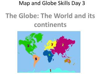
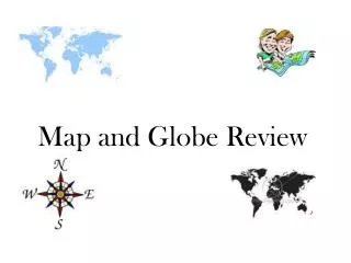
Map and Globe Skills. Grade 4. Maps. a representation, usually on a flat surface, as of the features of an area of the earth, showing them in their respective forms, sizes, and relationships. Atlas. an atlas is a collection of maps bound together. Globe .

E N D
Map and Globe Skills Grade 4
Maps • a representation, usually on a flat surface, as of the features of an area of the earth, showing them in their respective forms, sizes, and relationships
Atlas • an atlas is a collection of maps bound together.
Globe • a globe is a sphere on which is depicted a map of the earth.
Latitude and Longitude Latitude Lines: lines dividing a map or globe that run horizontal (east to west)to help give location point Longitude Lines: lines dividing a map or globe that run vertical (north to south) to help give location point
Illustrated Geography Terms Let’s look at some of the terms that you will be looking at on the map: Valley—Death Valley Plains—Great Plains Lake—Great Lakes Gulf—Gulf of Mexico River—St. Lawrence River Coast—Coastal Plain
Graphic Scales • Since an accurate map represents the land, each map has a "scale" which indicates the relationship between a certain distance on the map and the distance on the ground. • The map scale is usually located in the legend box of a map, which explains the symbols and provides other important information about the map. A map scale can be printed in a variety of ways.