Download
1 / 44
470 likes | 713 Views
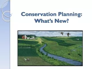
Freshwater conservation planning. Jeanne Nel jnel@csir.co.za. Systematic conservation planning and the role of software: from data to implementation and management Society for Conservation Biology Port Elizabeth 26-29 June 2007. Outline. Framework for freshwater conservation planning

E N D
Freshwater conservation planning Jeanne Nel jnel@csir.co.za Systematic conservation planning and the role of software: from data to implementation and management Society for Conservation Biology Port Elizabeth 26-29 June 2007
Outline • Framework for freshwater conservation planning • Planning units for freshwater • Mapping biodiversity pattern • Incorporating biodiversity processes • Quantitative targets • Conservation design • Scheduling catchments for implementation • Integration with terrestrial conservation • Implications of climate change • Try to cover “high road” (plenty of data, time and funding) and “low road” (no data, or rapid assessment) options
Framework for freshwater conservation planning • Same overarching goals and principles to terrestrial • No single “recipe” as methods depend on: • Data availability • Expert knowledge • Skills & training of the conservation planning team • Time & budgetary constraints • Attention needs to be given to: • Supporting process data layers, especially connectivity • Rehabilitation • Supporting process layers are space hungry – make more palatable for implementation through: • Multiple-use zoning • Scheduling
Planning units • Sub-catchments small enough to match variability of biodiversity pattern • Immediately captures some degree of connectivity • These are still generally larger than terrestrial planning units
Biodiversity pattern • River types • Focal fish species • Focal invertebrate species • Wetland types • Free-flowing rivers • Special features • Riparian forests • Scenic gorges and waterfalls • Large intact wetlands
Biodiversity pattern: river types • Top down vs bottom up approaches (Kingsford et al. 2005) • Based on variables that drive heterogeneity vs those that respond to heterogeneity • Drivers generally based on hydrology and geomorphology, for which surrogates can be derived • Response variables generally use biota and water chemistry, are data intensive and often confounded by human impacts • General trend is to use hydrogeomorphological classification ………..ANDsupplement wherever possible with freshwater focal species Classification approaches: • Higgins et al. 2005. Conservation Biology 19(2): 432-445 • Kingsford, R.T. et al. 2005. Available from: http://www.ids.org.au/~cnevill/RiversBlueprint.pdf
Biodiversity pattern: river types Application of classification approaches: • Nel et al. 2007. Diversity and Distributions 13: 341-352 • Thieme et al. 2007. Biological Conservation 135: 484-501 VEGETATION Spatial overlay GEOLOGY …clean slivers & assess ”false heterogeneity” LANDSCAPE-LEVEL CLASSIFICATION CLIMATE HYDROLOGICAL VARIABILITY Spatial overlay RIVER TYPES STREAM GRADIENTS STREAM-LEVEL CLASSIFICATION
Biodiversity pattern: River types • Hydrological variation • Low road: model water balance using mean annual precipitation and evapotranspiration; provides sub-catchment level hydrology • Middle road: model using hydrological gauge data; generally only available for main rivers • High road: use topocadastral data which ID’s perenniality based on seasonal surveys • Stream gradients • Low road: use elevation thresholds to ID high-elevation, mid-elevation and lowland streams • High road: Model stream slope based on rivers and DEM GIS layers & assign geomorphological zonation:
Example of river types…… From: • Nel et al. 2006. Available from: http://www.waternet.co.za/rivercons/
Biodiversity pattern: Wetland delineations • Orthophotos and user-interpretation – works very well but time-consuming and mentally tedious • Remote sensing: • Fine-resolution (< 30 m) imagery hold potential but is still relatively expensive • 30 m resolution imagery with wetness potential models (based on seasonality, geology, topography) has been used in South Africa, but with disconcerting levels of accuracy • Amalgamation of existing GIS layers: • Delineations from ad hoc site visits by ecologists • Wetlands marked on 1:50 000 topocadastral maps • 30 m resolution waterbodies corrected for dams, and enhanced using wetness potential models) Relevant literature: • Ewart-Smith et al. 2006. Available from the Water Research Commission, South Africa, Report K8/652. • Goetz et al. 2006. Journal of the American Water Resources Association. 42(1):133-143.
Biodiversity pattern: Wetland types • Floristic vs hydrogeomorphological classification frameworks • Hydrogeomorphological frameworks classify according to ecological functional type and tend to be more commonly used • South African National Classification Framework: • Hierarchical • Based primarily on hydrogeomorphological criteria • Biotic criteria are used as secondary descriptors Secondary descriptors Level 1: Primary descriptors Relevant literature: • Ewart-Smith et al. 2006. Available from the Water Research Commission, South Africa, Report K8/652.
Biodiversity pattern: Wetland types • Functional type is based on drainage, landform and/or setting • Can use surrogates based on river buffers, soil depth and slope • Slope from United States 90 m digital elevation data; http://www.personal.psu.edu/users/j/z/jzs169/Project3.htm • Soil from General Soils Pattern Map of South Africa which provides soil and terrain information at a 1:250000 scale. Available from www.agis.agric.za. • Results are strongly limited by scale of environmental surrogates
Example of wetland types…… From: • Nel et al. 2006. Available from: http://www.waternet.co.za/rivercons/
Biodiversity pattern: Focal fish species • Umbrella, keystone, flagship, threatened, rare or endemic species • Point locality & expert knowledge • What is the status of the population at each locality • Exclude marginal river reaches; select ones with the most suitable habitat & containing populations large enough to be “viable” • Modelled distributions and probability of occurrence • Core populations based on abundances • Needs to be accompanied by persistence considerations Relevant literature: • Brewer et al. 2007. North American Journal of Fisheries Management 27:326–341. • Filipe et al. 2004. Conservation Biology 18:189-200. • Nel et al. 2006. Available from: http://www.waternet.co.za/rivercons/ • Winston & Angermeier 1995. Conservation Biology 9:1518-1527.
Example of fish sanctuaries and connector areas From: • Nel et al. 2006. Available from: http://www.waternet.co.za/rivercons/
All families (90) Focal genera (25) Biodiversity pattern: other focal species • Data almost non-existent • Invertebrates often exist at family level; rarely species level problematic • But see Linke et al. 2007 Relevant literature: • Linke et al. 2007. Freshwater Biology 52:918–938.
Biodiversity pattern: special features • The low road option of incorporating expert knowledge! • Features generally include: • Rivers free of alien fish • Intact river gorges & waterfalls (scenic and evolutionary value) • Large known & intact wetland systems • All were included as moderate protection zones in the final conservation design, PLUS • Planning unit cost was “discounted” for all sub-quaternary catchments containing special features
Outline • Framework for freshwater conservation planning • Planning units for freshwater – sub-catchments….see Hydrosheds • Mapping biodiversity pattern • Incorporating biodiversity processes • Quantitative targets • Conservation design • Scheduling catchments for implementation • Integration with terrestrial conservation • Implications of climate change • Try to cover “high road” (plenty of data, time and funding) and “low road” (no data, or rapid assessment) options
Biodiversity processes • Four key considerations for freshwaters: • Step 1: Select systems of high ecological integrity • Step 2: Incorporate connectivity • Step 3: Incorporate any additional spatial processes • Step 4: Select persistent populations Relevant literature: • Pressey et al. in press. Trends in Ecology and Evolution. • Pressey et al. 2003. Biological Conservation 112: 99–127. • Rouget et al. 2006. Conservation Biology 20(2): 549–561. • Sarkar et al. 2006. Annual Review of Environmental Resources 31:123–59.
Step 1: Select systems of high ecological integrity • Incorporates numerous local-scale processes & large-scale processes associated with the natural flow regime • Use as an initial screening mechanism in selecting for pattern targets • Field-based biological assessments at site-level BUT labour intensive • Land cover surrogates in riparian buffers & throughout the catchment • BUT cumulative upstream impacts can be problematic • Wherever possible use field-based data and modelling in combination Relevant literature: • Amis et al. 2007. Water SA 33(2): 217-221. • Matteson & Angermeier 2007. Environmental Management 39:125–138. • Snyder et al. 2007. Journal of the American Water Resources Association 41: 659-677.
Used national data (Kleynhans 2000) Flow Inundation Water quality Stream bed condition Introduced instream biota Riparian or stream bank condition Integrity categories A (largely natural) to F (unacceptably modified) Evaluated against site assessment data Methods for mapping ecological integrity Main rivers in quaternary Tributaries (all other 500K rivers) • Used 30 x 30 m national land cover to calculate % natural vegetation, deriving: • Catchment disturbance index (sub-quaternary catchment) • Riparian disturbance index (within a GIS buffer of 500 m) • Macro-channel disturbance index (within a GIS buffer of 100 m) • Used 80% as threshold for “intact” vs “not intact” • Downgraded any intact tributaries with > 5 % erosion within 500 m of channel
Map of ecological integrity • 23% main rivers intact; 57% if tributaries are added • Emphasizes the role of tributaries as refugia • Main rivers need to be in a state that supports connectivity From: • Nel et al. 2006. Available from: http://www.waternet.co.za/rivercons/ Other application studies: • Linke et al. 2007. Freshwater Biology 52:918–938 • Thieme et al. 2007. Biological Conservation 135: 484-501
Wetland integrity/condition • Use NLC2000 to calculate % natural vegetation, deriving: • Catchment disturbance index (sub-quaternary catchment) • Buffered core disturbance index (within a GIS buffer of 100 m) • Core disturbance index (within a GIS buffer of 50 m) • Assign the minimum of these three indices to each wetland • Any wetland with a minimum natural vegetation of ≥ 90 % considered “Intact”, all others “Not intact” • For 10 wetland types that cannot meet their conservation targets in “Intact” wetlands, lower the minimum natural vegetation threshold to 80 % • 8 wetlands still cannot achieve targets……Need to look at rehab
Step 2: Incorporate connectivity • 3 spatial dimensions: • Longitudinal • Lateral • Vertical • 1 temporal dimension • natural flow regime • temporal availability of surface water • All 4 dimensions are highly inter-dependent • Space hungry so try to allocate different protection levels Federal Interagency Stream Restoration Working Group 1998 (http://www.nrcs.usda.gov/technical/stream_restoration/Images/scrhimage/part1/part1a.jpg). Relevant literature: • Freeman et al. 2007. Journal of the American Water Resources Association 43(1):5-14. • Pringle 2001. Ecological Applications 11(4): 981-998. • Ward 1989. Journal of the North American Benthological Society 8: 2–8.
Longitudinal connectivity • Large rivers free of artificial barriers • “High” protection level • Habitat requirements explicitly mapped • “High” & “Moderate” protection level • Upstream management zones • “Moderate” protection level
Lateral connectivity • Modelled sub-catchments • Allocated a “Very high” protection level if needed for pattern targets • Riparian zones • 50 m: mountain & upper foothill streams • 100 m: lower foothills & lowland rivers • Allocated a “High” protection level • Wetland functioning zones • Functional types were afforded different protections levels based on their functional importance & sensitivity
Wetland functioning zones Need to investigate linking different buffer widths to functional importance and sensitivity…………
Vertical connectivity • Groundwater sustains river flow and refuge pools in the summer low flow periods • Significant areas of groundwater-surface water discharge • Areas where there is a medium to high prediction of groundwater to surface water interaction • Modelled using 6 GIS surrogates: geological permeability, groundwater depth, springs, faults, presence of groundwater dependent vegetation, national estimates of baseflow contribution • Significant areas of groundwater recharge • Use 1 x 1 km national recharge data, based on the Chloride Mass Balance • Areas with > 30 mm/yr recharge considered significant • These were allocated a “Moderate” protection level Relevant literature: • Baker et al. 2003. Environmental Management. 32(6): 706-719. • Brown et al. 2007. CSIR Report No. CSIR/NEW/WR/ER/2006/0187B/C, CSIR, Pretoria.
Vertical connectivity Groundwater-surface water discharge Groundwater recharge
intact not intact Temporal connectivity • Spatial dimensions are strongly dependent on temporal dynamics of the natural flow regime • Rivers cannot be “locked-away” • Environmental Flow Assessments try to balance human & ecological requirements • Recommendations for Olifants, Doring and 2 major tributaries: • Compromise middle reaches of Olifants for no further development of the Doring; & for some rehabilitation • Tributaries of the Doring responsible for majority of Mean Annual Runoff included as upstream management zones & afforded “Moderate” protection levels Relevant literature: • Brown et al. 2007. CSIR Report No. CSIR/NEW/WR/ER/2006/0187B/C, CSIR, Pretoria.
Step 3: Incorporate any additional spatial processes • Steps 1 and 2 cater for generic processes of most freshwater systems • There may be other specific processes that can be mapped, also termed: • “Fixed spatial components" (Rouget et al. 2006) / “Spatial catalysts" (Pressey et al. in press) • Commonly defined using environmental surrogates such as climate, topography, geology, soils and vegetation • Freshwater-specific examples: • Areas of significant water yield (Driver et al. 2005) • Areas of high erosion potential (Adinarayana et al. 1999) • Evolutionary barriers, e.g. waterfalls & gorges (Roux et al. 2002) • Generally can beallocated a “Moderate” level of protection. Relevant literature: • Adinarayana et al. 1999. Catena 37:309–318 • Driver et al. 2005. Strelitzia 17: 1-45. • Pressey et al. in press. Trends in Ecology and Evolution. • Rouget et al. 2006. Conservation Biology 20(2): 549–561. • Roux et al. 2002. Conservation Ecology 6(2): 6. [online] URL: http://www.consecol.org/vol6/iss2/art6
Step 4: Select persistent populations • Accommodated by Steps 1 and 2, but serves as a further safe-guard where data exist • Considers requirements specific to the persistence of each focal species, for example: • Identifying and establishing linkages between all critical habitat • Identification of spatial refugia and relevant linkages • Replication within the planning region in areas that are unlikely to be influenced by the same natural or human disturbances • Incorporating populations or metapopulations that are large enough to prevent extinction from random demographic and genetic events Relevant literature: • Moyle & Yoshiyama 1994. Fisheries 19:6-18. • Poiani et al. 2000. BioScience 50(2): 133-146.
Persistent populations • Replication • Pattern targets can stipulate that each species must be represented at least twice by populations preferably on different major river systems • Suitable habitat & populations • Core populations • River with the most suitable habitat & containing the largest populations should be selected from point locality data for achieving pattern target • Habitat requirements • Many of the larger-sized species require a combination of mainstem and tributary habitat • For small-sized species, vulnerable to predation by invasive species in the mainstem, connectivity was excluded • Fish sanctuaries for pattern targets afforded the highest protection level (“Very high”); linkages between sanctuaries allocated a “Moderate” protection level
The importance of zones • So much land freaks managers out • Allocating multiple-use zones can help, e.g. : • Freshwater focal area • Critical management zone • Catchment management zone From: • Abell et al. 2007. Biological Conservation 134: 48-63.
Sub-catchments as planning units Ecological integrity Species habitat suitability & population size Species replication [Habitat requirements] Large, “free-flowing” rivers Habitat requirements High water yield areas Riparian zones Wetland functioning zones Groundwater-surface water discharge areas Groundwater recharge areas Upstream management zones Guidelines on environmental flows How to incorporate all these processes Implementation
Outline • Framework for freshwater conservation planning • Planning units for freshwater – sub-catchments….see Hydrosheds • Mapping biodiversity pattern • Incorporating biodiversity processes • Quantitative targets & conservation design • Scheduling catchments for implementation • Integration with terrestrial conservation • Implications of climate change • Try to cover “high road” (plenty of data, time and funding) and “low road” (no data, or rapid assessment) options
Conservation targets • River and wetland types • Generally use 20%, based on length of river; area of river buffered by 100 m; area of sub-catchment; area of wetland • Occurrence has also been used – e.g. at least one of river type X • Combination of 20% and occurrence can also be used – e.g. 20% of each wetland type represented in at least 3 different systems • Species • Simplistic – at least once • Replication – at least twice, preferably on different major systems • Free-flowing rivers & special features • 100% but for special features generally do not include the whole planning unit, only the feature itself • Discount the planning unit cost to favor selection for other conservation targets
Spatial configuration for pattern targets • Decision support software for achieving pattern targets, e.g. Marxan or C-Plan: • C-Plan calculates irreplaceability better • Marxan does costs and connectivity better • Generally combine, but similar matrices so not much extra work • Matrices
Spatial configuration for pattern targets • Planning unit cost used to achieve additional spatial efficiency with: • Spatial catalysts (e.g. apply a discount to planning units containing free-flowing rivers or water yield areas by) • Terrestrial priority areas • We hardly ever use area as cost; and have not yet integrated soic-economic costs into our planning • Boundary penalty • Strong boundary penalty to pass-through sub-catchments will force connectivity • Difficult to allocate multiple-use zones are selected planning units for pattern, connectivity or both • Therefore tend to be conservative with the boundary penalty factor
Conservation design • Using costs & boundary penalty, choose areas for pattern targets
Conservation design • Using costs & boundary penalty, choose areas for pattern targets • Add in areas requiring rehabilitation
Conservation design • Using costs & boundary penalty, choose areas for pattern targets • Add in areas requiring rehabilitation • Add in supporting zones
Future work • Testing the performance of surrogates • Integration with terrestrial • Wetlands and riparian zones of selected rivers integrate well with terrestrial planning units • In areas where there are no river choices, select rivers first and then achieve residual terrestrial and wetland targets • In areas where there are choices, investigate using terrestrial priorities in the sub-catchment planning unit cost • Terrestrial priority areas may conflict with FW goals • Scheduling • Integrating socio-economic costs; particularly with target achievement
Climate change • Aaaargh!!! ------Eren help!!!!