Download

1 / 20
200 likes | 375 Views
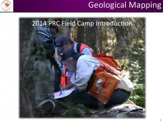
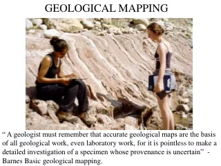
Geological Mapping. 2014 PRC Field Camp Introduction. Todays World, LIDAR……. Types of Geological Mapping. Regional Scale (typically government geoscientists) District Scale (typically government geoscientists) Property Scale (typically industry geoscientists)

E N D
Geological Mapping 2014 PRC Field Camp Introduction
Types of Geological Mapping • Regional Scale (typically government geoscientists) • District Scale (typically government geoscientists) • Property Scale (typically industry geoscientists) • Trench/Outcrop Scale (typically industry geoscientists) ImportantvsInteresting Data Depends on the scale of mapping project
Relative Quality of Geological Maps • Many factors affect the quality of the finished map • Frequency & distribution of outcrops • Complexity of stratigraphy & structure • Nature of topography • Experience of the field geologist (field methods & interpretations) • Quality & quantity of previous investigations • As a general rule, methods which insure a high degree of precision also consume more time • The ideal plan is one in which all aspects of the work are evaluated with regard to the scale of the finished product – the MAP • The key to such plans is balance
Task of a Field Geologist • Observing & Recording the: • Location of outcrops • Description of strata • Strike & dip of strata • Contact relationships between strata • Structural juxtaposition of rock units • Projection of these data into areas or depths where direct observation is impossible. • Interpretation of a Geologic History • In mineral exploration, timing & style of mineralization
Requirements of Field Geologists • Modern field geology is a multifaceted discipline that integrates basic field skills, geochemical and geophysical data sets, advances in technology, and new theoretical concepts into geological maps. • At the most basic level, geological field mapping skills have always been based on the ability to recognize and map igneous, metamorphic, and sedimentary rocks and interpret their inter-relationships, structural setting and juxtaposition. • Peer review of the stratigraphic and structural compatibility of a colleague’s geologic map is required of field geologists. • Specialized field mapping skills are GAINED WITH EXPERIENCE and may include, for example, volcanological reconstruction, sedimentary basin architecture and facies analysis, or hydrothermal alteration patterns and associated mineralization.
Required skills of the field geologist • basic field mapping skills, • core logging of drill holes, • integration and interpretation of geophysical data, • utilization of geochemical analyses, • compilation and integration of existing data into mapping projects, • digital map generation in geographic information systems (GIS), • analysis of the structural and stratigraphic compatibility of a completed mapping project, • knowledge of cartographic conventions and professional quality map layout, • budget development and tracking of the time, money, and human resources required to complete projects, • dissemination of the geologic map and ancillary data to others.
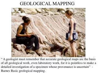
Field Methods • The detailed step by step procedures used in collecting and presenting the basic data obtained from outcrops. • This phase of investigation is vital, for on it will rest all succeeding conclusions. • The field measurements, maps, and associated data constitute the framework upon which far-reaching concepts are developed. • Therefore, the success (or failure) of costly mineral exploration tasks, such as drilling, rests entirely on the reliability of the field geologists work, which cannot easily be repeated (unlike much laboratory work).
Mapping Boards & Field Sheets • Three-piece Plexiglas boards sized to fit inside pockets of field vests work best. • Draw outcrop outlines in INK and fill in with COLOR • Dash in contacts IN THE FIELD where possible • Plot dashed arrows to show your traverses
Field Notes A good field geologist will construct a NEAT and USEFUL field notebook, the four main purposes are: • Recording data to look back upon later. • Remember that your memory is fallible and that in the years to come you may well have to look at a notebook in order to make new geological interpretations. • To stimulate the mental discipline necessary to concentrate and focus your attention upon the rock. • You always look and think more carefully when you have to write something down or draw it out. • Record ad hoc interpretations which may spring to mind from time to time. • This is particularly the case in structural geology where you may wish to sketch out flights of fancy. • A legible field notebook can be used by your peers, successors, and supervisors. • This can save them a lot of time, money, and repetitive labor.
Organizing a Field Notebook • I highly advise using loose-leaf notebooks • You can add specialized pages • Write out an emerging Table of Contents • Separate section for rock descriptions • Use Page Numbers • A picture is worth a thousand words • Maybe a couple of thousand words • Summarize your thoughts/ideas DAILY on the last page of your day’s notes • Write out questions, if you answer them later, then refer back & forth to page #’s
and can be used with Photographs I commonly photograph my Map or outcrop sheet prior to taking digital pictures of an outcrop. Much easier to remember where the photos were taken from.
Structural Geology The small scale reveals the large scale
Strike & Dip (planes) Bedding Foliation Shear bands Contacts Igneous layering Veins Joints Trend & Plunge (lines) Mineral lineations Intersection lineations Fold axis From my experience ….. It’s simply not possible to have to many structural measurements Always use the RIGHT HAND RULE in measurements
Using Stereonets Never Never Never Never Never be afraid!!!
Geological Maps are Never Correct A map is the author(s) interpretation of the factual data gathered in the course of field mapping. The best maps are thus outcomes of sound interpretations of the facts by geologists. Good geological maps present the factual data in such a way that future geologists may use this data to make new interpretations. (typically based on new information and/or ideas).
Geological Maps • Maps are one of the main means that field geologists use to report their findings • Also their field notes, presentations, discussions, etc.. • The map must be as accurate as possible • Is it stratigraphically & structurally compatible (does it make sense in itself or with the more regional picture?) • The map must be visually appealing • A good looking map conveys the message that the author (the field geologist) knows what they are doing (see below) • In the mineral industry, these maps will be used by many people for multiple reasons • Therefore it must contain enough ancillary information in order for other people (whom are not as familiar with the geology as the field geologist) to make decisions (drill hole targeting, investing, etc..) based largely on what is conveyed on the map.
Professional Quality Geologic Map • Title, Authors, Map Number • Scale, North Arrow, Coordinate System • Location Map • Map Symbols • Description of Map Units • Correlation Diagram • Explanatory Notes • Introduction • Structure (stereonet plots) • Mineralization • Thoughts, ideas, recommendations • References
Description of Map Units Write out descriptions of all rocks & map units ON THE OUTCROP No description should be trusted to one’s memory Oldest Youngest Color, grain-size, texture, name. Additional detail in the subsequent sentences.