Download
1 / 38
530 likes | 1.57k Views
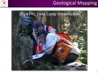
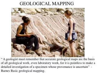
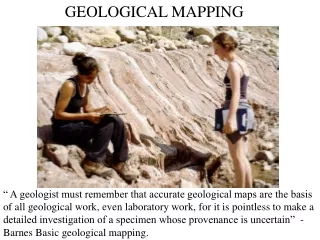
GEOLOGICAL MAPPING. “ A geologist must remember that accurate geological maps are the basis of all geological work, even laboratory work, for it is pointless to make a detailed investigation of a specimen whose provenance is uncertain” - Barnes Basic geological mapping.

E N D
GEOLOGICAL MAPPING “ A geologist must remember that accurate geological maps are the basis of all geological work, even laboratory work, for it is pointless to make a detailed investigation of a specimen whose provenance is uncertain” - Barnes Basic geological mapping.
Where will you be mapping?-1 • Semester 2- Easter: one week residential course (Leader Prof Eelco Rohling, March 31 April 7 • A series of exercises involving mapping, logging and construction geological cross-sections from field data. The locality (Tenby, South Wales) will also provide an introduction to a wide range of rock types and a large variety of field relationships, sedimentary and tectonic structures.
Where will you be mapping?-2 • Summer term weekend May 11 – 14 (Brittany residential field course) • Basic field skills but in an area of more complex igneous and metamorphic geology
Where will you be mapping?-3 • SOES 2012 (M Geol, Geology Single Honours, Geology with...., MGeoph,GS). • First summer vacation: residential field course at Ingleton (Leader Dr D Teagle, - First week Summer vacation) • This course provides basic training in field mapping and involves the production of a geological map of the Ingleton area.
Where will you be mapping?-4 • SOES 2022 (M Geol, Geology Single Honours, Geology with....and Geoscience pathway for OESS). • Easter vacation: residential field course, Almeria: leader Heiko Pälike • This course provides an opportunity to map, log and interpret a variety of different rock associations helping to build a comprehensive experience of field geology. The focus is provided by detailed study of some well exposed examples of geological processes. It also affords an introduction to fieldwork in an overseas environment.
Where will you be mapping?-5 SOES 3025/3027(M Geol, Geology Single Honours, Geology with....). • Year 2 Summer term (after semester 2 examinations): one week course (Anglesey: leader Dr Dorrik Stow) This completes the core component of fieldwork training. It focuses upon the challenges of mapping in an area of more complex geology where emphasis is placed upon the collection and presentation of data and putting into practice methods introduced in lectures and the laboratory. • NB OC/GY and OESS oceanography pathway students take SOES 3018 (Plymouth). Geophysical Sciences students take SOES 3021, Geophysical field methods
“ There is no substitute for the geological map and section - absolutely none. There never was and there never will be. The basic geology must come first - and if it is wrong, everything that follows will probably be wrong” - Wallace (1975) Mining Engineering, 27, 34-36.
Geological mapping: an ability to: • observe and record field data selectively and systematically for the construction of a geological map at a given scale; • compile a field note book containing an accurate record of all field data, including field sketches and photographs; • compile field sheets representing a visual summary, using accepted conventions, of all the mapping data recorded in the field notebook; • construct an accurate and well drafted interpretative geological map using conventional map symbols; • construct a representative geological section across the mapped area • (Geological Society of London)
LOCATE A fundamental skill is to be able to correctly position yourself on your base map
LOCATE – HOW? • Check grid orientation on map • Check compass, set declination • Triangulate (use compass to take bearings on three prominent features). Aim for small (< 1mm) triangle of error. • Pace and bearing. Pace out distance from known feature marked on map (use compass to take bearing on feature and mark faintly on map so line can easily be removed) • GPS -widely used in industry: new course SOES 2023 next year
LOCATE On a 1:10 000 map, 1 cm on the map represents 100 m in the field. You should be able to pinpoint yourself to within 10 m in the field, so when you translate this to the map, the margin for error is 1 mm Remember, when mapping at 1:10 000 scale, millimetre accuracy is expected
OBSERVE Spend some time looking at the exposure. What is the rock type? – Mineral composition? Grain size? Texture? What structure can I see? – Bedding? Tectonic fabric? Sedimentary structures?
OBSERVE • Observations are recorded in two ways; • On the field map (field sheet or slip) • In the field notebook (information which cannot be accommodated on the field map – see ppt on Blackboard - geological field work). • Map data is also normally recorded in the field notebook using a locality number reference system on the map and a grid reference in the field notebook • Thus you can navigate between the two.
ON THE MAP • All exposures ringed by a solid line, colour coded by formation with an abreviated lithological descriptor e.g. f.gr.rd. sstn (= fine grained red sandstone • Information about what can seen (can be pictorial) • All structural data, unless there is too much to fit it all on the map, in which case, representative structural data
You can put all sorts of things on the map, e.g. where you took a photograph or collected a sample
Ringed areas of exposure should be moderately coloured; surrounding unexposed areas should be shaded very lightly with the same colour.
RECORDING EXPOSURES • Map A: good features • Represents exposure shape on the map as accurately as possible, bearing in mind the scale • Accurate placement of boundary due to accurate recording of observations • ‘V’ effect in valley where boundary is inferred • Map B: poor features • Exposures too blobby and not to scale • Boundary poorly placed due to above features • ‘V’ effect in valley not interpreted
MAPPING TECHNIQUES • Traversing • Walking along a predetermined route plotting in the geology on the way • The geology in between traverses is interpolated, using whatever clues can be gleaned from the topographic map • This method is used predominantly for reconnaissance work • Large areas of ground can be covered
MAPPING TECHNIQUES • ‘Green line’ mapping • Exposures ringed by green lines using a very fine (0.1 mm) nib size • ALL exposures are portrayed. There should be evidence on the map that all the ground has been covered • When all exposures have been mapped, boundaries between the units can be drawn on the map • The classic technique for 1: 10 000 mapping Barnes: Plate 1
MAPPING TECHNIQUES • Boundary mapping • One of the main aims in compiling a geological map • Locate a boundary and follow it across the map • One of the easiest methods of mapping where exposure is good • Very effective in conjunction with aerial photographs • Does not work well if exposure is poor
STRUCTURAL DATA Use compass to transfer reading directly onto the map, e.g. strike direction Draw appropriate symbol on map in black ink with fine pen at point of measurement Indicate dip (plunge) amounts in figures on map. Record compete data in notebook Use red ink for faults if possible
MAPPING IN POORLY EXPOSED AREAS • You need to look for and record on the map indirect evidence, e.g. • Soil colour, spoil from man-made holes, fence posts, animal burrows • Float (loose rocks or stones which may reflect the underlying bedrock) but be wary of fluvially transported material • Vegetation can reflect underlying bedrock e.g. limestones – beech,juniper
MAPPING IN POORLY EXPOSED AREAS • Feature mapping • Map topographic features that may indicate underlying differences in the geology • Use them to help locate boundaries in unexposed areas • Map convex and concave breaks of slope Convex break of slope, tick on downhill side Concave break of slope, tick on uphill side
FEATURE MAPPING Break of slope used to help locate position of fault (top left)
BOUNDARIES AND CONTACTS • Always complete your map IN THE FIELD by drawing boundaries between units and extrapolating into unexposed areas • Never leave out a boundary EVEN IF you are uncertain where to place it; you will probably never return to the same spot: • Use the appropriate convention • Boundary certain • Boundary uncertain • Boundary conjectural
All field sheets should have a lithostratigraphic key and all structural symbols used should be explained. The lithostratigraphic key should contain information about lithotype (i.e. not just a list of formation names)
Make sure you write your name on the reverse of each field sheet. The lithostratigraphic key can be on the reverse A diagram to show how the field sheets fit together is very helpful
Do not keep more than one copy of each field slip. A field slip is a working document which should be inked up each night ready for use in the field the next day
SPOT THE DIFFERENCE? Mapping in pairs You must map independently and make your own observations We check to see that you have mapped independently by assigning markers to mapping pairs
These two maps were produced by two undergraduates mapping together What evidence is there that they were working independently?
Examples of good practice An exceptionally neat and detailed map with a huge amount of data, many observations but without obscuring critical detail
Examples of good practice This coastal map makes good use of free space to illustrate the style of some of the structures ‘a picture is worth a 1000 words’
Examples of good practice What are the good features of this map?
Good features: • Neatness (Use of capitals for clarity, all text written horizontally) • Annotation of all exposure by lithological type (though more detail would be better) • Annotation of map everywhere ( showing ground has been covered) • Mapping of features to help intepretation (of line of fault across top of map)
Many good features but: • Need to annotate ALL exposures to indicate lithology (ies) seen (avoid bubbles and numbers) • Need more information describing what can be seen to provide evidence for interpretations (see e.g. comment on map ‘Formation thrust forward from further south’)
ENJOY YOUR MAPPING Campsite bar-restaurant Cantabrians Scotland - Kerrera