Download
1 / 46
460 likes | 589 Views
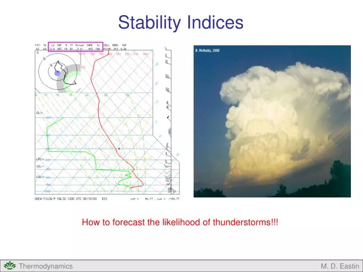
Stability Indices. How to forecast the likelihood of thunderstorms!!!. Stability Indices. Outline: Review of Stability Useful Parameters for Rising Air Parcels Convective Condensation Level (CCL) Convective Temperature (T c ) Lifting Condensation Level (LCL)

E N D
Stability Indices How to forecast the likelihood of thunderstorms!!! M. D. Eastin
Stability Indices • Outline: • Review of Stability • Useful Parameters for Rising Air Parcels • Convective Condensation Level (CCL) • Convective Temperature (Tc) • Lifting Condensation Level (LCL) • Level of Free Convection (LFC) • Equilibrium Level (EL) • Positive and Negative Areas • Stability Indices • Showalter Index (SI) • Lifted Index (LI) • K Index (K) • Total Totals (TT) • Severe Weather Threat Index (SWEAT) • Convective Inhibition (CIN) • Convective Available Potential Energy (CAPE) M. D. Eastin
Concept of Stability • Three Categories of Stability: • Stable: • Returns to its original position • after displacement • Neutral: • Remains in new position after • being displaced • Unstable: • Moves further away from its original • position after being displaced M. D. Eastin
Temperature Dewpoint Temperature Concept of Stability Basic Idea: Ability of an air parcel to return to is level of origin after a displacement Depends on the temperature structure of the atmosphere M. D. Eastin
Concept of Stability • How is air displaced? Spontaneous Ascent • Air parcel is warmer than its environment • which means the parcel is “buoyant” • Air becomes buoyant through “heating” Warm Cool Hot Cool M. D. Eastin
Concept of Stability • How is air displaced? Forced Ascent • Flow over mountains • Flow over fronts (cold, warm, stationary, occluded, etc.) M. D. Eastin
Γd Γs Height Γ Temperature Atmospheric Stability Analysis Combined Criteria for Moist Air (either saturated or unsaturated): Absolutely Unstable: Dry Neutral: Unsaturated parcel becomes warmer than nearby environment Saturated parcel becomes warmer than nearby environment Γd Unsaturated parcel becomes equivalent to the nearby environment Saturated parcel becomes warmer than nearby environment Γs Γ Height Temperature M. D. Eastin
Atmospheric Stability Analysis • Combined Criteria for Moist Air (either saturated or unsaturated): • Conditionally Unstable: • The vertical temperature profile at most locations in our atmosphere • is conditionally unstable Γ Unsaturated parcel becomes colder than nearby environment Saturated parcel becomes warmer than nearby environment Γs Γd Height Temperature M. D. Eastin
Atmospheric Stability Analysis Combined Criteria for Moist Air (either saturated or unsaturated): Moist Neutral: Absolutely Stable: Γ Unsaturated parcel becomes colder than nearby environment Saturated parcel becomes equivalent to the nearby environment Γs Γd Height Temperature Γs Γ Unsaturated parcel becomes colder than nearby environment Saturated parcel becomes colder than nearby environment Γd Height Temperature M. D. Eastin
Warm CCL Cool Hot Cool Useful Parameters for Rising Air Parcels • Convective Condensation Level (CCL): • Definition: Altitude to which an unsaturated moist air parcel, if heated • sufficiently from below, will rise dry adiabatically until it just • becomes saturated • Altitude of the base of cumuliform • clouds that are produced by thermal • convection from surface heating M. D. Eastin
Useful Parameters for Rising Air Parcels Convective Condensation Level (CCL): Skew-T Procedure: 1. Start at the surface Td 2. Move upward along a saturated mixing ratio line until it intersects the T profile 3. The CCL is the altitude (or pressure) at this intersection Td T Convective Condensation Level (CCL) CCL = 850 mb M. D. Eastin
Useful Parameters for Rising Air Parcels • Convective Temperature (Tc): • Definition: Surface temperature that must be reached to start the formation • of clouds by solar heating. • Often compared to the forecast • high temperature for the day • If Tforecast > Tc then • convective clouds • will form • If Tforecast < Tc then • convective clouds • will not form Warm CCL Tc Tc Cool Hot Cool M. D. Eastin
Useful Parameters for Rising Air Parcels Convective Temperature (Tc): Skew-T Procedure: 1. Find the CCL 2. Move downward along a dry adiabat to the surface 3. The Tc is the resulting temperature at the surface Td T Convective Temperature (Tc) CCL Tc = 12ºC M. D. Eastin
Useful Parameters for Rising Air Parcels • Lifting Condensation Level (LCL): • Definition: Altitude at which an unsaturated moist air parcel becomes saturated • when lifted dry-adiabatically. • Lifting can result from: • Convergence • Flow over topography • Fronts LCL M. D. Eastin
Useful Parameters for Rising Air Parcels Lifting Condensation Level (LCL): Skew-T Procedure: 1. Move up a saturation mixing ratio line from a Td value 2. Move up a dry adiabat from the corresponding T value 3. The LCL is the altitude or (pressure) of the intersection Note: An LCL an be determined for a parcel originating from any level, but the surface is commonly used Td T Lifting Condensation Level (LCL) LCL = 870 mb M. D. Eastin
Useful Parameters for Rising Air Parcels Level of Free Convection (LFC): Definition: Altitude at which a moist air parcel lifted dry adiabatically until saturated and pseudo-adiabatically thereafter would first become warmer (less dense) than the surrounding air Td T Altitude at which a lifted parcel first becomes warmer than the environment LCL M. D. Eastin
Useful Parameters for Rising Air Parcels Level of Free Convection (LFC): Skew-T Procedure: 1. Find the LCL for a parcel lifted from the surface 2. Move up a pseudo-adiabat until the parcel temperature first becomes warmer than the observed T profile 3. The LFC is the altitude or (pressure) of this location Td T Level of Free Convection Tp > Te LFC = 660 mb Tp < Te LCL Tp < Te M. D. Eastin
Useful Parameters for Rising Air Parcels Equilibrium Level (EL): Definition: Altitude at which the temperature of a buoyantly rising air parcel (i.e. a parcel warmer than its local environment) becomes equal to the temperature of the environment Td T Altitude at which the temperature of a buoyant parcel equals the environmental temperature LFC LCL M. D. Eastin
Useful Parameters for Rising Air Parcels Equilibrium Level (EL): Skew-T Procedure: 1. Find the LCL for a parcel lifted from the surface 2. Find the LFC for the same parcel 3. Continue moving up a pseudo-adiabat until the parcel temperature first becomes colder than the observed T profile 4. The EL is the altitude or (pressure) of this location Td T Equilibrium Level Tp < Te EL = 400 mb Tp > Te LFC Tp < Te LCL Tp < Te M. D. Eastin
Useful Parameters for Rising Air Parcels • Negative Area: • Layers within which a parcel requires forced ascent to remain in or rise through • (i.e. the parcel will experience a downward buoyancy force) • Parcel temperature is less than the environmental temperature (Tp < Te) Td T Negative Area Tp < Te EL Tp > Te LFC Negative Area Tp < Te LCL Tp < Te M. D. Eastin
Useful Parameters for Rising Air Parcels • Positive Area: • Layers within which a parcel can rise freely through the atmosphere • (i.e. the parcel will experience an upward buoyancy force) • Parcel temperature is greater than the environmental temperature (Tp > Te) Td T Tp < Te EL Positive Area Tp > Te LFC Tp < Te LCL Tp < Te M. D. Eastin
Useful Parameters for Rising Air Parcels Application: Find the CCL and TC M. D. Eastin
Useful Parameters for Rising Air Parcels Application: Find the LCL, LFC, and EL for the surface air parcel M. D. Eastin
Stability Indices • Basic Idea: • Single number that characterizes the stability (or instability) of the atmosphere • Advantages: • Easily computed • Easily applied in forecasting • Disadvantages: • Details of atmospheric profile may be ignored • Application Guidelines: • Forecaster must always closely examine the entire sounding • Must be used in conjunction with other forecasting methods M. D. Eastin
Stability Indices • Showalter Index (SI): • Temperature difference between: • The environmental air at 500 mb and • The temperature of an air parcel at 500 mb lifted • dry-adiabatically from 850 mb to saturation (i.e., the LCL) • and then pseudo-adiabatically thereafter up to 500 mb. • where: Te 500 Environmental temperature at 500 mb in K • Tp 500 Parcel temperature at 500 mb in K M. D. Eastin
Stability Indices Showalter Index (SI): Skew-T Procedure: 1. Find the LCL for a parcel lifted from 850 mb 2. Find the LFC for the same parcel 3. From the LCL move up a pseudo-adiabat to 500 mb 4. Subtract the parcel temperature (Tp) at 500 mb from the environmental temperature (Te) at 500 mb Td T SI = Te500 – Tp500 SI = (-32ºC) – (-25ºC) SI = (241 K) – (248 K) SI = –7 Te500 Tp500 500 mb LCL 850 mb M. D. Eastin
Stability Indices • Showalter Index (SI): • Forecast Guidelines: • +1 to +3 Showers are probable, Thunderstorms possible • need strong forced ascent • 0 to -3 Unstable – Thunderstorms probable • -4 to -6 Very Unstable – Heavy thunderstorms probable • less than -6 Extremely Unstable – Strong thunderstorms probable • Tornadoes are possible • Usage Guidelines: • Good for forecasting mid-level convection • Does not account for moisture in boundary layer M. D. Eastin
Stability Indices • Lifted Index (LI): • Definition: • Temperature difference between: • The environmental air at 500 mb and • The temperature of an air parcel at 500 mb lifted dry-adiabatically • from the mean conditions in the boundary layer to saturation • (i.e., the LCL) and then pseudo-adiabatically thereafter up to 500 mb • where: Te 500 Environmental temperature at 500 mb in K • Tp 500 Parcel temperature at 500 mb in K • Mean boundary layer conditions are determined by finding the • average wsw and θ in the lowest 100 mb of the sounding M. D. Eastin
Stability Indices Lifted Index (LI): Skew-T Procedure: 1. Identify the lowest 100 mb of the sounding 2. Find the mean wsw and mean θin the lowest 100 mb 3. Follow the mean wsw and mean θup to the LCL 4. From the LCL move up a pseudo-adiabat to 500 mb 5. Subtract the parcel temperature (Tp) at 500 mb from the environmental temperature (Te) at 500 mb Td T LI = Te500 – Tp500 LI = (-32ºC) – (-26ºC) LI = (241 K) – (247 K) LI = –6 Te500 Tp500 500 mb mean wsw LCL 880 mb mean θ 980 mb M. D. Eastin
Stability Indices • Lifted Index (LI): Finding the mean wsw and θ: • Identify the lowest 100 mb • Identify the maximum and minimum θwithin the 100 mb • Mean θis located 50 mb above the surface halfway between θmax and θmin • Identify the maximum and minimum wsw within the 100 mb • Mean wsw is 50 mb above the surface halfway between wsw-max and wsw-min • Note: The mean θand mean wsw may NOT fall along the sounding wsw-min wsw-max θmin θmax T Td 100 mb 50 mb M. D. Eastin
Stability Indices • Lifted Index (LI): • Forecast Guidelines: • 0 to -2 Thunderstorms possible, need strong forced ascent • -2 to -5 Unstable – Thunderstorms probable • less than -5 Very Unstable – Strong thunderstorms probable • Usage Guidelines: • Good for forecasting surface-based convection • Accounts for moisture in boundary layer • Addresses limitations of Showalter Index M. D. Eastin
Stability Indices • K Index (K): • Definition: • Measure of thunderstorm potential based on: • Vertical temperature lapse rates (T850-T500) • Moisture content of the lower atmosphere (Td 500) • Vertical extent of moist layer (T700-Td 700) • where: T850 Temperature at 850 mb in ºC • T500 Temperature at 500 mb in ºC • Td 850 Dewpoint temperature at 850 mb in ºC • T700 Temperature at 700 mb in ºC • Td 700 Dewpoint temperature at 700 mb in ºC M. D. Eastin
Stability Indices • K Index (K): • Forecast Guidelines: • K < 15 0% chance of thunderstorms • 15 – 20 < 20% chance of thunderstorms • 21 – 25 20-40% chance of thunderstorms • 26 – 30 40-60% chance of thunderstorms • 31 – 35 60-80% chance of thunderstorms • 36 – 40 80-90% chance of thunderstorms • K > 40 > 90% chance of thunderstorms • Usage Guidelines: • Does not require a plotted sounding • Biased toward “air mass” thunderstorms (i.e. not near fronts) • Works best for non-severe thunderstorms M. D. Eastin
Stability Indices • Total Totals (TT): • Definition: • Used to identify areas of potential thunderstorm development: • Temperature lapse rate between 850 and 500 mb (T850 and T500) • Low-level moisture (Td 850) • where: T850 Temperature at 850 mb in ºC • T500 Temperature at 500 mb in ºC • Td 850 Dewpoint temperature at 850 mb in ºC M. D. Eastin
Stability Indices • Total Totals (TT): • Forecast Guidelines: • TT < 45 No thunderstorm activity • 45 – 50 Weak potential for thunderstorm activity • 50 – 55 Moderate potential for thunderstorm activity • TT > 55 Strong potential for thunderstorm activity • Usage Guidelines: • Does not require a plotted sounding • Good for “air mass” thunderstorms (i.e. not near fronts) • More reliable than K-Index for severe thunderstorm potential M. D. Eastin
Stability Indices • Severe Weather Threat Index (SWEAT): • Definition: • Measure of severe weather potential based on: • Low-level moisture (Td 850) • Instability (Total Totals) • Low-level jet stream (vv850) • Mid-level jet stream (vv500) • Warm air advection (dd500 and dd850) • where: Td 850 Dewpoint temperature at 850 mb in ºC • TT Total Totals in ºC • vv850 Wind speed at 850 mb in knots • vv500 Wind speed at 500 mb in knots • dd850 Wind direction at 850 mb in degrees • dd500 Wind direction at 500 mb in degrees M. D. Eastin
Stability Indices • Severe Weather Threat Index (SWEAT): • Rules: • No term may be negative! • Set 12Td 850 = 0 if Td 850 is negative • Set 20(TT-49) = 0 if TT < 49 • Set 125[sin(dd500 – dd850) +0.2] = 0 if any of the following are not met: • dd850 is in the range 130º to 250º • dd500 is in the range 210º to 310º • dd500 – dd850 > 0 • vv500 and vv850 are both > 15 knots M. D. Eastin
Stability Indices • Severe Weather Threat Index (SWEAT): • Forecast Guidelines: • SWEAT > 300 Severe Thunderstorms • SWEAT > 400 Tornadic Thunderstorms • Usage Guidelines: • Does not require a plotted sounding • Only indicates potential for severe weather • Includes vertical wind shear terms required for deep convection • Forced ascent is needed to realize the potential M. D. Eastin
Stability Indices • Convective Inhibition (CIN): • Definition: • The energy that must be overcome to make a parcel buoyant • Energy is overcome by forced ascent • The negative areabelow the LFC between the environmental sounding • and the temperature of a lifted parcel Td T LFC Negative Area LCL M. D. Eastin
Stability Indices Convective Inhibition (CIN): Skew-T Procedure: 1. Find the LCL for a parcel lifted from the surface 2. Find the LFC for the same parcel 3. Identify those layers below the LFC in which the parcel temperature is less than the environmental temperature 4. The CIN is the total negative area Td T LFC CIN LCL M. D. Eastin
Stability Indices • Convective Available Potential Energy (CAPE): • Definition: • Buoyant energy available in the atmosphere • Forced ascent is usually required to tap into this energy • The positive areaabove the LFC between the environmental sounding • and the temperature of a lifted parcel Td T EL Positive Area LFC LCL M. D. Eastin
Stability Indices Convective Available Potential Energy (CAPE): Skew-T Procedure: 1. Find the LCL for a parcel lifted from the surface 2. Find the LFC and EL for the same parcel 3. Identify those layers below the LFC and EL in which the parcel temperature is greater than the environmental temperature 4. The CAPE is the total positive area Td T EL CAPE LFC LCL M. D. Eastin
Stability Indices Convective Inhibition (CIN): Forecast Guidelines: CIN > -10 J/kg Early development of storms -10 to -100 J/kg Late development of storms (severe weather possible) CIN < 100 J/kg No storms (“capped”) Convective Available Potential Energy (CAPE): Forecast Guidelines: CAPE < 500 J/kg Unlikely development of strong storms 500 – 2000 J/kg Potential for strong or severe storms CAPE > 2000 J/kg Strong or severe storms likely M. D. Eastin
Stability Indices Time for you to forecast thunderstorms… M. D. Eastin
Stability Indices • Summary: • Review of Stability • Useful Parameters for Rising Air Parcels • Convective Condensation Level (CCL) • Convective Temperature (Tc) • Lifting Condensation Level (LCL) • Level of Free Convection (LFC) • Equilibrium Level (EL) • Positive and Negative Areas • Stability Indices • Showalter Index (SI) • Lifted Index (LI) • K Index (K) • Total Totals (TT) • Severe Weather Threat Index (SWEAT) • Convective Inhibition (CIN) • Convective Available Potential Energy (CAPE) M. D. Eastin
References Petty, G. W., 2008: A First Course in Atmospheric Thermodynamics, Sundog Publishing, 336 pp. Tsonis, A. A., 2007: An Introduction to Atmospheric Thermodynamics, Cambridge Press, 197 pp. Wallace, J. M., and P. V. Hobbs, 1977: Atmospheric Science: An Introductory Survey, Academic Press, New York, 467 pp. Also (from course website): NWSTC Skew-T Log-P Diagram and Sounding Analysis, National Weather Service, 2000 The Use of the Skew-T Log-P Diagram in Analysis and Forecasting, Air Weather Service, 1990 M. D. Eastin