Download
1 / 64
650 likes | 874 Views
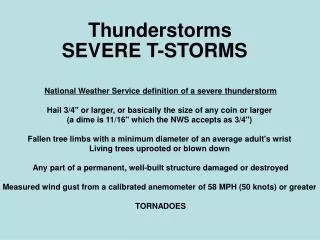
Thunderstorms. Chp 13.1. Orographic thunderstorms. air that is forced up by a mountain or hillside As air strikes the windward side, it is uplifted and cooled. Windward slopes of mountains tend to be the rainy sides the leeward side is dry.

E N D
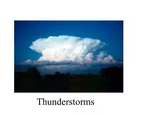
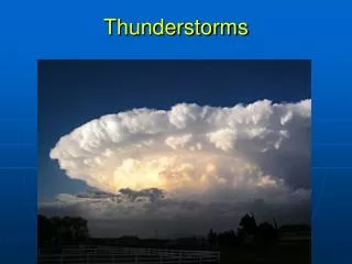
Thunderstorms Chp 13.1
Orographic thunderstorms air that is forced up by a mountain or hillside As air strikes the windward side, it is uplifted and cooled. Windward slopes of mountains tend to be the rainy sides the leeward side is dry. Dry climates found in the "rain shadow" of tall mountain systems Types of thunderstorms
the result of localized convection in an unstable air mass. a relatively weak thunderstorm that usually does not last much longer than an hour, moves slowly and does not produce severe weather a garden variety thunderstorm. Air mass thunderstorms tend to occur within a maritime tropical air mass The main threats from an air mass thunderstorm are lightning and brief heavy rain. air mass thunderstorms tend to occur in the afternoon hours because of uplifting produced from heat of the sun.
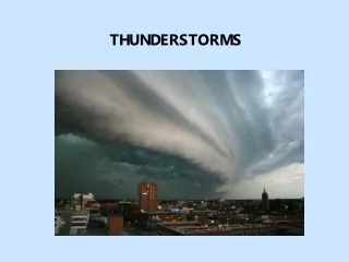
occur along the boundaries of weather fronts (e.g. cold front). An intense line of thunderstorms that forms right along or just ahead of a cold front is called a squall line. Severe thunderstorms, supercells, and/or tornadoes can form
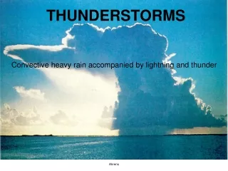
Starts with a cumulus cloud. Heating by the sun Air starts to rise vertically upward The cloud will continue to grow as long as warm air below it continues to rise. Cumulus stage
When the cumulus cloud becomes very large, the water in it become large and heavy. Raindrops start to fall through the cloud cool dry air starts to enter the cloud. Because cool air is heavier than warm air, it starts to descend in the cloud (known as a downdraft). The downdraft pulls the heavy water downward, making rain. This cloud has become a cumulonimbus cloud because it has an updraft, a downdraft, and rain. Lightning and thunder start to occur, as well as heavy rain. The cumulonimbus is now a thunderstorm cell. Mature Stage
After about 30 minutes, the thunderstorm begins to dissipate. This occurs when the downdrafts in the cloud begins to dominate over the updraft. Since warm moist air can no longer rise, cloud droplets can no longer form. The storm dies out with light rain as the cloud disappears from bottom to top. The whole process takes about one hour for an ordinary thunderstorm Dissipating Stage
Assignment • P. 333 # 1 - 5
Severe Weather Section 13.2
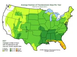
Supercells • responsible for producing tornadoes, large hail and other dangerous winds • warm, humid air in the lower atmosphere, colder air aloft and something to give the air near the ground an upward shove. • needs strong winds coming from different directions at different altitudes high above the ground • can last for hours, • Some supercells produce little rain, others, downpours that can cause flash floods. • Supercells are most common on the Great Plains, but also occur in other parts of the USA. • supercells can be detected using the National Weather Service's Doppler weather radar. • allow forecasters to peek inside a supercell and look for a Tornado Vortex Signature, or TVS.
Lightning • Lightning strikes about 100 times every second. • Lightning is an electric current. • many small bits of ice (frozen raindrops) bump into each other as they move around in the air. • All of those collisions create an electric charge. After a while, the whole cloud fills up with electrical charges. • The positive charges or protons form at the top of the cloud and the negative charges or electrons form at the bottom of the cloud. • Since opposites attract, that causes a positive charge to build up on the ground beneath the cloud. • The grounds electrical charge concentrates around anything that sticks up, such as mountains, people, or single trees. • The charge coming up from these points eventually connects with a charge reaching down from the clouds and - zap - lightning strikes!
http://www.youtube.com/watch?v=gKPwkau0Dh0 • http://www.youtube.com/watch?v=_X_7YRVGvtA
54,000 degrees Fahrenheit. That is six times hotter than the surface of the sun • Thunder is caused by lightning. • When a lightning bolt travels from the cloud to the ground it actually opens up a little hole in the air, called a channel. • Once then light is gone the air collapses back in and creates a sound wave that we hear as thunder. • The reason we see lightning before we hear thunder is because light travels faster than sound!
Next time you see a storm, count the number of seconds between when you see the lightning and hear the thunder. • Take the number of seconds and divide by 5 and that will tell you how far away the storm is in miles. • For example: If you counted 10 seconds between the lightning and the thunder, the lightning is 2 miles away!
Lightning Safety • IF YOU’RE OUTDOORS: • Keep an eye at the sky. Look for darkening skies, flashes of lightning, or increasing winds. • Lightning often proceeds rain, so don’t wait for the rain to begin. • If you hear the sound of thunder, go to a safe place immediately. • The best place to go is a sturdy building or a car, but make sure the windows in the car are shut. • Avoid sheds, picnic areas, baseball dugouts and bleachers. If there is no shelter around you, stay away from trees. • Crouch down in the open area, keeping twice as far away from a tree as far as it is tall. • Put your feet together and place your hands over your ears to minimize hearing damage from thunder. • If you’re with a group of people stay about 15 feet from each other. • Stay out of water, because it’s a great conductor of electricity. Swimming, wading, snorkeling and scuba diving are not safe. • Also, don’t stand in puddles and avoid metal. • Stay away from clotheslines, fences, and drop your backpacks because they often have metal on them. • If you’re playing an outdoor activity, wait at least 30 minutes after the last observed lightning strike or thunder..
IF YOU’RE INDOORS: • Avoid water. It’s a great conductor of electricity, so do not take a shower, wash your hands, wash dishes or do laundry. • Do not use a corded telephone. Lightning may strike exterior phone lines. • Do not use electric equipment like computers and appliances during a storm. • Stay away from windows and doors and stay off porches
Types of Precipitation • Rain • growing cloud droplets become too heavy to remain in the cloud • fall toward the surface as rain. • can also begin as ice crystals that collect each other to form large snowflakes. • As the falling snow passes through the freezing level into warmer air, the flakes melt and collapse into rain drops.
Hail • a large frozen raindrop produced by intense thunderstorms, • snow and rain can coexist in the central updraft. • As the snowflakes fall, liquid water freezes onto them forming ice pellets that will continue to grow as more and more droplets are accumulated. • Upon reaching the bottom of the cloud, some of the ice pellets are carried by the updraft back up to the top of the storm. • As the ice pellets once again fall through the cloud, another layer of ice is added and the hail stone grows even larger. • Typically the stronger the updraft, the more times a hail stone repeats this cycle and consequently, the larger it grows. • Once the hail stone becomes too heavy to be supported by the updraft, it falls out of the cloud toward the surface. • The hail stone reaches the ground as ice since it is not in the warm air below the thunderstorm long enough to melt before reaching the ground.
Freezing Rain rain that becomes supercooled and freezes upon impact with cold surfaces. Freezing rain is most commonly found in a narrow band on the cold side of a warm front, where surface temperatures are at or just below freezing.
Freezing rain develops as falling snow encounters a layer of warm air deep enough for the snow to completely melt and become rain. As the rain continues to fall, it passes through a thin layer of cold air just above the surface and cools to a temperature below freezing. However, the drops themselves do not freeze, a phenomena called supercooling (or forming "supercooled drops"). When the supercooled drops strike the frozen ground (power lines, or tree branches), they instantly freeze, forming a thin film of ice, hence freezing rain.
Severe Storms • Formation of hail based on amount of updraft
Tornadoes • A violent, whirling column of air in contact with the ground. • Extreme pressure gradient between the center and outer portions cause the rotation and winds. • Classification • Fujita scale • Developed in 1971 by T. Theodore Fujita of the University of Chicago
http://www.usatoday.com/weather/graphics/tornadoes/flash.htm
Hurricanes • Tropical cyclone • Large, rotating, low-pressure storms • Thrive on the energy from warm tropical oceans • Originate along the ITCZ • Require abundant supply of very warm ocean water • Some sort of disturbance to lift the warm air and keep it rising
Stages • Tropical waves • Tropical depressions • Hurricane • Minimum winds of 74 mph sustained • Eye – calm center of the storm • Eyewall – strongest winds of the hurricane • Storm surge • is the onshore rush of sea or lake water caused by the high winds associated with a landfalling cyclone and secondarily by the low pressure of the storm.