Download
1 / 16
160 likes | 278 Views
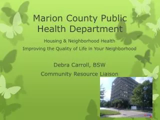
GIS Applications for the Marion County Health Department Indianapolis, Indiana. The Marion County Health Department. Bureau of Population Health (BPH) Bureau of Environmental Health (BEH). The Bureau of Population Health. Chronic Disease Communicable Disease Dental Health

E N D
GIS Applications for theMarion County Health DepartmentIndianapolis, Indiana
The Marion County Health Department • Bureau of Population Health (BPH) • Bureau of Environmental Health (BEH)
The Bureau of Population Health • Chronic Disease • Communicable Disease • Dental Health • Emergency Preparedness • Fetal and Infant Mortality • HIV/AIDS • Nutrition Services
The Bureau of Environmental Health • Childhood Lead • Food Safety • Hazardous Materials/ Emergency Response • Housing and Neighborhood Health • Mosquito Control • Water Quality
MCHD Facts • Environmental Control • 1.3 million pounds of trash • Water Quality • 5,000 public pool inspections • Indoor Air • 4,000 calls concerning household mold • Food Safety • Indianapolis 500: 4 tons of French fries, 2,700 gallons of soda and 600 pounds of chicken tenders
GIS in the MCHD • BEH in 1993 • BPH in 1994 • Both combined in 2000
GIS services • Health and Hospital Corporation of Marion County • MCHD • District Health Offices • Remote Sites • Wishard Health Services • IU Medical Group (IUMG) • Not-for-profit organizations: • American Cancer Society • Covering Kids and Families Coalition
GIS service types • Grants • Market Analysis • Research and Analysis • District Maps • Route Maps • Educational Materials • General Requests
Grant Maps • Project S.H.A.P.E. • Indiana University Medical Group (IUMG) • IU School of Dentistry • Infant Deaths “These will be helpful to our local and statewide efforts. The maps really do make the complex numbers visible in a very clear way.” - Covering Kids and Families Coalition
Market Analysis Maps • A.C.T.I.O.N. Center • South District Health Office • HHC Properties “The maps looked great and the media appreciated having it as a resource.” - Public Relations
Research and Analysis Maps • Childhood Lead • Smoke-free Restaurants • Covering Kids and Families Coalition • Wells and Surface Contamination • West Nile Virus • Infant Mortality • Lung Cancer Deaths • Radon Testing • IUMG Sites and Clients • High Risk Pre-Term Births
District Maps • EHS Food Safety Districts • IPD North District “These maps also help us to visualize the WNV sites. We can see clustering and trends that may be occurring with West Nile Virus.” - Mosquito Control
Route Maps • Water Quality Pool Route Maps • Mosquito Control Spray Route Map “The G.I.S. maps help us to more effectively and efficiently control mosquitoes in Marion County.” - Mosquito Control
Educational Materials • Smoking Cessation Sites • Haz/Mat Training • Indianapolis Urban League • WIC Farmers’ Market Sites “I find mapping very useful in marketing my educational programs for our department.” - Foods Safety
Other GIS Services • BEH Operations Tracking • Logs violations and complaints • Captures field data • Generates reports • Currently in development phase • ArcIMS • Internal use • Daily route maps • Daily EHS inspection maps • On-the-fly maps for reports
Contact Information Joan Keene Troy Divis GIS Coordinator GIS Analyst jkeene@hhcorp.org tdivis@hhcorp.org (317) 221.2289 (317) 221.2297 • Marion County Health Department • www.mchd.com • Health and Hospital Corporation of Marion County • www.hhcorp.org