Download
1 / 33
330 likes | 446 Views
GML & JPEG 2000 for Geographic Imagery. Ron Lake. Applications to Geo-spatial Intelligence. “Imagery” and Geo-spatial Intelligence. Objective is to understand what is happening ! Implications: Use many “observation sources” Conventional and non-conventional satellite imagery.

E N D
GML & JPEG 2000 for Geographic Imagery Ron Lake Applications to Geo-spatial Intelligence
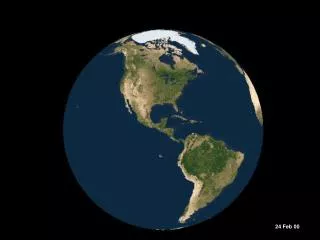
“Imagery” and Geo-spatial Intelligence • Objective is to understand what is happening ! • Implications: • Use many “observation sources” • Conventional and non-conventional satellite imagery. • Visual, radar and thermal imagery • Aerial photography (oblique, high oblique, panoramic) • Hyper-spectral imagery • Weather data • Ground observations • Extract – fuse information to create best model of “what is happening” Powering the Geo-Web
“Imagery” and Geo-spatial Intelligence • Not always clear “what” we are observing. • Use of decoys and obfuscation. • Need to operate in connected and disconnected environments. • High emphasis on data integrity – “pixels” alone don’t tell the story ! Let’s see what GML in JP2K brings to the table! Powering the Geo-Web
Stereo satellite image pair Stereo aerial image pair Single oblique aerial image Many Image Types Idea is to use a GML Application Schema for each image type. The GML “metadata” (from JPEG perspective) increases the value of the image data. Hyperspectral Satellite Image Powering the Geo-Web
More than “imagery” Powering the Geo-Web
Single oblique aerial image Many Image Types JPEG Data Package JPEG 2000 CodeStream Image Geometry Image Radiometry Image metadata GML Data & Schema Powering the Geo-Web
Stereo aerial image pair Many Image Types JPEG Data Package JPEG 2000 CodeStreams Image Geometry Stereo-Model Image Radiometry Image metadata GML Data & Schema Powering the Geo-Web
What is JPEG 2000? • ISO Standard for image compression. • Wavelet based like ECW or Mr Sid but open. • Handle very large images (gigabytes) • Not a geographic image format. • Can embed XML data in the data package (JPX) • Rich complex specification. • Can have ROI compression – lossy compression of entire scene with lossless compression of a region of interest. Powering the Geo-Web
What is GML ? • Geography Markup Language is an approved specification of the OpenGIS Consortium an organization of 260+ vendors, government agencies and academic bodies (including NGA!) • GML en route to being an ISO standard (is CD now) – ISO 19136 Powering the Geo-Web
What is GML? • XML Grammar (XSD) for geography. • Features (vector) • Coverages (i.e. images) • Coordinate Reference Systems, • Geometry, Topology. • Units of Measure • Time • Map Styling. Powering the Geo-Web
f(x) x range domain • Values • elevation • temperature • rock type • reflectance Geographic Region Distributions of quantities (Coverages) GML - Coverages Coverages are mappings from a domain set to a range set Powering the Geo-Web
Distributions of quantities (Coverages) GML - Coverages Coverage E-R View isA Sea Surface Temperature Bathymetry Model RS Image Powering the Geo-Web
Surface tesselations f(x) x range x f(x) • Values • depth • temperature • salinity • reflectance Segmented Curves f(x) x Discrete Point Sets Distributions of quantities (Coverages) x GML - Coverages We can classify coverages by the domain geometry Powering the Geo-Web
GML Coverage GML Describes: Coverage Domain Geometry (Grid, polygonal surface ..) Values (quantities with units, scalar, composite ..) GML encode (transport) value and geometry XML Values String Values Binary Values Powering the Geo-Web
GML in JPEG 2000 • JPEG 2000 allows use of XML for “metadata”. • GML is XML • How should GML be used? • OGC Developing GML in JPEG 2000 Specification: • Led by Galdos Systems and LizardTech • EUSC, SPOT Image, USGS, ERMapper, Intergraph, ITT are among key participants. • Galdos and LizardTech to release commercial codec/SDK. Specification will be released this fall. Powering the Geo-Web
e.g. ISO 19139 etc. GML Coverage description JPEG 2000 header Metadata Hierarchy Think about metadata in a hierarchical manner ! Coverage Metadata Coverage Values Powering the Geo-Web
Why GML & JPEG 2000? • Flexible, open standard for geographic imagery. • Enables best of both GML (geography) and JPEG 2000 (imagery) to be brought together. • Extensible. From a solid base can define extended support for Coordinate Reference Systems, Units, sensor types etc. • Extensible: Image package can contain the geographic image – extracted features – annotation – metadata – and styling of features & annotation. • Completely open standard – defined by OGC and ISO (JPEG 2000.) • Handles standalone (detached) and networked cases Powering the Geo-Web
Use Cases • Image/Coverage Types (Wide Variety) • Aerial Photograph • Stereo Pair • Satellite Image • Hyper-spectral Image • Triangulation Block • Digital Elevation Model • Image geometry • Image “radiometry” (coverage value/range) • Image Annotation • Feature Extraction/Interpretation • Coordinate references and units (e.g. radiometry) Powering the Geo-Web
GML & JPEG 2000 - Basics Coverage = generalized image GML Coverage Description Coverage Geometry Coverage Value Description Pointer to external file Coverage Values External Value File GML can use external files to hold coverage values Powering the Geo-Web
GML & JPEG 2000 - Basics GML Coverage Description JPEG 2000 Package Coverage Geometry GML can reference values within the containing JPX Pkg. Coverage Value Description Coverage Values Values Coverage Values Powering the Geo-Web
GML & JPEG 2000 - Basics GML Coverage Description Coverage Geometry Coordinate Reference System Definition Units of Measure Definition Coverage Value Description Coverage Values Can reference external definitions of CRS and Units of Measure Values Powering the Geo-Web
Geographic Image Metadata External Metadata Description via ISO 19139, ISO 19115, FGDC, User Defined Schema etc. GML Coverage Description Coverage Geometry Coverage Value Description Supports References to External Metadata Records Coverage Values Values Powering the Geo-Web
Geographic Image Metadata GML Coverage Description Supports References to Internal Metadata Records Coverage Geometry Coverage Value Description Coverage Values Internal Metadata Description via ISO 19139, ISO 19115, FGDC, User Defined Schema. NITF TREs ? Metadata (User Schema, ISO, FGDC etc) Values Powering the Geo-Web
Annotating Images GML Coverage Description Target Coverage Geometry Coverage Value Description Coverage Values GML can define annotation features in geographic or image coordinate systems. Annotation Features Values Powering the Geo-Web
Annotating Images GML Coverage Description Target Coverage Geometry Coverage Value Description Coverage Values GML can describe styling of the annotation – annotation appearance. Annotation Features Annotation Styling Values Powering the Geo-Web
Bundling Extracted Features GML Coverage Description Coverage Geometry Coverage Value Description Coverage Values Geographic Features An integrated package bundling features & imagery Values Powering the Geo-Web
Bundling CRS & Unit Definitions GML Coverage Description CRS Definitions can be bundled with the image. Units of Measure Definitions can be bundled with the image Coverage Geometry Coverage Value Description Coverage Values Can Package and Ship CRS or Units Definitions CRS Definition Units Definition Values Powering the Geo-Web
Dictionary Instance Instance Data Instance Data GML Coverage Description Coverage App Schena Feature App Schena Annotation App Schema Instance Schema (Static) Dictionary Schema Metadata Schema gml dictionary.xsd gml coverage.xsd gml units.xsd gml feature.xsd gml crs.xsd gml valueObjects.xsd Powering the Geo-Web
Applications to Geo-spatial Intelligence • Capture typical geographic imagery including • Rectified and non-rectified aerial and space borne imagery • Capture non-standard image types. • Define content standards across all image types – e.g. stereo pairs (aerial photographs), Ikonos etc. • Bundle annotation and imagery together. • Bundle features and imagery. • Support both connected and disconnected operations. Powering the Geo-Web
Applications to Geo-spatial Intelligence • Enhance data integrity – metadata, annotations, units of measure, CRS definitions travels with the data! • Facilitate automated extraction of metadata for image catalogues. OGC Web Registry Service (Catalogue) Image metadata GML in JP2K Powering the Geo-Web
Summary • Universal image representation • Image geometry and “radiometry” • Optical, radar, multi-spectral imagery. • Elevation, bathymetry, and weather data. • A final “image format” ? Powering the Geo-Web
GML Book First 8 chapters are introduction Covers theory and application Examples for DB and Legacy GIS Published May 2004 http://www.wiley.com/WileyCDA/WileyTitle/productCd-0470871547.html See a review in Jan/Feb 2005 Issue of GIS Professional Powering the Geo-Web
Questions Powering the Geo-Web