Download

1 / 32
320 likes | 338 Views
C16: THE MARINE ENVIRONMENT. shorelines (seashores) = boundary where land and sea meet 1. marks average height of sea (not considering waves and tides) 2. shore = areas that lies between high and low tides a. are often hundreds of meters wide b. constantly changing

E N D
C16: THE MARINE ENVIRONMENT shorelines (seashores) = boundary where land and sea meet 1. marks average height of sea (not considering waves and tides) 2. shore = areas that lies between high and low tides a. are often hundreds of meters wide b. constantly changing 3. shaped by action of waves, tides, and currents 4. waves shape by eroding and depositing sediments a. move faster in deep water than shallow b. wave refraction = difference in wave speed causes initially straight wave crests to bend when part of crest moves into shallow water c. wave crest bends toward headlands
5. rocky shorelines = most common features are rocks and cliffs a. waves scour hollows and notches which may becomes caves b. sea stack = island of resistant harder rock left after softer rock is worn away by waves and currents c. sea cave = tubelike passages formed in headland at sea level by never-ending assault of breakers 6. estuary = area where lower end of freshwater river or stream enters ocean a. contain brackish water = mixture of freshwater and salt water b. provide nurseries to young of many different species
beaches = deposits of sloping sediment that run parallel to shore 1. made of rock and shell fragments, sand, mud 2. composition of beach material depends on source Hawaii = black sands → basalt; green sands → olivine Jamaica = white sands → coral and shell fragments 3. longshore bar = shallow water offshore lies above a sand bar a. forms in front of most beaches b. surf zone = wave that break on the longshore bar c. longshore trough = deeper water closer to shore than longshore bar
4. longshore current = current that runs parallel to shore a. caused by waves hitting shore at a slight angle b. varies in strength & direction from day to day c. can carry tons of loose sediment = sand d. if not carrying all the sediment it can, it will erode the surfaces it passes by 5. rip currents = narrow currents that flow seaward at right angles to shoreline a. flow out to sea through gaps in longshore bar b. return water spilled into longshore trough to open ocean c. can reach speeds of several km/h d. dangerous to swimmers → should swim parallel to shore to get out of current NOT against
Shoreline depositional features: 1. berm = narrow shelf or ledge usually along a rocky shoreline 2. spit = narrow bank of sand that projects into water from bend in coastline a. formed when longshore currents drop sand it is carrying as it turns into a bay b. forms where shoreline changes direction c. can grow and cross a bay 3. baymouth bar (bay barrier) = formed when deposit or spit grows and completely cuts off bay 4. tombolo = formed when sand is deposited where it connects an island to mainland 5. hook = spit with a curved end
6. lagoon = shallow, protected bodies of water behind baymouth bars and/or barrier islands a. considered saltwater coastal lakes connected to open sea by shallow, restricted outlets b. has poor circulation of water c. may later fill with sediment and become a salt marsh 7. barrier island = sand deposits that parallel shore but are separated from mainland a. begin as underwater ridges of sand formed by breaking waves b. hurricanes and storms add sediment raising some to sea level c. once exposed the wind blows loose sand into dunes d. considered a temporary feature Ex: Hatteras, NC 8. coast = border of land along shoreline
PROTECTIVE STRUCTURES: 1. can use seawalls, groins, jetties, and breakwaters to prevent beach erosion and protect oceanfront property 2. artificial structures can interfere with natural shoreline processes; could have negative effects 3. groins = wall-like structures built into water perpendicular to shoreline for purpose of trapping beach sand a. interrupt natural longshore transport and deprive beaches down coast of sand b. can cause aggravated beach erosion down coast from area
4. jetties = concrete walls built to protect a harbor entrance from drifting sand a. trap sand upshore from harbor and prevent it from reaching beaches downshore b. sand will eventually drift around and will have to be dredged to keep harbor open 5. breakwaters = built in water parallel to straight shorelines to provide anchorage for small boats a. longshore current slows down behind breakwaters and can no longer move its load of sediment b. if left along sediment will fill anchorage area; must dredge regularly
SEA LEVEL CHANGES: 1. global sea level has risen 10 – 15 cm in last 100 years. 2. continues to rise slowly; 1.5 – 3.9 mm/yr 3. Earth’s average surface temperature has increased ~0.5oC over last century 4. predict global sea levels could rise another 30 cm in next 70 years a. polar ice sheets melt will flood many countries and low lying coastal cities b. melting of Antarctic ice sheet would cause rise of 6 m in sea level flooding many barrier islands
5. fjords = deep coastal valleys scooped out by glaciers during ice age and later flooded when glaciers melted 6. affected by tectonic uplift and sinking a. coastline sinks → sea level rises b. coastline rises → sea level drops c. form emergent coasts = form when seafloor is pushed upward faster than sea level is rising
SEAFLOOR FEATURES 1. continental margin = area where underwater edge of a continent meets ocean floor a. more a part of land than it is a part of ocean b. composed of 3 sections: continental shelf, continental slope, continental rise 2. continental shelf = relatively flat part of continental margin that is covered by shallow ocean water a. usually slopes very gently downward from shoreline b. width depends on changes in sea level; average width = 60 km; average water depth = 130 km c. good fishing areas d. can find mineral deposits and deposits of oil and natural gas
3. continental slope = area at edge of continental shelf that plunges steeply down to ocean floor a. marks boundary between crust of continent and crust of ocean floor b. slopes average nearly 100m/km c. cut by deep submarine canyons d. formed by turbidity currents = rapidly flowing water currents along bottom of sea that carry heavy loads of sediments 1) may originate as underwater landslides on continental slope 2) form from sediment stirred up by large storm waves on continental shelf 3) can move > 30 km/h and erode bottom sediment and bedrock
4. continental rise = gently sloping region between continental slope and ocean floor a. made up of large amounts of sediment deposited by turbidity currents b. may be several kilometers thick c. rise gradually get thinner and eventually merges with sediment of seafloor beyond continental margin
5. submarine canyon = deep, V-shaped valleys that have been cut in rock a. cuts through continental shelf and slope b. formed by turbidity currents, earthquakes, or other movements that occur on continental slope 6. ocean basins = deeper parts of seafloor that lie above thin, basaltic, oceanic crust a. exist beyond continental margin b. represent 60% of Earth’s surface
7. abyssal plain (abyss) = large, flat areas on ocean floor 5 or 6 km below sea level a. caused by currents depositing sediments from continental shelves and slopes onto bottom b. range in depth from 3000 - 6000 meters c. abyssal hills = small, rolling hills that occur often in groups, next to continental margins and oceanic ridge systems
8. ocean trench (deep sea trench) = area where one piece of seafloor dives beneath another one a. longer and deeper than valleys on continents b. long, narrow, and steep-sided; sometimes arc shaped depressions c. many lie next to chains of volcanic islands d. relatively narrow, about 100 km across, may extend for thousands of kilometers e. deepest: Mariana Trench = 11 km (9.2 miles) - compared to land = Grand Canyon = 1.6 km (1.3 miles) f. longest: Peru-Chile Trench = 5900 km (3440 miles)
9. mid-ocean ridge = underwater mountain chain that rises from ocean floor a. caused by forces within Earth that causes crust to move apart and buckle b. form chain 65,000 km (39,000 miles) long that crosses every ocean c. average height = 1500 m; may be thousands of km wide; highest peaks may form volcanic islands d. fracture zones = areas where ridge breaks into series of shorter, stepped sections which run at right angles across ridge e. contain rift valleys = deep crevices 1) region of great earthquake and volcanic activity 2) mark the center of the areas where new crust is formed f. Atlantic Ocean = Mid-Atlantic Ridge Pacific Ocean = Pacific-Antarctic Ridge or East Pacific Ridge
10. hydrothermal vents = hole in seafloor where heated magma erupts a. located along bottom of rifts b. black smoker = eject thick, black, smokelike plumes and ejects superheated water (350oC) c. white smoker = ejects warm water
11. seamount = cone-shaped mountain peaks that rise more than 1000 meters above ocean floor a. have steep sides that lead to a narrow summit (top) b. are volcanic in origin c. if it is still active may produce a volcanic island d. when rise above ocean surface form islands 1) could become submerged due to sinking or rising of sea level 2) Ex: Hawaiian Islands e. can be found alone but are usually found in groups, clusters, or rows f. guyots (tablemounts) = submerged flat topped seamounts
12. rift zone = area in middle of some oceans that contains a system of cracks where seafloor is spreading apart a. molten material rises through cracks and becomes new ocean crust b. earthquakes and volcanoes are common along this zone
MARINE SEDIMENTS 1. land derived include mud, sand, dust, volcanic ash 2. deep ocean floor = fine-grained, deep sea mud 3. sandy sediments closer to land 4. ooze = sediments that contain the remains of microscopic organisms 5. red clay = made of sediments carried to oceans by rivers - found in areas where ocean life is not abundant 6. manganese nodules = contain oxides of manganese, iron, copper, and other metals a. authigenic deposits = deposits that form directly from seawater in place where they are found b. will crystallize out of water; grow slowly c. can be mined for their value
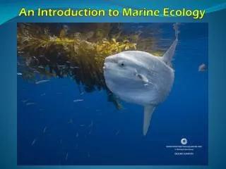
OCEAN LIFE Life Processes: 1. water allows organisms in oceans to use less energy in moving around 2. protects against sudden temperature changes 3. water makes up the tissues of plants and animals 4. provides the liquid in which male and female reproductive cells can join 5. helps organisms get rid of their wastes
6. contains important nutrients and gases that organisms need 7. photosynthesis = plants use carbon dioxide, nutrients in water, and sunlight to produce food and oxygen 8. respiration = oxygen is combined with food so the energy in food can be used - produces water and carbon dioxide 9. energy is transferred through food chains 10. chemosynthesis = process used by bacteria to produce food and oxygen by using dissolved sulfur compounds a. takes place at rift zones where lava oozes from the crust b. organisms feed on bacteria
Types of Life 1. plankton = drifting plants and animals a. largest group b. float at or near the surface of ocean where sunlight penetrates c. many are microscopic in size d. main food source for many larger organisms (whales) e. phytoplankton = plant portion 1) diatoms = one celled, yellow green algae f. zooplankton = animal portion 1) includes eggs, very young fish, jellyfish, crabs, and tiny adults of other organisms 2) most depend on surface currents for movement but a few can swim
2. nekton = forms of ocean life that swim a. able to actively search for food b. can move from one part of the ocean to another c. can move from one depth to another d. remain in areas where conditions are most favorable e. deep dwelling creatures have special light generating organs for attracting live food 1) angler fish = luminous lure over forehead 2) viperfish = luminous organs in its mouth
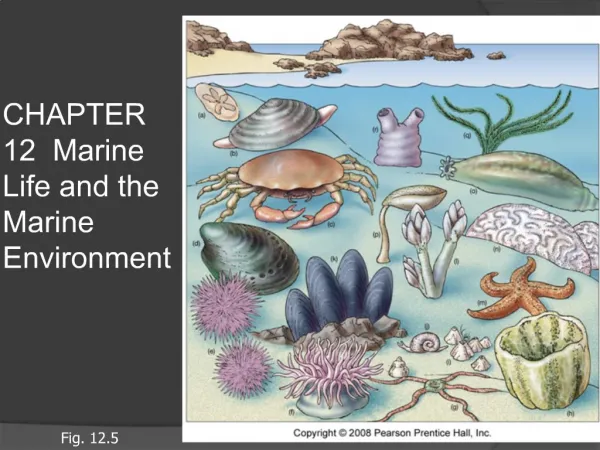
3. benthos = organisms that live on the ocean floor a. kelp = large brown algae that grows in shallow, cool water near the shore b. animals include corals, snails, clams, sea urchins, and bottom dwelling fish c. feed on decomposed matter that sinks to the bottom or other benthos d. corals = animals that build hard, boxlike capsule around its body from calcium it removes from water 1) live in warm waters close to equator 2) form a reef = when capsule is cemented to others to form a colony Kelp Sea Anemone
Types of Coral Reefs: 1. fringing reef = touch shoreline of an island or continent 2. barrier reef = separated from shore by an area of shallow water 3. atoll = ring shaped reef a. surrounds an island that has been worn away and sunk beneath the surface b. has a lagoon in the middle
Life Zones: 1. intertidal zone = regions that lies between the low and high tide lines a. most changeable zone b. organisms must be able to live without water some of the time c. organisms = anemones, crabs, clams, mussels, and some types of seaweed
2. neritic zone = extends from the low tide line to the edge of the continental shelf a. receives plenty of sunlight b. water pressure low and temperature constant c. richer in life than any other zone d. ocean floor is covered with seaweed e. source of much of the seafood people eat f. zone ends where there is too little sunlight for seaweed to grow
3. open-ocean zone = two types a. bathyal zone = begins at a continental slope and extends down about 2000 meters 1) sunlight cannot penetrate to the bottom 2) forms of nekton live here = squid, octopus, large whales b. abyssal zone = extends from 2000 meters to an average depth of 6000 meters 1) covers the large, flat plains of ocean 2) no sunlight penetrates area 3) water pressure very high 4) animals that live here are small and strange looking 5) little food available
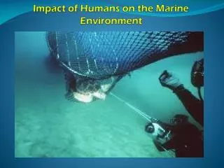
OCEAN POLLUTION: 1. pollution = whenever unnatural substances are introduced into an environment 2. humans concentrate pollution along the coasts of continents 3. industrial wastes = concentrations of metals and chemicals that harm organisms 4. solid wastes = plastic bags, fishing line can entangle animals 5. medical waste = needles, plastic tubing, and bags are a threat to both humans and animals 6. pesticides / herbicides used in farming reach the ocean as runoff 7. crop fertilizers and human sewage cause plant plankton to reproduce rapidly → when die bacteria that breaks down uses all oxygen in water killing other organisms 8. oil spills = tanker collisions, leaks at offshore oil wells
9. oil mixed with waste water and pumped out of ships 10. oil dumped in streams for discarding will eventually reach the ocean 11. thermal pollution = when power plants and other industries pump warm water into an ocean 12. large amounts of sediment are washed into ocean due to deforestation, agriculture, and construction * will destroy filter feeding animals such as clams and oysters 13. marine habitats are destroyed when saltwater marshes are filled in for land development 14. causes a disruption in the food chain around Earth and also affects oxygen supply * plant plankton in ocean are responsible for most of oxygen available on Earth → if they die so would many other organisms !!