Download

1 / 32
320 likes | 411 Views
An improvement plan for JMA marine meteorological predictions and information. Scientific and Technical Workshop at JCOMM-4 Yeosu, Republic of Korea 24-25 / May / 2012. Nadao Kohno Office of Marine Prediction, Global Environment and Marine Department Japan Meteorological Agency.

E N D
An improvement plan for JMA marine meteorological predictions and information Scientific and Technical WorkshopatJCOMM-4 Yeosu, Republic of Korea 24-25 /May /2012 Nadao Kohno Office of Marine Prediction, Global Environment and Marine Department Japan Meteorological Agency
Contents • JMA Computer system • Numerical Analysis and Prediction System (NAPS) • Current system and products • Improvement plans in the next system • plans in wave / storm surge information
Contents • JMA Computer system • Numerical Analysis and Prediction System (NAPS) • Current system and products • Improvement plans in the next system • plans in wave / storm surge information
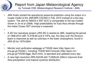
JMA super computer system • JMA has been using computer systems (Numerical Analysis and Prediction System; NAPS) since 1959. • The NAPS was usually replaced in every 5 years. The current system is the 8th generation (NAPS8) and has been used since 2006. • The NAPS is going to be replaced to the next one (NAPS9) on 5 June 2012. The main frame of the NAPS9 is HITACHI SR16000.
Super Computer(main) (HITACHI SR16000)
Contents • JMA Computer system (NAPS) • Numerical Analysis and Prediction System (NAPS) • Current system and products • Improvement plans in the next system • plans in wave / storm surge information
Case: Typhoon ROKE (2011) Upper panels: weather charts Lower panels: wave charts by CWM 00UTC 19 Sep. 00UTC 20Sep. 00UTC 21Sep. 00UTC 22 Sep. 975 hPa 950 hPa 8 m 12 m
Wave observation at Irozaki ・期間:平成23年9月20日21時~23日21時 ・沿岸波浪モデル:9月20日21時初期値の石廊崎地点における予測値 10.63m 10.46m 22 20 21 20 21 22 Irozaki
Wave spectrum (Irozaki) Observation (34.60N138.83E) Coastal Wave Model (CWM) (34.60N, 139.00E)Initial:12UTC 20/Sep/2012 The wave model reasonably predicted not only wave heights and periods but also wave spectra.
Examples of wave information (Windsea, swell height sequences) guidance (within JMA) radio facsimile (for mariners) JMA website (for public people)
Storm surge Guidance predicted points (33 or 30 hours forecast at 281 points) Storm surge map tide station points Other beach points (no ast. Tide)
Storm surge Information for Asian region Storm Surge Watch Scheme JMA provides real time storm surge predictions to the Typhoon Committee members . Upper: storm surge map Lower: enlarged image JMA Numerical Typhoon Prediction (NTP) Website
Enhancement of Products • Time sequences at the selected point of the Typhoon Committee members is going to issued on 5 June 2012.Start with a point in each member, but the number of points will be added in due course. • JMA would like to ask the members to inform desirable points. (Tide observation or sea topography data provision will contribute to accurate prediction.) Example of a time series data at Quarry Bay (Hong Kong)
Contents • JMA Computer system (NAPS) • Numerical Analysis and Prediction System (NAPS) • Current system and products • Improvement plans in the next system • plans in wave / storm surge information
For better Marine Meteorological Information… • Wave information • Wave data assimilation system • Stochastic information (ensemble forecast) • Intensive forecasts / shallow water effects • Utilization of wave spectrum (applied information) • Storm surge information • Wave setup prediction model • To add typhoon courses for storm surge prediction • Probabilistic Ensemble forecasts • Modification of bogus wind fields • Research of the predictability of seiche
Development plans • Wave data assimilation system • JMA operates the Objective Wave Analysis System (OWAS) since 1 December, 2009. • It analyzes wave heights by referring various observations. • A wave data assimilation system has been developed, by referring the OWAS results. • The developed assimilation system showed good impacts. In verification tests, RSMEs were decreased by about 0.2 to 0.6m. • The good impact of the assimilation system was confirmed, this system is going to be launched to the operation this year. Image of assimilation cycle • Wave models/OWAS run 4times a day (6 hourly) • Data assimilation is carried out to two time levels, namely at the initial time (FT=0) and the previous time (FT=-6) • Wave spectrum is divided to windsea and swell part, and each part are rectified. • (In detail, please refer Kohno et al.(2011), The paper of 12th Wave Workshop. )
The global calculation result (January, 1-31, 2010) Northern Hemisphere Tropics Southern Hemisphere ―TEST-RTN(-Simple Mod) BIAS RMSE ・The assimilation impact is preserved up to 72 hours forecasts ・The assimilation impact is large in the SH (swell maintain information, high waves exist) ・The bias becomes to change in early forecast times (problem of spin-up) ・The developed scheme gets the better results than the simple modification
Development plans • Bay-scale fine mesh wave information • For intensive wave information, JMA is applying a fine mesh shallow-waterwavemodel to bays or coasts, where shallow water effects or small scale effects ion are important. • Four areas are going to be added in this year. 2008 Tokyo Bay, Ise bay, Osaka Bay, Harima Nada, Ariake Sea 2011 Sendai Bay, Off Niigata 2012 Off Tomakomai Suoh-Nada, Iyo-Nada, Hiroshima Bay/ Aki-Nada ・・・
New areas in 2012 3 1 2 Off Tomakomai 42.0N~ 43.0N 141.0E ~143.0E Seto Inland Sea (1.Suoh-Nada, 2.Iyo-Nada, and 3. Hiroshima-Bay/Aki-Nada) 33.3N~ 34.4N 131.0E ~132.8E
Development plans • Probabilistic wave information • Wave forecast information is crucial for voyaging vessels and fishing boats. Especially week range forecast is effective their voyage planning, disaster prevention or weather routing. • However, it is difficult to deterministic predict accurately fro this range, stochastic forecast is necessary. • JMA is going to develop ensemble wave forecast system in a few year. • It is also planned to issue weekly wind and wave forecasts to public. Global wave ensemble system (plan)
Wave ensemble forecast system Spread of Significant wave heights (contours indicate wave heights of the control run) Results of 144 hours forecast member1 member 4 member2 member5 Probabilisticinformation (probability of wave heights over 8m) member3 member6 ・・・ Statistic analysis of total 51 members
Development plans • Advanced information on waves • Sea state gives strong influence to voyaging vessels. In usual, wave heights are commonly referred for sea state estimation. However, complicated sea state is quite dangerous and tough for voyaging vessels and fishing activities. JMA is planning to add dangerous area to wave charts. • As for coasts, damages by waves are principally determined by wave heights (energy), but wave periods (length) is also important factor for estimation wave powers to coastal structure or wave run ups. • JMA is now developing some practical information on “tough navigation area” effected by multiple waves or being influenced by against currents. • JMA is also considering to develop some index to indicate influence to coast.
An image of wave chart with dangerous area mark • Marking threshold (tentative) • Significant Wave height (Hw) > 1.5m • Plural waves exist: Hw_i, i=1,2,・・・ • Wave energy Eiare comparableto the maximum one: Ei / Emax > 0.4 Wave spectrum We have just started investigation.
An image of wave chart with dangerous area mark Surface current speed (from MOVE/WNP) Current speed against wave (from wave model and MOVE/NWP )
Development plans • Wave setup information • There are points where storm surge forecasts tend to be under estimated. Some of these points are likely to be influenced by the ocean waves (wave setup). which is not included in the operational system. • We have developed a model to estimate wave setup values for operational use, based on Goda (1975). • The new model is going to be quasi-operationally used and verified this year. • This model will be operationally used in a few years. Sea topography gradient: 1/10 1/100 1/1000 Input (offshore wave) Hw=6.0m, Tp=12 sec Against to the beach ・constant gradient ・grid resolution 50m (1/10 and 1/100) 200m (1/1000)
JMA super computer system • JMA super computer system, Numerical Analysis and Prediction System (NAPS), is replaced soon (on 5 June, 2012). The new system has about 30 times larger calculation power and 8 times larger storage than the current system. • JMA is planning to improve its operational system and information for marine meteorology, in the next NAPS system (about five years). • JMA expects these improvements contribute for issuing better marine meteorological information.