Download

1 / 59
590 likes | 842 Views
Hurricanes. Sustained winds at least 74 mph Circulation (c-clkws in N Hem; clkws in S Hem). synonyms. Hurricane : north Atlantic, eastern North Pacific Typhoon : western North Pacific Baguio : Philippines Cyclone : India, Australia. Typhoon Angela.

E N D
Sustained winds at least 74 mph • Circulation (c-clkws in N Hem; clkws in S Hem)
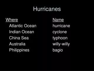
synonyms • Hurricane : north Atlantic, eastern North Pacific • Typhoon: western North Pacific • Baguio : Philippines • Cyclone : India, Australia
Progression of tropical storms leads to hurricane: 1. tropical disturbances disorganized groups of thunderstorms; some spin: 90% fizzle out 2. tropical depressions : wind speeds 23 mph 3. tropical storm : wind speeds 39 mph (named) 4. hurricane : wind speed 74 mph
Begin as “easterly waves” Most Atlantic hurricanes begin in Africa
Pacific High Azores Bermuda High Monsoonal Low
NE Trades ITCZ Turned SW by Coriolis deflection equator ocean Africa SE Trades
At this point, storm is a “tropical disturbance” • If storm moves off African continent towards Atlantic, becomes “easterly wave” (carried west by equatorial easterlies) • Of approx. 100 each year, 6 become hurricanes
Requirements: • Warm ocean surface • (>78°F) • Warm to depth of 200 ft • Vast • Basin or current • Surface convergence • Coriolis deflection • Do not form at equator (5 – 20 °N,S)
Anatomy of a hurricane • Spiral bands of thunderstorms organized around low pressure center • Surface winds converge towards central LOW • Warm, moist air • Air aloft diverges around a central HIGH
anatomy of a hurricane • eyewall • Tallest clouds • Most rain • 100 in / day • Highest wind speed • Wind speeds strongest here due to conservation of angular momentum • eye • air is sinking • Clear skies • Warmer temperatures • 15 miles diameter; 1 hour
Process of hurricane development: • Hurricane starts as tropical storm, clustered thunderstorms spinning around a central low: • Heavy rain • High winds • Release of latent heat (condensation) • Increases temperature of cluster • Central pressure drops
The lower the Low, the higher the winds speeds towards the center • Bringing warm flow of warm, moist air • More latent heat is released • Pressure continues to drop High Edge of storm: Outflow sinks and warms Low
Converging moist air and resulting release of latent heat of condensation fuels the process • Rises, condenses in eyewall • Coriolis deflection makes it spin • Cclkws surface; clkws aloft (N. Hem)
Central low pressure Average: 950 mb Typhoon Tip (1979): 870 mb Hurricane Gilbert (1988): 888 mb Hurricane Katrina: 907 mb
SH_ _ ! We’re in the middle of a ……….. …hurricane???
At top of storm: Ice crystals spiral out of storm • Create a blanket of cirrostratus cloud cover • Obscures view from above of spiral bands of clouds • On satellite images, hurricanes look like they have uniform thickness and density but they are really strongly banded
Hurricane Destruction: • High Winds (exceed 74 mph) • High rainfall (can be as great as several meters per day) • Storm surge • May contain clusters of short-lived tornadoes flooding
Storm surge • Sea surface rises and high waves push onshore • 2 processes: • Piling up of water as heavy winds drag surface water forward to land, causing sea surface to rise • Low pressure in storm center causes water to rise • For every 1 mb drop in pressure, water level rises 1 cm • Storm surge usually increases sea surface by 3 – 6 feet, but can be extreme
Hurricane Camille: storm surge 25 feet 1900 Galveston Hurricane: storm surge 14.5 ft. 8000 drowned (book: Isaac’s Storm) 1970 Bay of Bengal / Bangladesh : storm surge 40 ft. 300,000 – 500,000 fatalities
Zones of high storm surge and wind speed: • Right-hand side of storm (relative to direction it is moving) in front (“forward right flank”) • Additive effect of wind speed and storm speed
Right-forward flank
Andrew’s destructionAugust 1992 • $ 26.5 billion • 164 mph peak gust • 26 deaths • 17’ storm surge • 1 tornado • 922 mb central pressure • Began as tropical wave off west coast Africa, August 14, became Tropical Storm Andrew on Aug 17, became hurricane on Aug. 22, Category 4 Aug 23, blasted Florida Aug. 24
Floyd’s destructivenessSeptember 1999 • 155 mph sustained winds; gusts 185 mph • 921 mb • One of the largest peacetime evacuations in US • 52 deaths • rain : 2-3 inches / hour • $1 billion