Download
1 / 31
310 likes | 443 Views
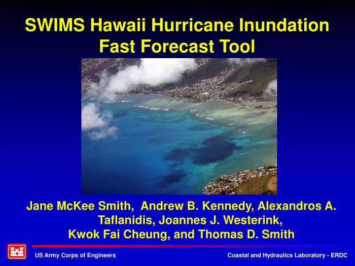
SWIMS Hawaii Hurricane Inundation Fast Forecast Tool. Jane McKee Smith, Andrew B. Kennedy, Alexandros A. Taflanidis, Joannes J. Westerink, Kwok Fai Cheung, and Thomas D. Smith. Introduction. Island communities are vulnerable to storms Nowhere to evacuate Infrastructure within hazard zone

E N D
SWIMS Hawaii Hurricane Inundation Fast Forecast Tool Jane McKee Smith, Andrew B. Kennedy, Alexandros A. Taflanidis, Joannes J. Westerink, Kwok Fai Cheung, and Thomas D. Smith
Introduction • Island communities are vulnerable to storms • Nowhere to evacuate • Infrastructure within hazard zone • Unique/Important Island Features & Physics • Steep slopes • Reef roughness • Reef flat dynamics (ponding, wave reformation) • Importance of waves • Growth of long waves
Pacific Islands Land-Ocean Typhoon (PILOT) Exp. Surge & Wave Island Modeling Studies (SWIMS) • Objectives: • Collect coastal processes data under typhoon and high-wave conditions in island environments • Improve model physics and tools for island application for emergency management and design Products • Field data sets: • Guam • Saipan • Oahu, Hawaii • St. Croix, VI • Laboratory Data Sets (2D/3D) • Model Improvements • Fast Forecasting System
SWIMS Fast Forecasting System • Pre-run storms with high-fidelity models • ADCIRC • unSWAN • BOUSS-1D • Create database of response • Develop surrogate model to forecast inundation • Deterministic • Probabilistic • Hurricane Evacuation Studies Mass Management System • Interface for Emergency Managers (MMS)
Potential Impacts • Cat 4 storm on Oahu • Severe damage to air & sea ports • Island-wide power and communications outages (1 month or longer) • 80% of homes destroyed • 650,000 people seeking shelter • Since 1950: • Nina (1957) • Dot (1959) • Iwa (1982) • Estelle (1986) • Iniki (1992) HurricaneIniki
Storm Selection: Tracks • Five base storm tracks from hurricane climatology (NWS) • Tracks shifted to give different landfall locations • Tracks and parameters varied to give a matrix of potential storms (bound most possible landfall scenarios)
Storm Selection • Base Tracks • 120,150,180, 210, 240 deg • Central Pressure • 940, 955, 970 mb • Radius of Maximum Winds • 30, 45, 60 km • Forward Speeds • 7.5, 15, 22.5 kts • 15 Landfall Locations (Oahu and Kauai)
Wave, Surge, and Runup Inundation Database Wave and surge prediction (high-fidelity model) • High-resolution grid Oahu and Kauai • SWAN+ADCIRC wave and circulation models • Validation with tides and Hurricane Iniki Wave runup prediction • BOUSS-1D Wave, surge, and runup inundation database and predictions for new events • Surrogate modeling
Grid Domain • Domain incorporates Hawaiian Islands and north central Pacific Ocean • Grid resolution ranges from 30 m on land and in the nearshore to 5000 m in deep water • Incorporates high resolution features, channels, coral reefs and wave breaking zones • 1,590,637 nodes • 3,527,785 elements
SWAN+ADCIRC Model – Coupled Waves and Currents on Unstructured Grids • ADCIRC solves for water surface elevations and currents in two dimensions • SWAN solves the wave action density and is a phase-averaged wave model with wave energy represented by a spectrum • ADCIRCpasseswater elevation and currents to SWAN • SWAN passes wave radiation stresses to ADCIRC • Models run on in parallel on the same grid
Hurricane Iniki Water Levels NOAA water elevation gauges
Wave Height (ft) for Category 4 storm, forward speed of 7.5 knots
Wave Height (ft) for Category 4 storm, forward speed of 22.5 knots
Wave Runup Analyses • SWAN+ADCIRC gives wave heights and still water levels near shore • Wave runup (intermittent wave inundation at the shore) can be dominant in some storms • Hundreds of meters inland, several meters more elevation than still water level • During Hurricane Iniki (6-8m) • Two approaches to wave runup • Parameterized relations predict runup given the significant wave height, wave period, and basic nearshore bathymetry • Boussinesq modeling along one-dimensional transects • Hawaiian topography too complex to use parameterized results
Wave Runup Analyses • Use one dimensional Boussinesq model BOUSS-1D to compute runup over 750 transects on Oahu, 443 on Kauai • Phase resolving - represents each individual wave through time and space • Forced by waves and water level at offshore boundary of transect • Precompute runup for a matrix of storms and water levels • SWAN+ADCIRC computations of waves, water level projected onto pre-computed results to give runup for any storm
RunupElevation (m) Time(s) Cross-shore Distance (m) Time(s) Offshore wave time series (m) Time(s) Wave Runup Analyses: Boussinesq Model Output along a Transect
Pre-run suite of basis hurricane scenarios Moving least-squares response surface surrogate model Predict the output for any new hurricane scenario Surrogate Model Basis hurricane scenarios New hurricane scenario
Comparison of Hurricane Output Predictions High-fidelity model predictions Surrogate model predictions
Uncertainty in all hurricane parameters (described by probability models) Use the surrogate model to predict Deterministic scenario Average (expected) output Output with certain probability of being exceeded Probability (%) of exceeding a specific threshold Probabilistic Prediction of Hurricane Output (Risk) Current hurricane location Expected hurricane track Cone of potential tracks
Summary • Fast Forecasting Tool provides framework for dynamic and fast evaluation of waves, surge and inundation • High-fidelity, high-resolution models to simulation hundreds of hurricanes • Query the database for deterministic or probabilistic estimates • Results in seconds to minutes • Simulations for the Big Island and Maui County are running now (~800 runs) • Ongoing work in Guam, too…
Guam • Jackson State U.: Himangshu S. Das and Hoonshin Jung • Grid: circular domain (6 deg radius ~ 666 km) • Resolution 14 km to 25 m • 239,664 nodes and 473,083 elements