Download
1 / 29
290 likes | 382 Views
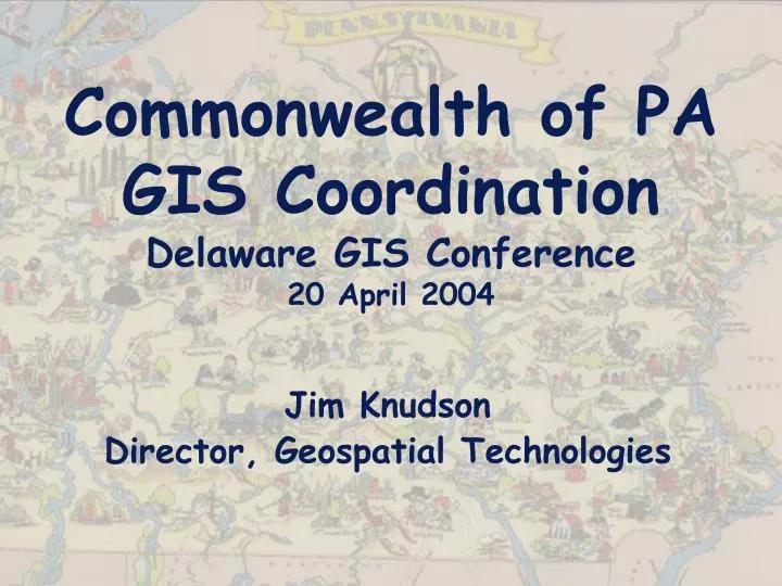
Commonwealth of PA GIS Coordination Delaware GIS Conference 20 April 2004. Jim Knudson Director, Geospatial Technologies. PA GIS/GT Barnraising. Starting to build GIS capabilities across the Commonwealth. State of PA GIS GIS Coordination. PA GT Barnraising Presentation History of GIS in PA

E N D
Commonwealth of PAGIS CoordinationDelaware GIS Conference20 April 2004 Jim Knudson Director, Geospatial Technologies
PA GIS/GT Barnraising Starting to build GIS capabilities across the Commonwealth
State of PA GISGIS Coordination • PA GT Barnraising Presentation • History of GIS in PA • GIS Coordination • State Initiatives • Coordination with Adjacent States • Questions
GIS in PA History • Early technology adoption by DEP, PENNDOT, DCNR • Several counties used state agency data to start GIS operations • Healthy GIS Industry grew up around public sector GIS initiatives • Today, PA is home to many excellent GIS and photogrammetry service firms • Best data today is created by local government • Lots of e-Gov geospatial web deployments today
GIS Coordination • First State GIS Coordinator appointed 10/20/2003 • Primary Initiatives • GIS Data Standards – PGDSS • GIS Job Classifications Need Review • Reduction of duplication • Commonwealth, Enterprise Coordination • Homeland Security GIS • Enterprise Assets – PAMAP, Routing, Geocoding, Citrix for desktop GIS • Collaboration with all partners, including adjacent states
The Case for GT Governance in Pennsylvania • 19 agencies using GIS (out of 44 agencies under Governor’s Jurisdiction) • No coordination of state agencies • 67 Counties, 2566 municipalities, little cooperation or coordination • $10M+/year spent by agencies on contractors • No GIS data standards • Overlapping efforts at state and local level and in multiple state agencies • No formal data stewardship • No current statewide imagery asset
Administration Aging Agriculture Community/Economic Development Conservation and Natural Resources Environmental Protection Education Emergency Management Fish and Boat Game Commission Health Historical and Museum Commission Insurance Labor and Industry Military and Veterans Affairs (PA Guard) PENNDOT PENNVEST Public Welfare State Police 19 Agency GIS Users Today
GT Guiding Principles • Create data once, use it a bunch • Reduce overlap and duplication of efforts • Support the Governor’s initiatives • Provide Homeland Security support • Create and communicate standards initiatives • Maintain current knowledge of agency operations and business • Develop an enterprise strategic plan • Support agencies and advance their capabilities • Identify, prioritize, and build enterprise assets and resources (e.g. imagery, geocoding solution) • Promote state collaboration with local governments for best data • Seek sustainable funding sources and achieve sustainability of operations
Data Standards • PA Geospatial Data Sharing Standard (PGDSS) • PaMAGIC has pursued best practices and geospatial data standards for 5+ years • January 2004 meeting with PaMAGIC and I-Team members to discuss final changes to draft geospatial standards • Initial standards reflect The National Map framework data layers • PGDSS v1.0 to be completed by 5/31/04 • Pilot/prototype project to test standards in 2004, seeking FGDC CAP grant
PAMAP • The Pennsylvania Map • State should procure orthophotography to control standards and ability to share with everyone • Locals create and maintain the most accurate and current geospatial data • State will provide orthophotography and ask counties to share geospatial data sets • Data will be provided in PGDSS formats • Goal is statewide coverage every 3 years
GT Coordination • Review vendor licensing issues – ESRI, GDT, find ways to reduce costs • Determine common agency and local government needs and help solve them • Homeland Security GIS needs a common backend GIS database • Agencies need help, counties and municipalities need help also • Coordination occurs at all levels – federal, state, local, private industry, academia
GT Enterprise Architecture • Enterprise GT Architecture • Citrix for Desktop • OIT intranet servers for web GIS applications • Database Server (ArcSDE - SQL Server or Oracle?) • Mapping Server (ArcIMS) • Application server – agency hosting agreements • Benefits – allow agencies application redundancy, new agencies to deploy first web GIS applications • Use of same database ArcSDE server between Citrix and intranet applications • Application Servers – Geocoding, Routing, specialized applications should be centralized and made available to all agencies • Create geospatial web services – ArcIMS and OGC compliant interfaces – WMS, WFS, OpenLS
GT Needs and Responses • Issue: Standards • State needs data standards to allow vertical data sharing between locals and the state in support of PAMAP (also state to feds) • Data on PASDA Clearinghouse is in Shapefile format, but not standardized. Every data set requires a different workflow once downloaded in order to put it into the user’s required format • State grants to local partners should have a project data standard so that project location data can be provided back to the state in GIS format • Standards Initiatives • Creation of Pennsylvania Geospatial Data Sharing Standard (PGDSS) to facilitate data sharing between counties and the state as part of the PAMAP program • Standardization of GIS Data Shapefile map projections and datum for all datasets on the PA Spatial Data Access (PASDA) website so that only have one (known) workflow for all data sets downloaded to integrate into user’s system • Definition of state grant program GIS data standards for funded projects so we can build a grant information system and visualize where we have spent state funds on local projects
GT Needs and Responses • Issue: Homeland Security/Incident Response System GIS • Need to have a consistent GIS for all HS/Incident Response systems in order to establish a common operating picture • Need to work on creating Critical Infrastructure GIS data layers • Need to define real-time GIS information needs and address enterprise-wide • HS/ER System GIS Initiatives • Established a Homeland Security GIS Task Force • Multiple state agencies and one county GIS/Emergency Management participant • Maintaining the GIS Critical Infrastructure master spreadsheet • Will operate as a think tank to provide input to programs
GT Needs and Responses • Issue: Homeland Security/Incident Response System GIS – continued • HS/ER System GIS Initiatives - continued • Design a new GIS data architecture for all agencies to use • Quit building complete copies of all data inside each agency • Build a GIS distributed data server infrastructure where data is stored once and accessed by all agencies (at CTC, redundant servers) • Agency servers only need to contain agency-specific data • Critical Infrastructure Data Creation • Assigning agency data stewardship • Trying to get PAMAP data sharing program with counties going • Examining external options to help solve the data creation/maintenance problems • Real-Time GIS Data • Exploring Weather data – looking at a solution for NWS and GIS real-time weather plus web-browser access to weather imager and forecasts for entire commonwealth, including county EMAs
GT Needs and Responses • Issue: Build Enterprise GIS Assets to solve common problems • Every agency using GIS and many that aren’t using GIS have an address geocoding and address standardization/validation problem • Need a routing capability for navigation purposes – e.g. State Parks • Many GIS agencies have duplicated sets of boundaries – zipcodes, counties, etc • There is a need for statewide imagery and a higher accuracy DEM • Some agencies cannot afford GIS Hardware and Software • Enterprise GIS Assets Initiatives (Enterprise Server Farm) • Create a Geocoding/Geolocating Server for the Commonwealth • Create a Routing Server for the Commonwealth • CTC/ESF Server Farm Enterprise GIS Assets • Citrix deployment of ESRI desktop software – pilot project • Enterprise intranet GIS mapping server environment for hosted applications. Agencies will sign hosting agreement to use resources. • Build geospatial data architecture to store data once that all agencies can use (e.g. Imagery server, basemap server, homeland security server, etc.) • Digital Imagery for PA – • Statewide USDA 1m CIR Cost Sharing – USDA/FSA NAIP program • PAMAP - $4.5M/year for first 3 years to complete entire state
GT Needs and Responses • Issue: Sustainable Funding • Funding for agencies, for counties, and for enterprise initiatives are uncertain and we usually end up with shortfalls • There are many enterprise opportunities for improvements, but they require sustainable funding • Agency dollars could be pooled under OIT/GT office to get volume discounts • Sustainable Funding Initiatives • OIT has made GIS a priority by establishing the GT office and including GIS as part of the strategic planning, agency profiles, and Communities of Practice and Legislature are looking at sustainable funding for PAMAP • There are some opportunities for DHS funding • There are some other smaller grants or partnership opportunities working with independent organizations, foundations, and the feds • GT will keep beating the bushes looking for funding opportunities
Agency Roles for GT Governance • Executive sponsorship within each agency, so that executive staff understand what the capabilities are, why GT is important, to establish the GT Governance structure, and that we need action now • Identify opportunities for increased effectiveness in resource utilization – staff, IT resources, training needs • Identify the key issues that each agency is facing regarding GT • Designate resources to serve on the Steering Committee • Attend the monthly GTC (user) meetings • Funding for enterprise approaches (PAMAP, consolidated licenses, etc.) • Work to developed a coordinated GIS effort within each agency
Adjacent States Coordination • Pennsylvania shares borders with Delaware, Maryland, West Virginia, Ohio, New York, New Jersey • Cross-border issues are important and cooperation/collaboration are required • Real-time data sharing is needed and desirable • POCs need to be established • Better and more frequent communications
Contact Information Jim Knudson (pronounce the K) Director, Geospatial Technologies Office for Information Technology Governor’s Office of Administration 210 Finance Building Harrisburg, PA 17120 http://www.oit.state.pa.us/BGT jknudson@state.pa.us (717) 346-1538
PA GIS Conference May 10-11 Harrisburg Hilton Hotel Theme: Building Our Geospatial Future Plenary Speakers: Day 1 – Jack Dangermond, ESRI Day 2 – Jim Knudson, State GIS Coordinator Website: http://www.pagisconference.org