Download
1 / 20
200 likes | 488 Views
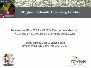
Maryland Statewide GIS Coordination. November 20 Statewide Addressing & Road Centerline Projects. Ashley Lesh, GIS Specialist Center for GIS Towson University . SHA Project History.

E N D
Maryland Statewide GIS Coordination November 20 Statewide Addressing & Road Centerline Projects Ashley Lesh, GIS Specialist Center for GIS Towson University
SHA Project History • The Shared Centerline Program started in 2001 with the Maryland State Highway Administration (SHA) testing vertical integration of transportation data using the Howard County attributed centerline • SHA developed a methodology that would allow sharing the common centerline from local governments • SHA attaches a unique-ID onto each road segment allowing simplification of future data exchange as well as making the data model flexible
Project History • This is why a cooperative centerline was needed: • Original SHA Route System
Project History • New SHA Routes with County Centerline data
Project History • Maryland State Highway Administration (MD-SHA) and the Maryland Association of Counties (MACO) received a 2005 Special Achievement in GIS award for its outstanding use of geographic information system (GIS) technology from ESRI • Later in 2005, ESRI President Jack Dangermond met with SHA, sharing with the team that data interchange may be enhanced with the new capabilities being introduced into the ArcGIS data server environment at the 9.2 release
Project History • The Cooperative Centerline Program has evolved into the Federated, or Synchronized Street Centerline Project, via the current Pilot between SHA, Towson University and Anne Arundel, Baltimore, Harford, Howard and Saint Mary’s Counties
Maryland Statewide Addressing Initiative: Immediate Project Goals • To provide a unified, statewide road centerline that supports addressing needs; • To provide counties with a means to automatically share an unrefined version (i.e., not for federal reporting) of their street centerline data; • To augment existing efforts of Maryland State Highway Administration’s federal reporting by improving data access via a centralized distribution node; • To advance ESRI’s mission in demonstrating the data synchronization capabilities of ArcGIS Server 9.2; • To increase the efficiency of statewide highway incident reporting. Long Range Goal: To establish a single, statewide road centerline that supports addressing, linear referencing, routing, and cartography.
Maryland Statewide Addressing Initiative:Project Benefits • Foundation for Maryland’s Spatial Data Infrastructure • Unified, statewide addressing layer that supports geocoding • Counties can geocode beyond their borders • States can leverage locally rich data consistently • Elimination of the need for manual data exchange via CD • Ability to establish a persistent replica that is updated automatically • Ability to extract data for a specified geography through a geodata service • Accessible by other applications that require geocoding • Combining Web services through a Service Oriented Architecture (SOA) approach • Builds upon established SHA database schema
Maryland Statewide Addressing Initiative:Minimum Level of Effort Required By County • Agree to push production data to a CGIS server • Install free software • Schedule automatic “pushed” updates
Maryland Statewide Addressing Initiative:Draft Pilot Architecture Geocoding Service Master DB Map Service ETL Merge Geodata Service Geodata Service Map Service Geodata Service Map Service Geodata Service Map Service County 2 County 3 County 1
Maryland Statewide Addressing Initiative:Project Timeline • July - December 2007: Pilot Project • Baltimore County • Howard County • Frederick County • Anne Arundel County • Montgomery County • St. Mary’s County • January 2007 - June 2008: Statewide Rollout • July 2008 – ongoing: Convergence with SHA Centerline
Maryland Statewide Addressing Initiative:County Pilot Meeting: 9/13/07 • Attendees • Kenny Miller, Acting Maryland Geographic Information Officer • Marshall Stevenson, Frederick County • Apollo Teng, Montgomery County • Doug Adams & Patrick Fangmeyer, Baltimore County • David Gillum & Jeff Cox, Anne Arundel County • Manesh Pillai, Howard County • Mike Sheffer, SHA • Matt Felton, TU-CGIS • Jeff Roberts, TU-CGIS • Ashley Lesh, TU-CGIS
Maryland Statewide Addressing Initiative:County Pilot Meeting: Outcomes • Future Concepts • Creation of a core cartographic standard • Future funding for issues related to the Statewide merged dataset • Creation of a lessons learned/recommendations document • Creation of a Feedback Mechanism • Help in reporting discrepancies while geocoding • Statewide Centerline • Concerns • Overlapping ranges • Edge-matching issues • Need for surrounding State centerline data
Maryland Statewide Addressing Initiative:County Pilot Meeting: Outcomes • ETL Mapping Schema • Each county provided feedback on schema mappings
Maryland Statewide Addressing Initiative:County Pilot Meeting: Outcomes • ETL Mapping Schema • Each county provided feedback on schema mappings
Maryland Statewide Addressing Initiative:County Pilot Meeting: Outcomes • Model Builder • ETL & Merge • Each county centerline ran through the ETL • Produces an output shapefile • Output shapefiles from the ETL are merged • Produces the Statewide merged dataset
Maryland Statewide Addressing Initiative:Updates • ArcGIS Server at CGIS • Creation of Services is complete for the pilot counties • Map Service • Geodata Service • Geocoding Service • In-network and Off-network replica creation and synchronization successful
Maryland Statewide Addressing Initiative: Foundations • Foundation for Maryland’s StateStat and BayStat efforts • MDiMap • Provide framework layers as a service • consistent base map
Questions? Ashley Lesh, GIS Specialist Center for GIS, Towson University 8000 York Road Towson, MD 21252 (410) 704-2081 alesh@towson.edu