Download
1 / 53
541 likes | 856 Views
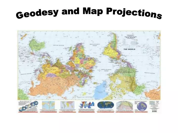
Geodesy and Map Projections. What is a Map Projection?. It is how we represent a three dimensional Earth on a flat piece of paper However…

E N D
What is a Map Projection? It is how we represent a three dimensional Earth on a flat piece of paper However… The process of transferring information from the Earth to a map causes every projection to distort at least one aspect of the real world – either shape, area, distance, or direction.
Mercator Projection and the “Greenland Problem” Also known as Northern Hemisphere dominant projection
How about this? Infamous Peters projection of 1974 - Equal Area, True Direction Shape (conformality) and Distance Not Preserved
The Answer It depends • A “good” map is one that is being successfully used for its intended purpose and was created in a precise and accurate manner • Always a trade-off in errors • Shape (Conformal) • Distance • Area • Direction (Local angles) • Can only keep one or two of these accurate • OR compromise between all four • Errors may not be significant for small study areas but they do exist
Shortest distance between two points???? Mercator Maps used as Charts in Navigation (Ships and Planes)
Basic Definitions • Geodesy - The science of determining the size and shape of the earth and the precise location of points on its surface. • Map Projection - the transformation of a curved earth to a flat map. • Coordinate systems – Any set of numbers, usually in sets of two or three, used to determine location relative to other locations in two or three dimensions
Types of Coordinate Systems • (1) Global Cartesian coordinates (x,y,z): A system for the whole earth • (2) Geographic coordinates (f, l, z) • (3) Projected coordinates (x, y, z) on a local area of the earth’s surface • The z-coordinate in (1) and (3) is defined geometrically; in (2) the z-coordinate is defined gravitationally
Z Greenwich Meridian O • Y X Equator Global Cartesian Coordinates (x,y,z) Extremely cumbersome and difficult to relate to other locations when translated to two dimensions.
Geographic Coordinates(f, l, z) • Latitude (f) and Longitude (l) defined using an ellipsoid, an ellipse rotated about an axis • Elevation (z) defined using geoid, a surface of constant gravitational potential • Earth datums define standard baseline values of the ellipsoid and geoid (more on this later….)
Origin of Geographic Coordinates Equator (0,0) Prime Meridian
Latitude and Longitude Lines of latitude are called “parallels” Lines of longitude are called “meridians” The Prime Meridian passes through Greenwich, England
Latitude and Longitude in North America 60 N 30 N 60 W 120 W 90 W 0 N
Length on Meridians and Parallels (Lat, Long) = (f, l) Length on a Meridian: AB = ReDf (same for all latitudes) R Dl D R 30 N C B Re Df 0 N Re Length on a Parallel: CD = R Dl = ReDl Cos f (varies with latitude) A
How Do We Define the Shape of the Earth? It is actually a spheroid, slightly larger in radius at the equator than at the poles We think of the earth as a sphere
Ellipsoid or SpheroidRotate an ellipse around an axis Z b a O Y a X Rotational axis
Selection of the Spheroid is what determines the SIZE of the Earth
Horizontal Earth Datums(Making sure we are where we think we are….) • What is a datum???? • An earth datum is defined by a specific ellipse and an axis of rotation • NAD27 (North American Datum of 1927) uses the Clarke (1866) ellipsoid on a non geocentric axis of rotation • NAD83 (NAD,1983) uses the GRS80 ellipsoid on a geocentric axis of rotation • WGS84 (World Geodetic System of 1984) uses GRS80, almost the same as NAD83
Representations of the Earth Mean Sea Level is a surface of constant gravitational potential called the Geoid Sea surface Ellipsoid Earth surface Geoid Since the Geoid varies due to local anomalies, we must approximate it with a ellipsoid
Geoid and Ellipsoid Earth surface Ellipsoid Ocean Geoid Gravity Anomaly
North American Datum of 1927(a very common horizontal datum – “old” data) Uses the Clarke 1866 Spheroid which minimizes error between the spheroid and the geoid at Meades Ranch, Kansas. (The center of the U.S.; unfortunately, not the world.) 1866 Spheroid (Clarke) Meades Ranch, Kansas Spheroid Center Earth surface Mass Center of Earth Geoid
North American Datum of 1983(a very common horizontal datum – “newer” data) Uses the GRS80 Spheroid which minimizes error between the spheroid and the geoid on average around the world. (Resulting in a spheroid center much closer to the mass center of the Earth.) GRS80 Ellipsoid Meades Ranch, Kansas Ellipsoid Center Earth surface Mass Center of Earth Geoid
Vertical Earth Datums • A vertical datum defines the “zero reference” point for elevation, z • NGVD29 (National Geodetic Vertical Datum of 1929) • NAVD88 (North American Vertical Datum of 1988) • Takes into account a map of gravity anomalies between the ellipsoid and the geoid which are relatively constant. Earth surface Ellipsoid Ocean Geoid Gravity Anomaly
Map Projection Flat Map Cartesian coordinates: x,y (Easting & Northing) Curved Earth Geographic coordinates: f, l (Latitude & Longitude)
Representative Fraction Globe distanceEarth distance = Earth to Globe to Map Map Projection: Map Scale: Scale Factor Map distanceGlobe distance = (e.g. 0.9996) (e.g. 1:24,000)
Geographic and Projected Coordinates (f, l) (x, y) Map Projection
Projection onto a Flat Surface(Three Broad Classes by Light Source)
Types of Projections Equal Area: maintains accurate relative sizes. Used for maps that show distributions or other phenomena where showing area accurately is important. Examples: Lambert Azimuthal Equal-Area, the Albers Equal-Area Conic. Conformal: maintains angular relationships and accurate shapes over small areas. Used where angular relationships are important, such as for navigational or meteorological charts. Examples: Mercator, Lambert Conformal Conic. Equidistant: maintains accurate distances from the center of the projection or along given lines. Used for radio and seismic mapping, and for navigation. Examples: Equidistant Conic, Equirectangular. Azimuthal or Zenithal: maintains accurate directions (and therefore angular relationships) from a given central point. Used for aeronautical charts and other maps where directional relationships are important. Examples: Gnomonic projection,Lambert Azimuthal Equal-Area.
Conic Projections(Albers, Lambert) The lines where the cone is tangent or secant are the places with the least distortion.
Cylindrical Projections(Mercator) The lines where the cylinder is tangent or secant are the places with the least distortion. Transverse Oblique
Projections Preserve Some Earth Properties • Area - correct earth surface area (Albers Equal Area) important for mass balances • Shape - local angles are shown correctly (Lambert Conformal Conic) • Direction - all directions are shown correctly relative to the center (Lambert Azimuthal Equal Area) • Distance - preserved along particular lines • Some projections preserve two properties • Some projections preserve none of the above but attempt to minimize distortions in all four • The degree and kinds of distortion vary with the projection used. Some projections are suited for mapping large areas that are mainly north-south in extent, others for large areas that are mainly east-west in extent.
Coordinate Systems • Hydrologic calculations are done in Cartesian or Planar coordinates (x,y,z) • Earth locations are measured in Geographic coordinates of latitude and longitude (f,l) • Map Projections transform (f,l) (x,y)
Coordinate System A planar coordinate system is defined by a pair of orthogonal (x,y) axes drawn through an origin Y X Origin (xo,yo) (fo,lo)
Commonly used coordinate systems and associated projections • State Plane (Texas, California, etc) • Usually is a Lambert Conformal Conic projection (not always) • Reference meridian • Two standard parallels • Good for East-West areas • Commonly used by state and local governments for GIS databases • Broken into appropriate sections representing areas of the state • Coordinate System is in Feet • False Easting (FE), False Northing (FN) • Reference Latitude • Central Meridian • (0 + FE, 0 + FN) is origin of coordinate system
Universal Transverse Mercator Coordinate System • Uses the Transverse Mercator projection • Each zone has a Central Meridian(lo), zones are 6° wide, and go from pole to pole • 60 zones cover the earth from East to West • Reference Latitude (fo), is the equator • (Xshift, Yshift) = false easting and northing so you never have a negative coordinate • This time in METERS!!!!! • Commonly used by federal govt agencies such as USGS (also a few states)
Mercator Projection The only map on which a straight line drawn anywhere within its bounds shows a particular type of direction, but distances and areas are grossly distorted near the map's polar regions.
UTM Zone 14 -99° -102° -96° 6° Origin Equator -90 ° -120° -60 °
Summary Concepts • Two basic locational systems: geometric or Cartesian (x, y, z) and geographic or gravitational (f, l, z) • Mean sea level surface or geoid is approximated by an ellipsoid to define a horizontal earth datum which gives (f, l) and a vertical datum which gives distance above the geoid (z)
Summary Concepts (Cont.) • To prepare a map, the earth is first reduced to a globe and then projected onto a flat surface • Three basic types of map projections: • conic • cylindrical • Planar/azimuthal • A particular projection is defined by a datum, a projection type and a set of projection parameters