Download
1 / 38
380 likes | 536 Views
The Exhilarating World of Geodesy and Map Projections. You will want to pay attention… there will be a test on this material!!!. Geodesy: measuring the Earth.

E N D
The Exhilarating World of Geodesy and Map Projections You will want to pay attention… there will be a test on this material!!!
Geodesy: measuring the Earth • Geodesy: a branch of earth sciences, is the scientific discipline that deals with the measurement and representation of the Earth, including its gravity field, in a three-dimensional time varying space. • Geodesy deals with the determination of the earth's shape and size, as well as its gravity field, i.e. the measurement of gravitational acceleration. • The knowledge of the gravity field is important, because almost every geodetic measurement is closely related to gravity, e.g. instruments have to be leveled along the a horizontal surface.
Calculating Routes on the Earth’s Surface • Calculations however (including calculations of a route for high-speed trains) do not use the actual shape of the earth, but mathematically defined surfaces and bodies such as planes, spheres or ellipsoids of rotation. • The difference between reality and these simplified mathematical models is shown in the figure below. http://www.gug.bv.tum.de/seiten-e/technik/physik.html
Geodesy and GPS • It is critical to know about the difference between heights above sea level (which are related to the gravitational field and thus the only way to determine the slope) and the ellipsoidal heights, which are a result of GPS measurements. • Geodesy provides information about the reference surface of the heights above sea level - the so-called geoid. The geoid is represented as the surface of an imaginary, calm sea, continued below the continents. • It is the connection between the heights measured with GPS and heights above sea level, used in national vertical control networks. http://www.gug.bv.tum.de/seiten-e/technik/physik.html
Earth as a Geoid Earth has a dynamic surface and complex structure. A Geoid is too complex a shape for daily needs so easier to think of Earth as an ellipsoid http://www.hydrology.uni-kiel.de/lehre/vorlesung/ws04-05/vl_msc0104_02.pdf
Geoid-Spheroid-Ellipsoid • A GEOID is the earth’s actual shape (including elevation above/below sea level) • A SPHEROID is an ellipsoid that approximates the shape of a sphere • An ELLIPSOID is created by rotating an ellipse about either major axis or minor axis
Earth as Reference Ellipsoid • Ellipsoid defined by an equatorial radius, polar radius and the reciprocal of the flattening • Ellipsoid approximates the geoid in size and position • Different ellipsoids in use. They differ in equatorial radius and flattening as well as positioning of their center. Geoid with different elipsoids and different reference locations
Graticule: parallels and meridians • System of imaginary intersecting lines was created based on 360 degree Babylonian system for dividing a circle or sphere • Map projections are based on: • Central Meridians • Standard Parallels
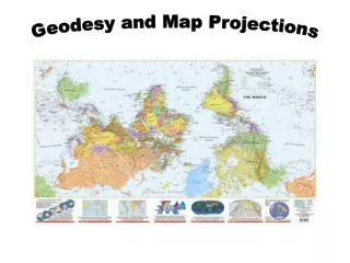
What is a Map Projection? • A map is a flat representation of a globe • A map projection is a systematic transfer of points on a curved surface to a flat projection surface
SSADD: 5 Key Properties of Maps • Scale: relationship of distance and area on Earth to distance and area on map • Shape: shape is preserved when the scale of any point on the map is the same in any direction • Area: proportional relationship between study region and area of the Earth that it represents • Distance: length from center of the projection to any other place on the map • Direction: angles from a point on a line to another point are portrayed correctly in all directions
Why use Map Projections? • GIS and paper maps are flat and more convenient than 3D models for most applications • Scanning and digitizing maps is a big source of spatial data used in GIS • Most common spatial data models are flat and cannot be created on curved surface • Earth has to be projected to see all of it • Much easier to measure distance on a plane
Problems with Map Projections • Maps can preserve some of the properties but not all • No projection can retain more than one of these properties over large portion of globe • Every map projection distorts the earth is several ways • Decisions of which projection to use depends on reducing distortion
Projection Parameters • Projection Center: point of projection • Projection Families: Developable Surfaces • Projection Aspect: orientation of developable surfaces • Location of developable surface
Projection Centers • Gnomonic: projection point from Earth’s center • Stereographic: at antipodal surface • Orthographic: at infinity
3 Families of Projections Developable surface: 2 D surface upon which map information is projected. Can be unrolled without distortion although projection will contain distortions • Cylindrical • Conical • Planar
Cylindrical Projections • Used by mariners for navigation • Meridians run north - south • Parallels run east- west • True at equator and distortion increases towards the poles
Conical Projections • Used for mid latitude maps • True at areas between standard parallels
Planar Projections • Used to navigate flight routes • Preserves Great Circle Lines • In polar aspect, these maps project meridians as straight lines radiating from the poles and parallels as complete circles centered at the pole • True at poles and distortions increases outwards
4 Types of Projection Aspect • Normal: oriented with polar axis • Transverse: perpendicular to polar axis • Polar: centered on N/S Poles • Oblique: all others
Location of Developable Surface • Tangent: DS touches the globe • Secant: DS cuts into the globe
Map Property Preservation • If a projection preserves… • SHAPE it is called CONFORMAL . • AREA is called EQUAL-AREA or Equivalent. • DISTANCE it is called EQUIDISTANT • DIRECTION it is called AZIMUTHAL
Tissot’s Indicatrix: Graphical Tool to Analyze Projection Properties • http:www.jhlabs.com/java/maps/proj
Example: Mercator Projection • Cylindrical • Conformal • Areas not preserved and increase towards the top and bottom of the map • Preserves true-direction along graticule lines • Used for ocean navigation
Mercator Projection • http:www.jhlabs.com/java/maps/proj
Example: Lambert Conformal Conical • Conical • Conformal • Preserves shape of geographic features • Useful in mapping mid latitudes
Lambert Conformal Conical • http:www.jhlabs.com/java/maps/proj
Example: Orthographic Azimuthal • Planar • Azimuthal • Equatorial or Oblique Aspects • Azimuthal not suitable for displaying entire Earth in one view
Orthographic Azimuthal • http:www.jhlabs.com/java/maps/proj
Robinson Projection • ‘Looks’ Balanced • Used by NGS Distance Shape Direction are all distorted but… • http:www.jhlabs.com/java/maps/proj
Projection Systems • A Projected Coordinate System is a projection based on two different projections depending on the shape of the region it describes • State Plane Coordinate System (SPCS) • States extending east to west, uses Lambert conformal conical projection • States extending north to south, uses tranverse cylindrical Mercator projection • Measured in feet • Minimizes distortions within 1 foot
Projection Systems • Universal Tranverse Mercator Coordinate System (UTM) • Uses 60 zones, each 6 degrees of longitude wide • Measured in meters • Uses a secant variation • Minimizes distortion < 1meter within each zone
Unprojected vs. Undefined Data • Unprojected geographic coordinate system allows more flexibility in setting ArcMap’s data frame coordinate system to suit analysis needs • Undefined coordinate system is missing files to enable ArcMap to read and reference them with other data layers. You will need to define the coordinate system to fully use the file in an ArcMap project.
Final Thoughts • Map projections are critical for transferring 3D globe onto 2D flat surface • Many types of projections used for different purposes • Need to understand map projections to work with multiple layer files in GIS to make each layer ‘fit’ with the other. • Go to JH Labs website and explore more unusual map projections. Bring a copy of your favorite unusual projection with a description of which properties are preserved and which are distorted.
Assignment • Go to JH Labs website (JH Labs: Java Map Projection Library http:www.jhlabs.com/java/maps/proj) and explore more unusual map projections. • Bring a copy of your favorite unusual projection with a description of which properties are preserved and which are distorted. • Go online to search how geodesy is used in making maps, refining measurements of earth’s surface, navigation systems, or another interesting aspect of how it is used by scientists and engineers. Write a one page (double spaced 12 font) summary of the information you found. Provide the website URLs and any images that will help explain your findings. • Be prepared to share your projection selection and your geodesy research summary with a small group.
Quiz Material • Know definitions for geoid, spheroid, ellipsoid • Know definition of geodesy and ‘map projection’ • Know definitions of the 5 Key Properties of Maps (SSADD) • Know at least one reason for using map projections and at least one problem with map projections • Know 3 types of projection centers • Know 3 families of projection • Name 3 specific map projections and the characteristics of one of them (pros and cons) • Name one example of a Projected Coordinate System
Resources used for presentation • JH Labs: Java Map Projection Library http:www.jhlabs.com/java/maps/proj • Information on Geodesy and Geoinfomatics Engineering http://www.uni-stuttgart.de/studieren/angebot/geodaesie/index.en.html#diploma • Geodesy and Geoinformaiton http://www.gug.bv.tum.de/seiten-e/technik/physik.html • Hydrology and Water Management Ecology Centre: http://www.hydrology.uni-kiel.de/lehre/vorlesung/ws04-05/vl_msc0104_02.pdf • GEOG101: http://faculty.winthrop.edu/storiec/files/GEOG101/lectures/05-GEOG101-MapsGIS.pdf • Kate Beard’s SIE 509 Principles of GIS: Map Projections • higheredbcs.wiley.com/legacy/college/strahler/0471480533/student_pres/ch03.ppt – • http://www.biology.ualberta.ca/facilities/gis/uploads/instructions/5_GCP_Fall2004.pdf