Download
1 / 24
240 likes | 375 Views
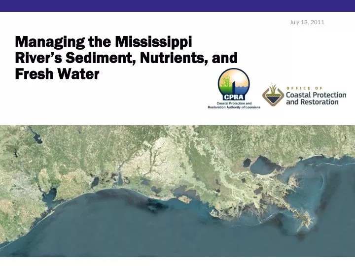
Managing the Mississippi River’s Sediment, Nutrients, and Fresh Water. July 13, 2011. Why?. The human need to reduce variability in dynamic systems…

E N D
Managing the Mississippi River’s Sediment, Nutrients, and Fresh Water July 13, 2011
Why? The human need to reduce variability in dynamic systems… to support well intended activities such as flood control, navigation, coastal and economic development, subsurface fluid extraction, agriculture, fisheries production, and others
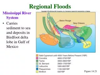
History John McPhee, The Control of Nature: "This nation has a large and powerful adversary. Our opponent could cause the United States to lose nearly all her seaborne commerce, to lose her standing as first among trading nations . . . . We are fighting Mother Nature . . . . It's a battle we have to fight day by day, year by year, the health of our economy depends on the victory." • Early settlement Individual agricultural levees • 1830’s Navigation channel imp. • Post Civil War Organized levee districts • 1876 20 ft channel at South Pass • 1879 Mississippi River Commission formed • 1917 Flood Cont Act – levees from IL to LA • 1927 Great flood • 1928 Flood Control Act – MR&T
Crisis Unforeseen? When discussing the Mississippi River Commission 1894 report of survey on the delta to account for the sinking land it was noted: “The conditions are very different now from those existing prior to the existence of levees. There are at present no annual accretions of sedimentary matters from the periodical overflows of the river. These accretions formerly were a little more than equal to the annual subsidence of the lands…”
History • Flood Control Act of 1965 • Caernarvon Freshwater Diversion • Davis Pond Freshwater Diversion • CWPPRA 1990 • Multiple small scale projects • LCA 2004/WRDA 2007 • 7 proposed diversions • Near-term critical
River Management:Then Project specific Project area effects Project resource allocation Funding Best available science and engineering
Goals • Vision • Something to achieve • Better Science • Systems approach to management: • Navigation, Flood protection, Ecosystem sustainability • National Priority • Ecosystem sustainability = Navigation, Flood Control
Vision • Louisiana’s Comprehensive Master Plan for a Sustainable Coast : 2012 update Comprehensive systems approach What do we want to achieve? How do we get there? – Projects Under what circumstances? – Funding, Sea level rise • Vision • Decision Criteria, Constraints, and Uncertainties • Comprehensive Project-effects Models • Prioritization Tool • Prioritized Project Portfolios • Expected Outcomes • Adaptive Management and Implementation Plan • Long–term Funding Scenarios
Vision Ecosystem Services Agricultural/aquaculture production Freshwater-dependent services Shrimp harvest Oyster harvest Saltwater commercial/recreational fisheries harvest Carbon/nutrient uptake Increasing Levels of Ecosystem Services Surge/wave attenuation Existing Shoreline recreation Decreasing Ecotourism
Science • Mississippi River Hydrodynamic and Delta Management Project • Two Parts: • What resources are available • What do we with to them
Science: Hydrodynamic How much sediment is available? How much freshwater is available? Nutrient availability and potential for wetland assimilation? When? What is the fate of these resources? What happens to the navigation channel if continued ecosystem degradation continues?
Science: Delta Management • What do we do with available resources? • Large scale diversions • Channel re-alignment • Slack water channel/sail through lock • Sediment pipeline • Sediment traps • Nutrient sinks • Driver - 2012 Master Plan
National Priority • Gulf Coast Ecosystem Restoration Task Force • Conserve and restore habitat • Restore water quality • Protect and replenish living coastal marine resources • Enhance Community resilience
National Priority • Gulf Coast Ecosystem Restoration Task Force • Looking at things like • Cross cutting federal budgets • Increase sediment use form river for restoration • Incremental funding for better sediment management • Focused effort on Lower Mississippi River • Working group to develop long-term approach (NAS) • Support state’s master plan – federal interest = federal funding • Support LCA diversion implementation • Augmenting CWPPRA with NRDA, CWA when available • Declare a national emergency
Shifting Approaches • Ongoing and gradual • Master Plan Update • MR Hydrodynamic and Delta Management • Modeling and data collection on River better than ever before • Myrtle Grove, West Bay, Pass a Loutre • 2011 flood response • Advancing diversions • More projects borrowing form river using river sediments that ever before • Administration recognition
Shifting Approaches • Vision • We have to know where we are going • Better Science • We have to know how to get there • National Priority • We need the support of the Nation
Future Scientific Directions • Locate diversions where project objectives best correspond to river resources EXAMPLE: MISSISSIPPI RIVER HYDRODYNAMIC & DELTA MANAGEMENT STUDY • Have in place a robust data collection effort to be able to document the effects of project operations EXAMPLE: CONTINUED DEVELOPMENT OF SWAMP • Feed monitoring data into a comprehensive modeling program to predict future responses of the system to continued operation and allow predictions to frame changes in operation EXAMPLE: LOUISIANA APPLIED MODELING PROGRAM • Have data and outputs peer-reviewed to establish scientific credibility
LCA Mississippi River Hydrodynamic and Delta Management Study
Mississippi River Hydrodynamic Study • Start with best data possible on lower river hydrodynamics and sediment transport • Two-year data collection across full reach has been discussed • Develop integrated 1D/2D models of hydrodynamics and sediment transport for the lower river to identify best sections of river for future diversions • HEC-6T and HEC-RAS likely but not only options • Develop robust 2D/3D models of hydrodynamics and sediment transport for specific sections to refine specific locations of diversions • As per LCA Science Board review of West Bay Study • Strong preference for open-source, subject to peer review
Mississippi River Delta Management Study • Develop up-to-date bathymetry, topography and geotechnical stability for the receiving basin adjacent to the prior-identified site • Develop robust multi-dimensional hydrodynamic models for the relevant interdistributary basins • Options include ADH and CH3D-SED (used for West Bay) and the State’s Delft-3D portfolio • Couple the hydrodynamics to land-building and ecosystem change models, possibly including predictive models for • Wetland morphology and vegetation • Fisheries and other upper trophic levels • Options include CASM (used for LCA Mods to Caernarvon/Davis Pond) and Ecopath with Ecosim (calibrated for Caernarvon, in development for Barataria) • Risk assessment • Such as ADCIRC, HAZUS, etc.
Mississippi River Delta Management Study • The strategy for dealing with all modeling needs should be to • Employ cross-sector expertise for data collection and model development • Utilize existing models as a foundation • Improve existing models with new data and technology • Explore new models with improved capabilities • Subject all models and outputs to peer review to establish credibility • Communicate all modeling results to relevant stakeholders • The Mississippi River Hydrodynamic and Delta Management Study will tell us • Where future diversions are best sited for specific purposes, and • How to best operate multiple diversions over multiple years