Download
1 / 22
220 likes | 386 Views
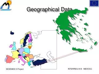
Geographical Data Products. Carol Blackwood UKBORDERS 3 rd July 2012. Key geographical products. Key geographical data products that support census data and research: Digital boundary data Digital version of geographical boundary information

E N D
Geographical Data Products Carol Blackwood UKBORDERS 3rd July 2012
Key geographical products • Key geographical data products that support census data and research: • Digital boundary data • Digital version of geographical boundary information • Used for data visualisation and spatial analysis • Postcode directories • Geographical lookup table that provides information about postcodes such as the location of that postcode, ward, LSOA etcetc
Benefits of mapping census data • Can be applied to data to add value, reveal patterns, support decisions • Range of types of spatial analysis from simple interpretation of a map to types that require complex software • E.g. queries, measurement, transformations and more…
Serving census related geographical data products to UK academia
UKBORDERS – Service aims • to provide UK education and research with cost-effective access to digitised boundary data, ancillary look-up tables for thematic mapping and GIS operations; • to provide high quality support and assistance to that community in the exploitation of these resources; and • to support the development and then realisation of the ESRC national dataset strategy.
UKBORDERS – key features • Provide easy access to census related digitised boundaries and key geographic reference data • Web based service available 24/7, delivering to the UK academic community. • Extensive library of boundary data and associated look-up tables • Including: 1971, 1981, 1991 and 2001 censuses • Non-census boundaries (e.g. environmental boundaries) • Selected historical boundaries going back to 1851 (e.g. 1881 Census Parishes) • Access to current and historical postcode directories (1980 to present)
Heading 1 • Bullet point • Easy Download • Quick & easy download • Most popular National datasets • Most popular formats • Incl. 2001 LUTs and generalised datasets
Heading 1 • Bullet point • Boundary Data Selector • Access to all available boundaries • Refine area of interest • Choice of data formats and compression options • Map view to preview area
Heading 1 • Bullet point • Postcode Directory Download • Easy access to Postcode Directories • ONSPD • NSPD • Historical
Heading 1 • Bullet point • Postcode Data Selector • Sub-setting tool to select postcode areas/district/sectors • Select postcode attributes of interest • Create custom LUTs between postcodes and boundary datasets (e.g. Datazones etc)
Heading 1 • Bullet point • View Metadata • Discover and view metadata for boundary datasets • Describes data • Allows users to gauge fitness for purpose
In addition • Help, support and training • Comprehensive help pages • Expert support • Training through Census workshops • eLearning Modules • To explain the relevance and value of the census geography products • Interactive learning objects explain key spatial data concepts and UK geographies • Thematic Mapper • A Web based application that enables the creation of Choropleth thematic Maps from uploaded CSV files containing area based statistics. • Uses OS Open Data boundaries • DIaD • Data Integration and Dissemination demonstrator • demonstrating use of geospatial web services to perform GeoLinking and Cartogram creation
2011 Geography Products – England & Wales • ONS 2011 Geography Prospectus released 31st May 2012 • What geographical outputs released & when • http://bit.ly/NjVyaE • First release of geography products in October 2012, one month prior to 2nd release of Census data • 2011 Output Area, Lower and Middle Layer Super Output Areas • 2011 Output Area, Lower and Middle Layer Super Output Areas population weighted centroids • 2011 Output Area to 2011 lookup files (to higher geographies and 2001 to 2011 LUTs) • Second release of geography products in January 2013 • 2011 Workplace zones (WZ) • 2011 Workplace zones population weighted centroids • Further lookup files for 2011 OAs to urban geographies
2011 Geography Products - Scotland • National Records of Scotland (NRS) Outputs prospectus released 19th June 2012 • http://bit.ly/QAabFQ • Geography products to be released in early Spring 2013 (with 2nd release of census data) • Digitised boundaries for output areas • Postcode to output area index • Output area to higher area index
2011 Geography Products - NI • Not so clear… • 1st release of statistics July 2012, 2nd Nov 2012 • Subsequent releases in 2013 • Geographical boundaries in one of those releases??
Research Potential • Enables comparison with previous Census • Although geographies change! Less than 5% OAs/SOAs expected to change • Building up pictures of change, can be related to economic etc change • Open data • More flexible for research • e.g. Thematic mapper potential with census data • Updating of visualisations and online services
UKB beyond • Will become part of the CSS-UKDS • New look • New name? • New facilities? • Short-term no apparent change for the user • We’ll keep doing what we have been doing, providing key services and support to academic users of Census geographies and related data