Download
1 / 16
240 likes | 567 Views
Introduction t o Geographical Data. Kris Ray Confederated Tribes of the Colville Reservation. GIS Definitions. G eographic I nformation S ystem (GIS) used for capturing, storing, analyzing and managing data and associated attributes which are spatially referenced to Earth OR

E N D
Introduction to Geographical Data Kris Ray Confederated Tribes of the Colville Reservation
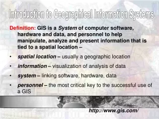
GIS Definitions • Geographic Information System (GIS) used for capturing, storing, analyzing and managing data and associated attributes which are spatially referenced to Earth OR • A computer system capable of holding and using data describing places on Earth's surface OR • Graphic representation of where features are, explicitly and relative to one another
Components of GIS • Hardware (computer to run program and display data) • Software (to collect and calculate data) • Trained staff (to coordinate above functions) • Data (collected from actual points on earth)
Foundation of GIS • Geographic data - referenced spatially by coordinate system • Latitude and longitude • Universal Transverse Mercator • Legal-Survey Description • Attribute data • Characteristics of feature or map component • Map legend • Links attributes to geographic data
Geographic Data • Point data - Associated with a single location in space. Example: monitoring sites • Linear data - location is described by a string of spatial coordinates. Examples: rivers, roads and pipelines • Area data - described by a closed string of spatial coordinates or polygon. Examples: forest stands, soil classification, and administrative boundaries
Layers • Representation of a dataset in a digital map environment • Components of the legend • Theme • Overlays • Composed of visual representation and attribute data
Visualization of Layers “Mini-maps” or “sub-maps” come together to make a map that answers a question
Projection • Mathematical means of transferring information from a model of Earth, 3-dimensional curved surface to 2-dimensional medium—paper or a computer screen • Different projections used for different types of maps – each projection particularly suits certain uses • For example, a projection that accurately represents shapes of continents will distort relative sizes
Datum • Reference specifications of measurement system, usually a system of coordinate positions on a surface (horizontal datum) or heights above or below a surface (vertical datum) • North American Datum of 1927 (NAD 27) • Zero based on geographic center of lower 48, in Kansas • World Geodetic System of 1984 (WGS 84) and the North American Datum of 1983 (NAD 83) • Zero is based on Earth’s center of gravity Source: ESRI @ http://support.esri.com/index.cfm?fa=knowledgebase.gisDictionary.search&searchTerm=datum
Different Data NAD 83 + WGS 84 NAD 27
Coordinate System • Geographic Coordinates such as latitude and longitude, 56°27'40" and 116°11'25". • Map Projection Universal Transverse Mercator (UTM) where coordinates are measured in meters, 545,000.000 and 6,453,254.000 normally reference to a central meridian. Easting's refer to X coordinates while Northings refer to Y coordinates. • Legal Survey Description, Meridian, Township, Range and Section
Remember • GIS is a way of analyzing geographic data • Layers: “mini-maps” or “sub-maps” • Best maps have layers that come together to answer one specific question • WGS 84 and NAD 83 work well with GPS • Always make sure data (plural of datum) match Source: ESRI @ http://support.esri.com/index.cfm?fa=knowledgebase.gisDictionary.search&searchTerm=datum