Download
1 / 14
140 likes | 594 Views
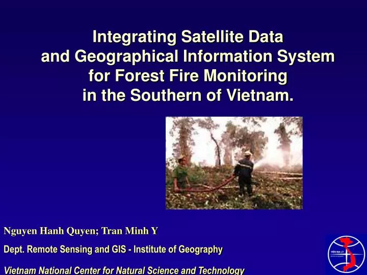
Integrating Satellite Data and Geographical Information System for Forest Fire Monitoring in the Southern of Vietnam. Nguyen Hanh Quyen; Tran Minh Y Dept. Remote Sensing and GIS - Institute of Geography Vietnam National Center for Natural Science and Technology Introduction

E N D
Integrating Satellite Data • and Geographical Information System • for Forest Fire Monitoring • in the Southern of Vietnam. Nguyen Hanh Quyen; Tran Minh Y Dept. Remote Sensing and GIS - Institute of Geography Vietnam National Center for Natural Science and Technology
Introduction - The suffering from forest fire is dramaticin VietNam and other ASEAN country. - Determine the cause of the forest fire can help to reduce the disaster, and raising the awareness. Objective - Remote sensing technique has closely monitored the fires raging across the forests - Time series analysis for the trend of land cover change - Calculate the habitat loss in the fire area.
Overview of the study area • The Uminh Thuong natural conservation: • The core area of the nature conservation is 7943.8ha • The most precious and important virgin natural forest in the South of Vietnam. • Ecosystem are diverse in both quality and quantity of fauna and flora • The forest has a peat layer about 1.5 meter deep • Weather condition are separated into 2 seasons: Rainny and drought.
Forest fire districts in U Minh Thuong region Source: UNDP
Material and Method Why choosing the SPOT satellite images? - The High Resolution Visible (HRV) sensors on board the SPOT satellites provide high resolution (20 m in the multispectral mode) images of the fire areas. - Individual smoke plumes can be observed in the images - The precise locations of the fires can be determined. - The types of landcover on fire can also be determined from the spectral and contextual features of the fire areas. - High frequency for achiving data at the area
Material 1. MOSS1 taken on 12 Dec 1988 2. SPOT taken on 08 Jan 1995 3. SPOT taken on 04 Feb 2002 4. SPOT taken on March 2002 5. SPOT taken on 28 Sept 2002 6. MODIS from March to April 2002 Methodology - The combinationchannels 4,3,2 representation ( SWIR(4), NIR(3), and Red(2) bands in RGB display respectively. - Colocomposite and land cover classification for 3 images. - Data Fusion temporal analysis for accounting the change before and after the forest fire.
Raw satellite Image in 1988 and 1995 SPOT Quicklook image Basic image processing Fire detection Geo-referencing Digital image classification Map of land cover change from 1988 to 1995 Map of forest fire monitoring Multi data fusion Forest loss in 2002 Methodology
Map of land cover in 1995 SPOT image 08 Jan 1995
Burning point Feb 2002 (a) March 2002 (b) Fig 1. Fire detection in April 05th (a) and 18th (b) 2002 in the surrounding area of Uminh Thuong by MODIS satellite image Fig 2. Area of monitoring the forest fire in the Uminh Thuong forest Sept 2002 (c)
A B Fig. 3. A. SPOT image on 28 Sept 2002 to map the cleared burnt area B. Map of Land cover derived from SPOT image on Feb. 2002
Result The land cover change from 1988 to March. 2002, before the forest fire
Habitat loss Total area burnt scar in U Minh Thuong is 2954.4 ha = 37.5% Mainly natural melaleuca forest, takes 32.1% of the area Table 2. Area of habitat on fire
Conclusion and recommendation - The research has calculated the burnt area and support for the governemnt to help the local and restore the forest. - Multi temporal data fusion technique to define the cause of land cover change and also the potential area of fire, monotoring forest fire to support for the manager. - Data access for disasater monitoring research can be achived from the Internet -The government need to apply space technology on forest fire detection, improve the daily real time warning system for forest fire hazard during the dry season. - Urgent need to cooperate interms of disaster management and reduction
* http://www.crisp.nus.edu.sg/ * http://www.landsat.org