Download
1 / 51
510 likes | 513 Views
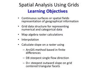
This internet seminar provides an overview of data grids for HPC, focusing on the application of geographical information system grids. Topics covered include parallel computing, web services, two-level programming, and grid libraries.

E N D
Data Grids for HPC: Geographical Information System Grids Marlon Pierce Geoffrey Fox Indiana University December 7 2004 Internet Seminar
Parallel Computing • Parallel processing is built on breaking problems up into parts and simulating each part on a separate computer node • There are several ways of expressing this breakup into parts with Software: • Message Passing as in MPI or • OpenMP model for annotating traditional languages • Explicitly parallel languages like High Performance Fortran • And several computer architectures designed to support this breakup • Distributed Memory with or without custom interconnect • Shared Memory with or without good cache • Vectors with usually good memory bandwidth
PaymentCredit Card WSDL interfaces Security Catalog Warehouse shipping WSDL interfaces What are Web Services? • Web Services are distributed computer programs that can be in any language (Fortran .. Java .. Perl .. Python) • The simplest implementations involve XML messages (SOAP) and programs written in net friendly languages like Java and Python • Here is a typical e-commerce use?
What Is the Connection? • Both MPI and Web Services rely upon messaging to interact. • But the difference is in speed of message transmission • MPI useful for microsecond communication speeds. • Clusters, traditional parallel computing • Web Services communicate with Internet speeds • Millisecond communication times at best. • This implies that we have (at least) a two-level programming model. • Level 1: MPI within science applications on clusters and HPC. • Level 2: Programming between science applications.
Service Data Two-level Programming I • The Web Service (Grid) paradigm implicitly assumes a two-level Programming Model • We make a Service (same as a “distributed object” or “computer program” running on a remote computer) using conventional technologies • C++ Java or Fortran Monte Carlo module perhaps running with MPI on a parallel machine • Data streaming from a sensor or Satellite • Specialized (JDBC) database access • Such services accept and produce data from other services, files and databases • The Grid is used to coordinate such services assuming we have solved problem of programming the service
Service1 Service3 Service2 Service4 Two-level Programming II • The Grid is discussing the composition of distributed serviceswith the runtime interfaces to Grid as opposed to UNIX pipes/data streams • Familiar from use of UNIX Shell, PERL or Python scripts to produce real applications from core programs • Such interpretative environments are the single processor analog of Grid Programming • Some projects like GrADS from Rice University are looking at integration between service and composition levels but dominant effort looks at each level separately
3 Layer Programming Model Application (level 1 Programming) MPI Fortran C++ etc. Semantic Web Application Semantics (Metadata, Ontology) Level 2 “Programming” Basic Web Service Infrastructure Web Service 1 WS 2 WS 3 WS 4 Workflow (level 3) Programming BPEL Semantic Web adds a another layer between workflow and Services representing traditional applications
Data and Science Applications • Two- (or three-) level programming applies to all applications. • Typically we need to bind together HPC and non-HPC parts. • How do you provide data to your application? • How do you share data between applications? • How do you communicate results to analysis and visualization programs? • This is particularly important as the size and quality of observational data is growing rapidly. • Q: How do you easily bind together science apps and remote data sources? • A: Web Services (and Grids) provide the unifying architecture.
Grid Libraries • Programming the Grid has many similarities with conventional languages • In HPSearch you use similar Scripting languages • Grids are particularly good at supporting user interfaces as the browser is a particular service • Portal technology important “gift” of Grids for HPC • Most promising (and not exploited often) is building Grid “Libraries” which are collections of services which can be re-used in several applications • Mastercard service is a typical business Grid library • Visualization, Sensor processing, GIS are naturally distributed components of a HPC application that can be developed as Grid libraries
Data Deluged Science • In the past, we worried about data in the form of parallel I/O or MPI-IO, but we didn’t consider it as an enabler of new algorithms and new ways of computing • Data assimilation was not central to HPCC • ASC set up because didn’t want test data! • Now particle physics will get 100 petabytes from CERN • Nuclear physics (Jefferson Lab) in same situation • Use around 30,000 CPU’s simultaneously 24X7 • Weather forecasting, climate, solid earth (EarthScope, Eath Systems Grid, GEON) • We discussed our project SERVOGrid in October 2004 lecture. • Bioinformatics curated databases (Biocomplexity only 1000’s of data points at present) • Virtual Observatory and SkyServer in Astronomy • Environmental Sensor nets
Data Deluge @ Home • In 2003, all of Marion County, IN (including Indianapolis) was surveyed using Light Detection and Ranging (LiDAR) sensing. • GRW, Inc flew a Cessna 337 airplane over the entire county to produce digitized maps. • 1 point per square meter. • 495 square miles total. • Can be used to create high resolution contour maps…. • But what do you do with all of the data? • LiDAR data represents 3 orders of magnitude increase in data resolution over what is used today in conventional flood prediction (B. Engles, Purdue). • Flood modeling codes thus must become HPC codes to handle the size of newly available data.
Example Data Grid: The Earth System Grid • U.S. DOE SciDAC funded R&D effort • Build an “Earth System Grid” that enables management, discovery, distributed access, processing, & analysis of distributed terascale climate research data • A “Collaboratory Pilot Project” • Build upon ESG-I, Globus Toolkit, DataGrid technologies, and deploy • Potential broad application to other areas http://www.earthsystemgrid.org
ESG Data Sets • Community Climate Systems Model data • This is data that is compatible with the National Center for Atmospheric Research (NCAR) global climate model, CCSM • Couples atmospheric, land surface, ocean, and sea ice models. • This is a US government model for climate modeling and prediction. • http://www.ccsm.ucar.edu/ • Parallel Climate Model data • Data compatible with extensions to CCSM. • Uses same atmospheric model but different ocean and sea ice models.
ESG Challenges • By the end of 2003, DOE-sponsored climate change research had produced 100 TB of scientific data. • Stored across several DOE sites and NCAR. • Consequence of HPC, will only escalate as models can simulate global weather patterns at increasingly fine resolution. • Basic problems in data management • What is in the data files (metadata)? • How were data created and by whom (provenance)? • How data be stored and moved between sites efficiently? • How can data be delivered to scientific community? • ESG web portal
ESG Data Sets • Community Climate Systems Model data • This is data that is compatible with the National Center for Atmospheric Research (NCAR) global climate model, CCSM • Couples atmospheric, land surface, ocean, and sea ice models. • This is the US government’s workhorse code for climate modeling and prediction. • http://www.ccsm.ucar.edu/ • Parallel Climate Model data • Data compatible with extensions to CCSM. • Uses same atmospheric model but different ocean and sea ice models.
Example Data Grid: GEON • Project Goal: Prototype interpretive environments of the future in Earth Sciences. • Use advanced information technologies to facilitate collaborative, inter-disciplinary science efforts. • Scientists will be able to discover data, tools, and models via portals, using advanced, semantics-based search engines and query tools, in a uniform authentication environment that provides controlled access to a wide range of resources. • A prototype “Semantic Grid” • A services-based environment facilitates creation of scientificworkflows that are executed in the distributed environment. • Advanced GIS mapping, 3D, and 4D visualization tools allow scientists to interact with the data. • www.geongrid.org
GEON Grid Application: SYNSEIS • SYNSEIS is a grid application that provides an opportunity for seismologists and other earth science partners to compute and study 3D seismic records to understand complex subsurface structures. • SYNSEIS is built using a service-based architecture. While it provides users an easy-to-use GUI to access data, models and compute resources, it also provides “connectors” (APIs) for developers should they choose to utilize any of its components in other applications.
Crustal Models Crustal Models Crustal Models SOAP Web service SOAP SOAP Web service Web service TeraGrid SDSC TeraGrid NCSA LLNL MCR SYNSEIS Architecture GEON Portal SYNSEIS(FLASH GUI) Cornell Map Server Web service GASSGRAMGridFTPGSI SynSeis Engine Corba IRIS DMC Waveform and seismic event catalogs: www.iris.edu
GEON SYNSEIS Conclusions • Using the Grid technology, GEON team was able to bring an extremely complex and cumbersome seismic data analysis procedure to a level that can be used by anyone efficiently and effectively, hence SYNSEIS is a first step towards faster discovery. • Democratization of community resources allows not only GEON researchers but also external community members to access state-of-the-art software and tools. • Although the tool is developed for GEON applications, it holds a tremendous potential for projects like EarthScope. SYNSEIS can be used by EarthScope researchers to conduct timely analysis of collected data • SYNSEIS also has a high potential to be used in educational environments allowing students to experiment with data and make their own earthquakes. • SYNSEIS has allowed us to practice building distributed data and computational resources.
SERVOGrid Example: GeoFEST • SERVOGrid was discussed in more detail in the October lecture of this series. • But worth another mention in this context. • GeoFEST is • Geophysical Finite Element Simulation Tool • GeoFEST solves solid mechanics forward models with these characteristics: • 2-D or 3-D irregular domains • 1-D, 2-D or 3-D displacement fields • Static elastic or time-evolving viscoelastic problems • Driven by faults, boundary conditions or distributed loads • GeoFEST runs in a variety of computing environments: • UNIX workstations (including LINUX, Mac OS X, etc.) • Web portal environment • Parallel cluster/supercomputer environment • GeoFEST output can be compared directly with current and future InSAR satellite data.
GeoFEST and Data Grids • GeoFEST works directly with Earth fault data. • Luckily for us, there is a Web Service data source for earth faults in California • QuakeTables: accessible for human use through • http://infogroup.usc.edu:8080/public.html • http://complexity.ucs.indiana.edu:8282/jetspeed/index.jsp • USC, UC-Irvine, and IU designed and built this as part of the SERVO project. • But GeoFEST needs programmatic access to the fault data • Users design layer and fault geometry problems and create finite element meshes through Web portal interface. • Like GEON, we use portlets. • Portlets are a standard way to make Java-based (and other) portals out of reusable components. • Must then pass this information to GeoFEST as an input file. • GeoFEST on some remote host from the data.
Browser Interface HTTP(S) User Interface Server WSDL WSDL WSDL WSDL SOAP SOAP WSDL WSDL WSDL WSDL DB Service 1 Job Sub/Mon And File Services Viz Service JDBC DB Operating and Queuing Systems IDL GMT Host 1 Host 2 Host 3
a Site-specific Irregular Scalar Measurements a Constellations for Plate Boundary-Scale Vector Measurements Ice Sheets a Volcanoes PBO Greenland Long Valley, CA Topography 1 km Stress Change Northridge, CA Earthquakes Hector Mine, CA
Data Data Filter Filter Filter Data Filter Data OGSA-DAIGrid Services AnalysisControl Visualize Grid Data Filter Data Deluged ScienceComputing Architecture HPC Simulation Grid Data Assimilation Other Gridand Web Services Distributed Filters massage data For simulation
Data Assimilation • Data assimilation implies one is solving some optimization problem which might have Kalman Filter like structure • Due to data deluge, one will become more and more dominated by the data (Nobs much larger than number of simulation points). • Natural approach is to form for each local (position, time) patch the “important” data combinations so that optimization doesn’t waste time on large error or insensitive data. • Data reduction done in natural distributed fashion NOT on HPC machine as distributed computing most cost effective if calculations essentially independent • Filter functions must be transmitted from HPC machine
Distributed Filtering Nobslocal patch >> Nfilteredlocalpatch≈ Number_of_Unknownslocalpatch In simplest approach, filtered data gotten by linear transformations on original data based on Singular Value Decomposition of Least squares matrix Send needed Filter Receive filtered data Nobslocal patch 1 Filter Data Nfilteredlocal patch 1 Geographically DistributedSensor patches Nobslocal patch 2 Filter Data Nfilteredlocal patch 2 HPC Machine Factorize Matrixto product of local patches Distributed Machine
The Story So Far… • HPC applications generate huge amounts of data. • Constant problem for all HPC centers, including DOD MSRCs. • Managing scientific information about these applications is just as important as storage technology. • HPC applications use observational data as input. • Projects like the ESG, GEON, and SERVO illustrate how HPC applications need to be coupled to data sources. • Quantity of observational data is growing rapidly, opening fields for non-traditional HPC (LiDAR and flood modeling). • Huge amounts of new data potentially drive new HPC applications (LiDAR->Flood modeling) • Earth sciences are a focus of our examples, but really, many applications have data sources that are geographically described. • Weather prediction is an obvious example. • Thus we see the importance of coupling GIS data grid services to HPC applications for both data access and visualization/interpretation.
What is GIS? • Geographic Information Systems • ESRI: commercial company with many popular GIS products. • Open Geospatial Consortium (formerly OpenGIS Consortium). • We will focus on OGC since they define open and interoperable standards. • What are the characteristics of a GIS system? • Need data models to represent information • Need services for remotely accessing data. • Need metadata for determining what is stored in the services.
GML: A Data Model For GIS • GML 3.x is a interconnected suite of over 20 connected XML schemas. • GML is an abstract model for geography. • With GML, you can encode • Features: abstract representations of map entities. • Geometry: encode abstractly how to represent a feature pictorially. • Coordinate reference systems • Topology • Time, units of measure • Observation data.
Example Use of GML • The SCIGN (Southern California Integrated GPS Network) maintains online catalogs of GPS stations. • Collective data for each site is made available through online catalogs. • Using various text formats. • This is not suitable for processing, but GML is. • GML can be used to describe GPS using Feature.xsd schema, with values encoded at GPS observations. • www.crisisgrid.org.
Open GIS Services • GML abstract data models can encode data but you need services to interact with the remote data. • Some example OGC services include • Web Feature Service: for retrieving GML encode features, like faults, roads, county boundaries, GPS station locations,…. • Web Map Service: for creating maps out of Web Features • Sensor Grid Services: for working with streaming, time-stamped data. • Problems with OGC services • Not (yet) Web Service compliant • “Pre” web service, no SOAP or WSDL • Use instead HTTP GET/POST conventions. • Often define general Web Service services as specialized standards • Information services • Notification services in sensor grids
Anatomy of WFS (G. Aydin) • WFS provides three major services as described in OGC specification: • GetCapabilities: The clients (WMS servers or users) starts with requesting a document from WFS which describes it’s abilities. When a getCapabilities request arrives, the server dynamically creates a capabilities document and returns this. • This is OGC’s formalization of metadata, so important to GEON, ESG, etc. • DescribeFeatureType: After the client receives the capabilities document he/she can request a more detailed description for any of the features listed in the WFS capabilities document. • The WFS returns an XML schema that describes the requested feature. • Metadata about a specific entry. • GetFeature: The client can ask the WFS to return a particular portion of any feature data. • GetFeature requests contain some property names of the feature and a Filter element to describe the query. • The WFS extracts the query and bounding box from the filter and queries the feature databases. • The results obtained from the DB query are converted the feature’s GML format and returned to the client as a FeatureCollection.
<gml:featureMember> <fault> <name>Northridge2</name> <segment>Northridge2</segment> <author>Wald D. J.</author> <gml:lineStringProperty> <gml:LineString srsName="null"> <gml:coordinates> -118.72,34.243 -118.591,34.176 </gml:coordinates> </gml:LineString> </gml:lineStringProperty> </fault> </gml:featureMember> After receiving getFeature request, WFS decodes this request, creates a DB query from it and queries the database. WFS then retrieves the features from the database and converts them into GML documents. Each feature instance is wrapped as a gml:featureMember element. WFS returns a wfs:FeatureCollection document which includes all featureMembers returned in the query result. Sample Feature- CA Fault Lines
A WFS can serve multiple feature types data. • WFS returns the results of GetFeature requests as GML documents (Feature Collections). • Clients may include other services as well as humans.
Schematic Interactions Between GIS Services Client WMS Client IS WFS WFS california river data @gf1 california fault data @complexity WFS california boundary data @gf1
Defining IS • The central IS block in the proceeding diagram represents nebulous “information services.” • Information services are needed to bind together various GIS and other services. • What are their URLs? How do you interact with them (WSDL)? What do they do (capabilities)? • The OGC defines information services, but they are specialized to GIS. • Web Catalogue Service: state appears uncertain. • Web Registry Service: a common mechanism to classify, register, describe, search, maintain and access information about OGC Web resources. • But if they adopt Web Service standards, they get Web Service information system solutions for free. • IS is a more general problem than just GIS.
Universal Description, Discovery and Integration • UDDI is the standard for building service registries and for describing their contents. • UDDI is part of the WS-I core: http://www.ws-i.org/ • But no one seems to like it… • Centralized solution • Single point of failure • Poor discovery model • No uniform way of querying about services, service interfaces and classifications. • Limited query capabilities: search for services restricted to WS name and its classification • Stale data in registries • Out-of-date service documents in UDDI registries. • Need a leasing system • Registry entries need to be dynamically updated
UDDI Has Other Problems • Many Web Services need to maintain the concept of state between themselves during complicated interactions. • For example, for better performance, I may wish to cache maps in a Web Map Server instead of reconstructing it via calls to a Web Feature Service every time. • This is basically a glorified HTTP Cookie problem. • We need a way to store this kind of volatile session state data in light weight data. • UDDI==heavyweight. • So IS must support both registries and contexts.
GIS Service Registries • Functional capabilities of a GIS service is defined in “capabilities.xml” file • An information service can gather metadata about functional requirements of a GIS service • By processing the capabilities file in an automated fashion when a service is registered • By having the service provider declare these capabilities when publishing a service • Information System API introduce a library for XML Schema Processing of different capability files • UDDI with the geospatial focus of GIS Services • Data layers (features) of a GIS service may have varying geospatial coverage • UDDI registries do not natively support spatial queries. • We use existing geographic taxonomies such as QuadCode taxonomy to associate service descriptions with spatial coverage.
WS-Context: Session State Service • Repository of Context Information • Allows for • Sharing Context info • Info related to a particular transaction in multiple Web Service interactions • Sharing data • Data in multiple Web service interactions • Simply put, its a Distributed Variation of Shared Memory. • See http://www.arjuna.com/library/specs/ws_caf_1-0/WS-CTX.pdf
An Information Service with both WS-Registry and WS-Context capability WMS WMS WMS WSDL WSDL WSDL WSDL Information Service WSDL WSDL WSDL WSDL WSDL WSDL WSDL WSDL WSDL WSDL WS-Context Service WS-Context Service UDDI Registry Service UDDI Registry Service UDDI Registry Service JDBC JDBC JDBC JDBC JDBC DB DB DB DB DB WS-Context I WS-Context II UDDI-Replica III UDDI-Replica I UDDI-Replica II HTTP(S) SOAP SOAP SOAP SOAP WS Context Replica Group UDDI Replica Group
GIS FTHPIS Implementation Status (M. S. Aktas) • UDDI v.3E implementation • metadata extension [completed] • Processing geographic taxonomies to enable UDDI support spatial queries [completed] • WSDL interface to UDDI v.3 [completed] • WSDL interface to WS-Context 1.0 • Monitoring scheme • Leasing [completed] • Heart-beat • WS-Discovery implementation • metadata extension [completed] • WSDL interface to Information Service • Message dissemination via Soap Handler Environment • Caching mechanism • Replication mechanism