Download
1 / 46
460 likes | 591 Views
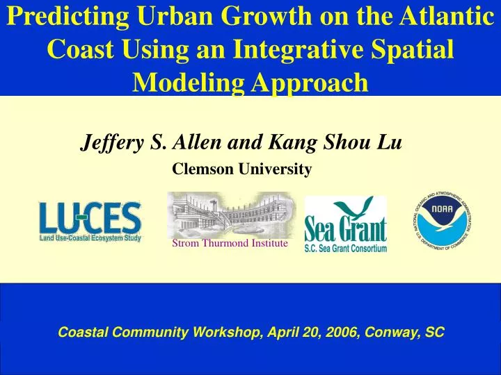
Predicting Urban Growth on the Atlantic Coast Using an Integrative Spatial Modeling Approach. Jeffery S. Allen and Kang Shou Lu Clemson University. Strom Thurmond Institute. Coastal Community Workshop, April 20, 2006, Conway, SC. > 800. 400 - 800. 200 - 400. 100 - 200. 0 - 100.

E N D
Predicting Urban Growth on the Atlantic Coast Using an Integrative Spatial Modeling Approach Jeffery S. Allen and Kang Shou Lu Clemson University Strom Thurmond Institute Coastal Community Workshop, April 20, 2006, Conway, SC
> 800 400 - 800 200 - 400 100 - 200 0 - 100 Population density map for North Carolina, South Carolina, and Georgia # of People Per Square Mile* * 1999 population estimates by CACI International, Inc. based on 1990 US Census
Population in the Coastal Counties of South Carolina & Georgia
Percent Change in Population in the Coastal Counties of South Carolina & Georgia
Source: (London and Hill, 2000) -- USDA, US Census Bureau and Jim Self Center on the Future, Clemson University.
Total Acres of Land Conversion by State, 1992-1997 (thousand acres) Rank STATE Acres converted to developed land (1,000 acres) 1 Texas 1219.5 2 Pennsylvania 1123.2 3 Georgia 1053.2 4 Florida 945.3 5 North Carolina 781.5 6 California 694.8 7 Tennessee 611.6 8 Michigan 550.8 9 South Carolina 539.7 10 Ohio 521.2 Source: (London and Hill, 2000) -- USDA, 1997 National Resource Inventory Summary Report
Purposes and Objectives Gain a better understanding of urban growth process; Develop a methodology for urban growth prediction; and Provide better information for: • Land use decision-making toward smart growth • Impact assessment studies • Public education of environmental awareness The objectives of this project are: • Developing an operational urban growth model • Calibrating the model using 1990-2000 data • Predicting urban extent by year 2030 for the Beaufort-Colleton-Jasper Region
Urban Growth Models • Lowry’s Model (1957) and Its Variants • Cellular Automata (Deltron) Model (San Francisco Bay Area) --- Clarke (1996) • California Urban Future Model (CUF I and II) --- Landis (1994, 1995, and 1997) • Land Transformation Model (LTM) (Michigan’s Saginaw Bay Watershed) ---Pijanowski et al (1997)
Challenges Faced in Urban Land Use Modeling • Natural resources • Activity settings • Aesthetic sanities • Natural functions Geology Geomorphology Hydrology Climate Soil Vegetation Economic Social Cultural Physical Systems Human Systems Land Uses • Functions • Structures • Activities • Ownership • Use status • Availability • Suitability • Capacity • Sustainability Land Use Systems • Components or structures of the land use systems:simple vs. complex • Relationships between components, agents, factors, and processes: deterministic vs. indeterministic. • Changes over space (and time): ordered vs. random vs. chaotic • Spatial distribution or patterns: regularity vs. irregularity (fractal) Model vs. Reality
Mount Pleasant Analysis Units Murrells Inlet ---200x200 m2 grids (cells) for calibrating models ---30x30 m2 grids (cells) for prediction Parcel --smallest legal unit Part of Mount Pleasant Zone --area demarcated by the major roads Grid or Cell --square-shaped area
Predictor Variables • Physical suitability • Land cover, Slope, Soil suitability • Service accessibility • Transportation, Waterline, Sewer line, CBD, Industrial parks, Demographic • Initial conditions • Existing urban, Vacant infill area, Agriculture land, Forest land • Policy constraints • Protected land, Comprehensive planning, Growth boundary, Zoning/Ordinance, Natural reserves, Parks, Floodplain, Cultural sites, Land ownership
Data for Deriving Predictor Grids Baseline Years: 1990 and 2000 for Training and Testing Projection Years; 2000-2030
Examples of Predictor Variables Distance to 2000 Urban Area Distance to 80 Industry Point Distance to Roads Distance to Highway System Distance to Water Lines Distance to Sewage system
Probabilities (dark is higher)
Predicted Urban Growth in the Myrtle Beach Region, South Carolina, 2000-2030 115 sq. mi. 164 sq. mi. 213 sq. mi. 1995 - 56 sq. mi.
Urban Sprawl Problems Urban growth is necessary and unavoidable. But uncontrolled growth - urban sprawl results in many problems such as: • Increased cost of living • Rising taxes and pressure on infrastructure and urban services • Traffic congestion and increased (travel) time • Environmental pollution • Loss of farm/forest land, habitats and rural (natural) landscape • Downtown declines and community segregation
Benefits of Urban Growth • Increased standard of living • Generation of wealth • Increase in amenities • Production of affordable housing • Increase in tax base • New business opportunities • New job opportunities • Increased “freedom” with the automobile • It is what we desire - “Freedom of Choice”
Urban Growth Trends • The pattern follows paths of subsidy. • Undervalued infrastructure • Discounted resources • Reductions for individual risk • Unintended consequences of past policies
What do we do now? • Growth is coming whether we want it or not • Determine where we do not want to grow • Increase communication among SPD’s, etc. • Be inclusive in planning • Provide incentives for growth in “growth areas” • Provide “dis-incentives” for areas to protect • Make users pay the freight for new growth • It is always easier said than done!!!