Download
1 / 36
370 likes | 499 Views
GEOMAGNETISM: a dynamo at the centre of the Earth. Lecture 3 Interpreting the Observations. OVERVIEW. Historical and paleomagnetic data Historical record gives good spatial resolution Paleomagnetic record covers a long time interval

E N D
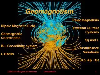
GEOMAGNETISM: a dynamo at the centre of the Earth Lecture 3 Interpreting the Observations
OVERVIEW • Historical and paleomagnetic data • Historical record gives good spatial resolution • Paleomagnetic record covers a long time interval • Measurements are interpreted in terms of a core field generated by a dynamo • Field morphology interpreted in terms of the dynamics • Secular variation in terms of core flows • Is the geodynamo unstable?
HISTORICAL RECORD • Accuracy limited by crustal field mainly • Global coverage => good spatial resolution • Many components measured • Known dates • Short duration: 1500-2000AD (500 years)
~1500 Start of navigational records • 1586 Robert Norman measures inclination in London • 1600 William Gilbert publishes de Magnete • 16?? Jacques l’Hermite’s voyage across Pacific • 1695 Edmund Halley measures D in Atlantic • 1715 Feuille measures I in Atlantic and Pacific • 1777 James Cook’s voyages; solves longitude problem • 1839 Gauss measures absolute intensity • 1840 Gottingen Union Observatories set up • 1840 Royal Navy exploration of Southern Oceans • 1840 James Ross expedition to Antarctica • 185? Suez Canal built • 1887 Challenger expedition • 1900-- First magnetic surveys, first permanent observatories • 1926 Carnegie burns out in Apia harbour • 1955 Proton magnetometer starts widespread aero- and marine surveys • 1966 First total intensity satellites (POGO) • 1980 Magsat • 2001-- Oersted, Champ, etc: decade of magnetic
POTENTIAL THEORY: uniqueness requires measurements on the boundary of: • The potential V • Normal derivative of the potential =Z… • …but not F (Backus ambiguity) • North component X… • ... but not East component Y • D and I (to within a multiplicative constant) • D and H on a line joining the poles
SPHERICAL HARMONIC EXPANSIONS Differentiating the potential gives the magnetic field components Setting r=a the Earth’s radius gives a standard inverse problem for the geomagnetic coeficients in terms of surface measurements Setting r=c the Core radius gives the magnetic field on the core surface
DATA KERNELS (Gubbins and Roberts 1983) The magnetic potential V at radius r is an average over the whole core surface: where is the angular distance between and (r’, Then where This is the data kernel for the inverse problem of finding the vertical component of magnetic field at the core surface from measurements of vertical component of magnetic field at the Earth’s surface. The data kernel for a horizontal component measurement, Nh, is found by differentiating with respect to
Smoothing constraint Data plane
LEAST SQUARES L1 NORM (double exponential)
Declination AD1600 Declination AD1990
PALEO/ARCHEOMAGNETIC DATA • Locations limited • 10x less accurate than direct measurement • Rarely is the date known accurately • Hence rarely more than one location at a time • Record is very long duration (Gyr)
Hawaiian data last 50 kyr from borehole data and surface flows (Teanby 2001)
AN IMPORTANT INSTABILITY? • Nobody has yet found a dynamo working in a sphere in the limit (Fearn & Proctor, Braginsky, Barenghi, Jones, Hollerbach) • Perhaps there is none because the limit is structurally unstable • Small magnetic fields lead to small scale convection and a weak-field state, which then grows back into a strong-field state • This may manifest itself in erratic geomagnetic field behaviour
STABILISING THE GEODYNAMO Time scale to change B in outer core: 500 yr Time scale in inner core (diffusion) 5 kyr
DYNAMO CATASTROPHE • The Rayleigh number is fixed • The critical Rayleigh number depends on field strength • Vigour of convection varies with supercritical Ra… • So does the dynamo action • If the magnetic field drops, so does the vigour of convection, so does the dynamo action • The dynamo dies
NUMERICAL DIFFICULTIES • At present we cannot go below • The resulting convection is large scale • The large E prevents collapse to small scales… • …and therefore the weak field regime • Hyperdiffusivity suggests smaller E… • ...but the relevant E for small scale flow is actually larger
CONCLUSIONS • We are still some way from modelling the geodynamo, mainly because of small E • The geodynamo may be unstable, explaining the frequent excursions, reversals, and fluctuations in intensity • Is the geodynamo in a weak-field state during an excursion? • If not, what stabilises the geodynamo?