Download
1 / 12
130 likes | 370 Views
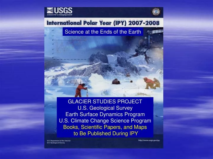
Science at the Ends of the Earth. GLACIER STUDIES PROJECT U.S. Geological Survey Earth Surface Dynamics Program U.S. Climate Change Science Program Books, Scientific Papers, and Maps to Be Published During IPY.

E N D
Science at the Ends of the Earth GLACIER STUDIES PROJECT U.S. Geological Survey Earth Surface Dynamics Program U.S. Climate Change Science Program Books, Scientific Papers, and Maps to Be Published During IPY
The Glacier Studies Project focuses on establishing baselines and analyzing changes, with satellite imagery, satellite altimetry, and other data, in the Glaciers Element of the Earth’s Cryosphere, in collaboration with more than 130 USGS, U.S., and foreign scientists
Glacier Studies Project • Satellite Image Atlas of Glaciers of the World • Coastal-Change and Glaciological Maps of Antarctica • Collaborative Projects with Others: • National Energy Authority of Iceland (Glacier Studies) • NASA Goddard Space Flight Center (Studies of changes, in response to warming in the Arctic, on the Greenland ice sheet and ice caps in the North Atlantic with MODIS, other satellite imagery, and ICESat altimetry data (also with Iceland NEA) • National Mapping Discipline (History of USGS Scientific Activities in the Exploration of Antarctica)
Satellite Image Atlas of Glaciers of the WorldU.S. Geological Survey Professional Paper 1386 A-K(Editors: Richard S. Williams, Jr., and Jane G. Ferrigno)Volumes to be Published During the IPY: • Glaciers of Alaska (1386-K): 2007 • Glaciers of Asia (1386-F): 2007 • State of the Earth’s Cryosphere at the Beginning of the 21st Century: Glaciers, Global Snow Cover, Floating Ice, Permafrost and Periglacial Environments (Includes Map/Poster of The Earth’s Dynamic Cryosphere) (1386-A): 2008 • Glaciers of Iceland (Includes Map of the Glaciers of Iceland (1386-D): 2008
Coastal-Change and Glaciological Maps of AntarcticaU.S. Geological Survey Geologic Investigations Series Map I-2600-A-XPrincipal Authors: Jane G. Ferrigno, Kevin M. Foley, and Richard S. Williams, Jr.Maps to Be Published During the IPY: • Maps I-2600-B, -C (with British Antarctic Survey), -H, and -I (two formats: paper map and accompanying pamphlet and digital) • Maps I-2600-J-W (single format: digital) • Map I-2600-X (Coastal-Change and Glaciological Map of Antarctica: two formats: paper map and accompanying pamphlet and digital) • Note: Maps I-2600-A and -C –G published prior to IPY in both formats
Collaborative Projects with Others:Books/Papers to Be Published During IPY: • Iceland National Energy Authority: • [Oddur Sigurðsson (NEA) and Richard S. Williams, Jr. (USGS)]: Geographic Names of Iceland’s Glaciers: Historic and Modern (USGS Professional Paper) Glaciers of Iceland (1386-D)
Collaborative Projects with Others:Books/Papers to Be Published During IPY: • NASA Goddard Space Flight Center: • [Dorothy K. Hall (NASA/GSFC), Richard S. Williams, Jr. (USGS), and Oddur Sigurðsson (NEA) • Various journal articles analyzing, from MODIS other satellite imagery and ICESat altimetry, changes on the surface of the Greenland ice sheet and ice caps in the North Atlantic
Collaborative Projects with Others:USGS Open-File Reports to Be Published During IPY: • National Mapping Discipline: • Tony K. Meunier (NMD); Editors: Richard S. Williams, Jr., and Jane G. Ferrigno • Open-File Report 2006-1116: U.S. Geological Survey activities in the exploration of Antarctica: 1946-2006 record of U.S. Geological Survey (USGS) and non-USGS collaborating personnel in Antarctic and their postal cachets: U.S. Navy (1946-48, 1954-60), International Geophysical Year (1957-58), and USGS (1960-2006) • Open-File Report 2006-1117: U.S. Geological Survey activities in the exploration of Antarctica: Introduction to Antarctica (including U.S. Geological Survey field personnel: 1946-1959)