Download
1 / 21
210 likes | 297 Views
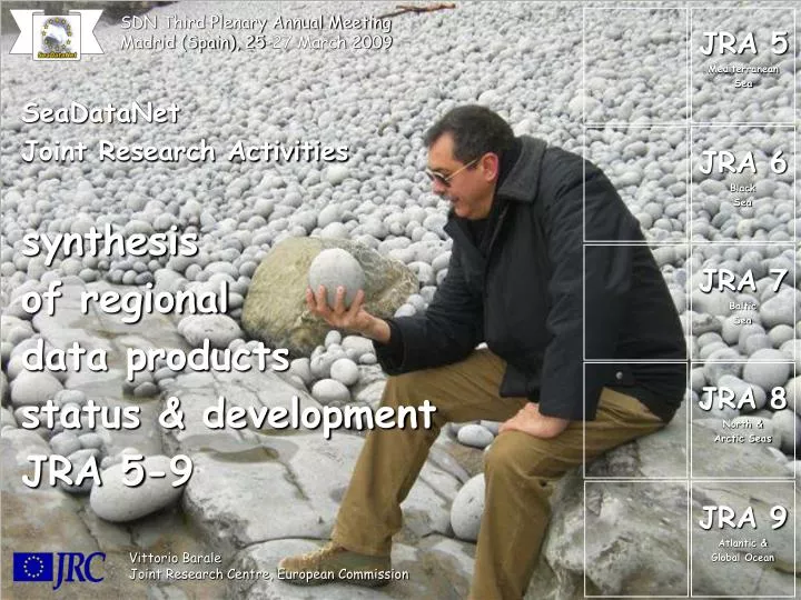
SDN Third Plenary Annual Meeting Madrid (Spain), 25-27 March 2009. JRA 5 Mediterranean Sea. SeaDataNet Joint Research Activities synthesis of regional data products status & development JRA 5-9. JRA 6 Black Sea. JRA 7 Baltic Sea. JRA 8 North & Arctic Seas. JRA 9 Atlantic &

E N D
SDN Third Plenary Annual Meeting Madrid (Spain), 25-27 March 2009 JRA 5 Mediterranean Sea SeaDataNetJoint Research Activities synthesis of regional data products status & development JRA 5-9 JRA 6 Black Sea JRA 7 Baltic Sea JRA 8 North & Arctic Seas JRA 9 Atlantic & Global Ocean Vittorio Barale Joint Research Centre, European Commission
VERSION 1 (V1) JRA Data Products time series & climatologies, common Geo-statistical Analysis Tools (DIVA) V1 (in situ data) seasonal and annual statistics, on grid points and water column: temperature, salinity, currents and bio-chemical parameters V1 (satellite data) seasonal and annual statistics, on (surface) grid points: temperature, dynamic height/altimetry, salinity, wind and sea state, sea ice VERSION 2 (V2) JRA Data Products V2 in situ and satellite Core Parameters (and priorities) … Criteria established for Web Access to V2 JRA Data Products
JRA 5 Mediterranean Sea V0 GRIDDED MONTHLY CLIMATOLOGIES (IN SITU DATA) V0 gridded monthly climatologies for Temperature and Salinity (DIVA proc.) using Medar/Medatlas 2002 (salinity data from 1978) horizontal grid resolution 1/8°, 25 levels lon 9.25W-36E, lat 30N-46N
JRA 5 Mediterranean Sea V1 GRIDDED MONTHLY CLIMATOLOGIES (IN SITU DATA) V1 gridded monthly climatologies for Temperature and Salinity (DIVA proc.) and annual climatologies of bio-geo-chemicals * (DIVA proc.) using data from Medar/Medatlas 2002 and Mater * (AMON, PHOS, DOXY+DOX1+DOX2, NTRA, NTRI, ALKY, PHPH, CPHL) horizontal grid resolution 1/8°, 32 levels lon 9.25W-36E, lat 30N-46N - available (NetCDF version) at : ftp://mfs.bo.ingv.it http://gnoo.bo.ingv.it/mfs/seadatanet
JRA 5 Mediterranean Sea V2 GRIDDED MONTHLY CLIMATOLOGIES (IN SITU DATA) V2 gridded monthly climatologies (basin-wide, DIVA proc.) for: temperature, salinity and bio-geo-chemical * parameters * (dissolved oxygen, nitrate, nitrite, phosphate, alkalinity, ph, total chl, ammonium) … same for Adriatic Sea (DIVA proc.) - available (NetCDF version) at: http://nodc.ogs.trieste.it/cocoon/data/DIVACLIMA-search ( monthly climatologies, maps of data distribution, DIVA mesh, error and analysed field ) ”We asked to the JRAs coordinator to postpone the V2 production in oder to have more time to organise the data collection for V2 climatologies …”
JRA 6 Black Sea V1 Data Products - identify available historical data sources for in-situ parameters Select parameters based on accessibility, sufficiency, coverage and quality Generate V1 products for selected parameters with traditional methods - identify available data sources for remote sensing parameters Select parameters based on their accessibility Generate V1 products for these parameters with traditional methods - collection of historical/recent data to avoid insufficient coverage - collection of recent data for updating existing V1 data products - upgrade of V1 products by assimilation of new data - introduce DIVA for further work to upgrade V1 products to V2 … problems … data on chemical parameters are scarce for reliable climatic products official requests for data other than T/S produced no reply / refusal no sea currents data from moored buoys time series with public access gaps inSST and OC due to cloud coverage, SLA and SCA not available DIVA not used (consistency, implementation, data scarsity, cost) QAA not applied due to lack of (a) common approach (b) data flow
JRA 6 Black Sea H2S 1920-1999 dissolved O2 1920-1999 dynamic height JUN 10 m heat storage JUN 10 m density JUN 10 m salinity JUN 10 m temperature JUN 10 m V1 Black Sea Data Products accessible at the web site http://www.ims.metu.edu.tr/Seadatanet/ except annual maps for O2, H2S, nutrients in process of verification
JRA 6 Black Sea • V2 Data Products • problem to fulfill V2 requirements for chemical in situ parameters • - time scales : not enough data for all required monthly fields (in winter) • - space scales : coverage is regular, but coarse, sometimes limited coastal areas • low-resolution basin-wide maps only for selected months and depths • higher resolutions maps limited to North-West Black Sea problems with SLA and SCA data products - data sets currently not available co-operation with other projects required, e.g. ECOOP, MyOcean • problemwith overlapping area • - selection of Sea of Marmara is questionable • - not part of either Med basin or Black Sea basin … beyond of responsibility of corresponding JRAs • will extend the area of interest to the Sea of Marmara for SST and Chl-a problemof reformatting Data Products to NetCDF - requires additional manpower data products upgrade
JRA 7 Baltic Sea VERSION 1 (V1) DATA PRODUCTS - ICES databases, coverage 9-30°E and 53-66°N (no Norwegian Sea) - overlap with North Sea dataset 9.75-12.20°E and 57.25-58.25°N - TEMP, PSAL, 13 depth layers, monthly resolution (1975-2005) - can be downloaded from ftp://ftp.dmu.dk/dmu/DIVA Example of a trajectory with ODV : (left panel) example of trajectory itinerary by ODV; (right panel) ODV using DIVA approximation for the trajectory itinerary
JRA 7 Baltic Sea DIVA on ICES/SDN WOA 2005 (period?) DIVA 1º grid B.A. (IOW) DIVA 1º grid ICES/SDN VERSION 2 (V2) DATA PRODUCTS - processed in a manner similar to V1 (aggregated to several months when needed) - TEMP, PSAL, NTOT, AMON, NTRI+NTRA, TPHS, PHOS, SLCA, DOXY-2xH2SX - … at present, preliminary DIVA approximations regarding V2 variables are deliverable within a few days upon request to NERI … Comparisons: July surface temperature 1975-2005
JRA 7 Baltic Sea DIVA analyses vs SST Monthly difference between EUMETSAT IMGW SST analyses and DIVA analyses for surface temperature, in 2002-2007; the unit is Δ°C, x axis is longitude, y axis latitude, color bars span from -5 to +5 °C. The black dots are data points for the DIVA analyses.
JRA 8 North & Arctic Seas Arctic Seas geographical boundaries V1 Data Products region originally divided in 8 sub-regions i.e. Barents Sea, Norwegian Sea, Greenland Sea, Irminger Sea, Iceland Sea (North of Iceland), Iceland Basin (South of Iceland), North Sea and Skagerrak focus on 3 basins: North Sea (+ Skagerrak), Barents Sea, Norwegian Sea A common border zone, where data is exchanged, ensures a smooth transmission between sub-regions. The western part of the Arctic will rely on the Global Ocean product due to lack of data in the area. North Sea and Barents Sea : first version of climatology (T, S) Norwegian Sea to be processed … - monthly datasets - gridding in the chosen areas - difficulties in datasets impose quality assurance - datasets cover a period of almost 40 years, 1970 – 2008 - parameters include temperature and salinity at standard depth levels (for Barents Sea standard depths are 450, 400, 350, 300, 250, 200, 150, 125, 100, 75, 50, 30, 20, 10, 0 m)
JRA 8 North & Arctic Seas °C SST North Sea surface temperature and salinity from the WOA 2005 (May climatological mean) psu SSS • V1 Data Products • The first version of the climatologies includes: • - surface TEMPERATURE, January to December, for the entire period … • - surface TEMPERATURE, seasonal plots for 3 sub-regions (North Sea + Skagerrak, Barents Sea, Norwegian Sea) • - long-term time series plot of annual, summer and winter mean surface TEMPERATURE in the sub-regions • - surface SALINITY, January to December, for the entire period … • - surface SALINITY, seasonal plots for 3 sub-regions (North Sea + Skagerrak, Barents Sea, Norwegian Sea) • - long-term time series plot of annual mean, summer and winter mean surface SALINITY in the sub-regions • - spatial distribution of TEMPERATURE in standard depth layers • spatial distribution of SALINITY in standard depth layers • “… I managed to run DIVA on a Barents Sea dataset with fairly good results …” • 2 resulting NetCDF files of 200Mb, one for Temperature and one for Salinity • at : http://talos.nodc.no:8080/ncWMS/godiva2.html#
JRA 8 North & Arctic Seas • V2 Data Products • … in V2 the maps above (V1) will be extended to include: • chlorophyll a, • oxygen, • primary production, • total nitrogen, • total phosphorus, • dissolved inorganic nitrogen (nitrate + nitrite + ammonium), • dissolved inorganic phosphorus (phosphate), • dissolved silicate, • to the extent that data coverage is sufficient to obtain reliable estimates …
JRA 9 Atlantic & Global Ocean V1 Data Products - effort to harmonize datasets and geo-statistical analysis tool - for the North Atlantic Ocean and associated specific areas : DIVA - for the Global Ocean : ISAS (objective analysis by Coriolis Center) North Atlantic Ocean ARGO dataset, space coverage: 20°S-77°N, time coverage: 1998-2007
JRA 9 Atlantic & Global Ocean V1 Data Products - Eastern North Atlantic, Bay of Biscay, Morocco upwelling - climatologies T and S (+ others) accessible by region, period, depth, variable … agreements must be found in the nomenclature of the filenames … - global product (Coriolis) at http://www.ifremer.fr/co/co0525/en/global/ … not for all the variables (especially for biological parameters) and depth levels … DIVA-analyzed temperature and salinity fields, at level 13 (1200m), 1975-2005
JRA 9 Atlantic & Global Ocean PSAL TEMP V2 Data Products - new effort to exchange datasets between partners - future work to include bio-chemical parameters - V2 will be extended to oxygen, nutrients and surface products from satellite data (altimetry, temperature and colour) DIVA-analyzed temperature and salinity fields, at 10 m depth, summer means
VERSION 2 (V2) UPGRADES … original SeaDataNet plans call for a re-assessment of the JRA data products, to be upgraded for a “final” V2 system … JRA5.Quantity of input data for Mediterranean climatologies to be enlarged. Advection constraint to be applied for production of different products. JRA6.Reformatting to NetCDF. JRA7.For the O2 variable, defined as [O2 - 2xSH2], the climatologies will use density maps enabling isobar contours instead of depth contours. JRA8.No upgrades planned. JRA9. Compute statistics also on the vertical profiles, not only on the horizontal gridded field, using a specific box size (1x1’ , 5x5’ , 1x1º). Such reference vertical profiles are very usefully for QC purposes.