Download
1 / 29
300 likes | 361 Views
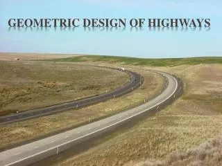
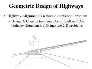
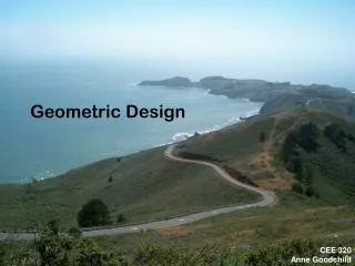
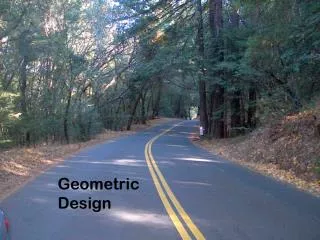
Geometric design of Highways. Geometric Design :- The highway design which deals with the visible elements of different highways such as alignment, sight distance is called as ‘Geometric design’ of highway. Objectives of Geometric design It gives maximum efficiency in the traffic operation.

E N D
Geometric Design :- The highway design which deals with the visible elements of different highways such as alignment, sight distance is called as ‘Geometric design’ of highway. • Objectives of Geometric design • It gives maximum efficiency in the traffic operation. • It gives the maximum safety to the users. • It helps to save time of travel. • It increases the speed of vehicles. • It increases the number of vehicles on road. • It reduces the cost of construction. • It reduces the cost of transportation. • It gives pleasure of travel.
Important terms :- 1. Right of way :- The area of the land acquired for construction and development of a road along the alignment is known as ‘Right of way’. The width of this acquired land is known as ‘land width’. Factors affecting the land width:- • Category of highway, roadway width and road margin. • Height of embankment and depth of cutting. • Drainage system and its size. • Sight distance on horizontal curves. • Reserve land for future widening.
Standards values of Land width recommended by IRC ( Indian Road Congress )
Important terms :- 2. Road margin :- The portion of land width on either side of the roadway of a road are known as ‘Road margin’. It includes parking lane, frontage road, cycle track, foot path, side slope etc. 3. Road way width :- The top width of highway embankment or bottom width of highway cutting excluding the side drains is called ‘Road way width’ or ‘Formation Width’.
Standards values of Road way width recommended by IRC ( Indian Road Congress )
4. Carriage Way :- The portion of road way constructed for movement of vehicle traffic is called as ‘carriage way or crust’. Standards values of Carriage way width recommended by IRC ( Indian Road Congress )
Important terms :- 5. Shoulder:- The portion of the road way between the outer edges of the pavement and edges of the top surface of embankment or inner edges of the side drains in cutting are known as ‘shoulder’. Objectives of shoulders :- • Shoulder are provided along the road edge to serve as an emergency lane. • Shoulder acts as service lane for break down vehicle. • They provide lateral stability to the carriage way. • They serve as parking places for vehicles in case of emergency. • They provide the space for erecting road signals.
Minimum Shoulder width recommended by IRC ( Indian Road Congress )
6. Side slopes :-The slopes given to the sides of earthwork of a road in embankment or in cutting for stability are known as ‘side slope’.Side slopes recommended by IRC
Important terms :- 7. Berms :- The portion of land width left in between the toe of road embankment and inner edges of side drain is known as ‘Berms’. Or The portion in between the top edge of road cutting & the nearest edge of spoil bank on either side are known as ‘Berms’. 8. Spoil bank :- The banks constructed from surplus excavated earth on the side of road cutting parallel to its alignment are known as ‘spoil bank’.
Important terms :- 9. Kerbs :- The boundaries between the pavement and shoulders or footpath are known as ‘Kerbs’. Types :- i) Low kerbs ii) Semi – barrier type kerbs iii) Barrier type kerbs. 10. Formation level :- The reduced level of finished surface of earth is known as ‘Formation level’.
Types of Gradient :- • Ruling gradient • Limiting gradient • Exceptional gradient • Average gradient • Floating gradient • Minimum gradient
Ruling gradient :- The gradient usually adopted while making the alignment of a road is called ruling gradient. It is fixed in such a way that all vehicles can overcome long distance without uneconomical fuel consumption. It is also known as ‘Design gradient’. • Limiting gradient :- Gradient steeper than the ruling gradient is called as limiting gradient. It is also known as ‘Maximum gradient’ or ‘Momentum gradient’. Demerits :- 1) very inconvenient for the pedestrians and animals.2) Load carrying capacity of vehicles will be reduced. 3) The road surface will wear out quickly due to high velocity of surface water 4) The wear & tear of vehicles will increase due to breaking action.
Exceptional gradient :- The gradient steeper than the limiting gradient is known as ‘Exceptional gradient’. It is used in extraordinary situation for shorter length. 4. Floating gradient :- The gradient on which a motor vehicle, moving with constant speed without any application of power or break. 5. Minimum gradient :- The minimum slope essential for effective drainage of rain water from road surface is called as ‘Minimum gradient’.
Sight distance :- The distance along the centre line of a road at which a driver has a visibility of an object (stationary or moving) above the carriage way is known as ‘Sight Distance’. Factors affecting sight distance :- • Speed of the vehicle. • The fractional resistance of the road surface. • Height of the driver eye. • Slope of the road surface. • Perception time and break reaction time. Types :- 1. Stopping or non-passing sight distance. • Overtaking or passing sight distance. • Intermediate sight distance. • Lateral sight distance.
Stopping Sight distance :- The clear distance ahead needed by a driver to bring his vehicle to a stop before meeting a stationary object on the road is called as ‘Stopping Sight distance’. SSD = V2 + ( 0.278 Vt ) 254 f
Crossing Sight distance :- For road with single lane highway permitting two way traffic movements, two vehicles coming in opposite directions, on seeing each other, will have to reduce their speed to enable each other for avoiding head to head collision. The sight distance provided for this purpose is known as crossing sight distance. CSD = 2 x SSD
Overtaking Sight distance :- The minimum distance open of the driver on a two way road to enable him to overtake another vehicle ahead with safety against the traffic from opposite direction is called as ‘Overtaking sight distance or Passing sight distance. Factors affects the OSD:- • Speed of overtaking, overtaken and the speed of vehicle coming from the opposite direction. • Distance between the vehicles. • Rate of acceleration of the overtaking vehicle. • Skill and reaction time of the driver.
Lateral Sight distance :- The sight distance needed by the driver of a vehicle who see another vehicle approaching the intersection, reacts and applied breaks to bring his vehicle to dead stop at the intersection without any accident is called ‘Lateral sight distance’.
Super-elevation :- When the fast moving vehicle on a horizontal curve, the centrifugal force acts on the vehicle from inside towards the outside of the curve and hence lateral stability is affected. In order to avoid such situation, the outer edge of the pavement is raised with respect to the inner edge. i.e the inclination provided to the pavement surface throughout the length of the horizontal curve it is known as ‘Super-elevation’ or ‘cant’ or ‘banking’ e + f = V2 127R
Object of Super-elevation:- • To counteract the effect of centrifugal force acting on moving vehicle. • To help a fast moving vehicles to negotiate a curved path without overturning and skidding. • To ensure smooth and safe movements of passengers and goods on the road. • To prevent damaging effect on the road surface due to improper distribution of road. • The maintenance cost of road on curve is reduced.
Minimum and Maximum Super-elevation:- If the super-elevation is less than the camber is known as Minimum super-elevation, it should be kept equal to the camber of the road for drainage purpose. Maximum value of the super-elevation in plain and ruling area roads has been fixed by IRC as 6.7% (1 in 15) for hilly roads it is upto 10% (1 in 10).
Method of providing super-elevation :- First stage second stage Method 1 Method 2