Download
1 / 27
270 likes | 407 Views
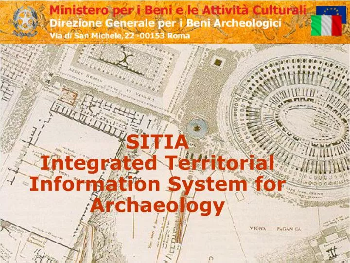
SITIA Integrated Territorial Information System for Archaeology. SITIA. Integrated Territorial Information System for Archaeology aims at integrating the Mountain Information System (SIM) of the Ministry for Agricultural and Forest Policies (MiPAF)

E N D
SITIA Integrated Territorial Information System for Archaeology DGBA - Adalberto Console
SITIA Integrated Territorial Information System for Archaeology aims at integrating the Mountain Information System (SIM) of the Ministry for Agricultural and Forest Policies (MiPAF) SIM performs a set of services directed to citizens, companies and the Public Administration, based on telematics infrastructure and on the integrated use of information deriving from various data banks, among which, in particular, those in the fields of agriculture and forests (MiPAF and Agency for Agriculture – AGEA), of the Ministry of Finance and ISTAT SITIA accomplishes the integration and personalization of competence thematic subjects A protocol between MBAC and MiPAF in under perfection . DGBA - Adalberto Console
Objectives (1) Privilege of the optics of the service, exploiting the acquired experiences in projects developed for SIM users, enlarging the services available to adequate to the actual exigencies of information detention and “quality” data Sophisticated and exhaustive “Archaeological Map of Italy” with the possibility of: - organizing all data according to a unitary and homogeneous context - follow repartitions according to territorial parcels - dispose of instruments of territorial planning DGBA - Adalberto Console
Objectives (2) Certainty of the information content (through the use of the cadastral parcel) to realize a unified authoritative counter, it guarantees the project strategic features, on the organization level A common cartographic base using architectural requirements to facilitate the information flow among different administrations, translating services on line, where the exchanges among different subject holders of cartographic data can be performed according to immediacy and security standards, preserving, at the same time, the quality of data DGBA - Adalberto Console
Services Territorial services for the management of territorial information from various sources, with the aim of supplying operating instruments to prevent risks, monitor events, manage territory and resources Administrative services for the management of administrative proceedings through a unified authorizing counter Consulting services for operating and decision making support, implementation to the activities of single citizens and administrations, screening of demand/offer for products and services DGBA - Adalberto Console
Quality (1) Geo referencing automatically obtained for items we possess cadastral references of; for the remaining items the same data can be obtained with the help of referencing territorial data available on the system (aerial/orthogonal photos, toponimes IGM, Road cartography, ...) Contextualizing of single items accompanied by specific territorial managing information, through the functions of the territorial applications and the overlapping of background cartographic bases, for the acquisition of various thematic subjects (restriction schemes, interest boundaries, etc.) DGBA - Adalberto Console
Quality (2) Availability of consolidated subjects related to the archaeological heritage in the central server for all central and local Administrations, operating on the areas connected with SITIA and SIM, according to specific licences Availability of information and “quality” data through access to certified source data (cadastral, orthogonal photos, administrative borders) DGBA - Adalberto Console
Features(1) Functionality able to respond centrally to advanced information needs for the administration and citizen-user: - internal management(cartography, item identification on the territory, subject representation, etc.); - unified counter for the citizen-user (according to specific norm) - unified counter for companies (according to specific norm) D.Lgs. 31 marzo 1998, n. 112. Conferimento di funzioni e compiti amministrativi dello Stato alle Regioni ed agli enti locali, in attuazione del capo I della L. 15 marzo 1997, n. 59. Art. 27-bis. Misure organizzative per lo sportello unico delle imprese. DGBA - Adalberto Console
Features (2) Coverage of the whole national territory through the use of cadastral cartography and digital orthogonal photos, supplying more detailed, complete and updated information for various operating needs Complex and articulated structure, composed of a databank containing geographical elements, in numeric form, integrating with descriptive elements in tabular, textual and visual forms DGBA - Adalberto Console
Features (3) Integration of differentiated information according to different categories of archaeological items, apt to contain specific different scale maps within a unitary system, to restore detailed maps according to different requirements and to be easily and progressively updated WebAccess to minimal information of administrative transparency and to data variously elaborated for decision making support DGBA - Adalberto Console
Data (1) Logically Interconnected and correlated Data Bases forming a unique integrated model, allowing common transactions on line to remote offices, connected to the central server These features allow:-continuousfunction of the service- data security- flexibility and easy use for users DGBA - Adalberto Console
Data (2) Cadastral cartography Data based on a referenced (vector) cartographic base, consisting now of distinguished data banks: - Building cadastral: archives and administrative procedures; - land cadastral: archives and administrative procedures; - geometric cadastral: archives and cartographic procedures; Covering of 27 provinces about 100.000 sheets (completion of the data bank for remaining 200.000 map sheets, through contracts and collaborations, in progress) DGBA - Adalberto Console
Data (3) Digital orthogonal photos scale 1:10.000 used by AGEA for integrated controls in agriculture requests by EU; covering 5/6 of the Italian surface; integrated, for the remaining part ,with those produced by SIM DGBA - Adalberto Console
Data (4) Orography,hydrography, road viability, etc. Cartographic representation obtained from the overlapping of the following information levels: • side exposition • linear and polygonal hydrography • road and railway network • inhabited areas Italian road network ,classified according to importance, and represented through diversified symbols on a urban and extra urban level () DGBA - Adalberto Console
Architecture (1) Structure according to three elaborating levels: • central server (DGBA) responsible to manage the system, central data banks and access point to other Administrations, including SIM service centre • data server (DGBA) containing data bases accessible through standard protocols • local system (Superintendence) responsible of managing administrative activities on the territory, carried out by territorial Superintendences DGBA - Adalberto Console
Architecture (2) Diversified access levels in relation to the organization structure, to guarantee the sharing of administration data to different typologies of users according to specific licences: • informative (for common users, basic and institutional information) • operative ( for employees, using common applications services) • executive ( for managers and executives, using specific application services) DGBA - Adalberto Console
Architecture (3) Access modality: • in term of transparency for the user, in respect to data source; • using SSO (Single Sign On) access; • in real time, via interconnections to the National Network of the Public Administration (or other WAN); • integrating vector themes, generated through queries, on relational data bases associated to cartographic data; • establishing, in conformity with security standards, suitable licences on access levels (defined by the system administrator, and distinguished in terms of functions or geographic ambit) DGBA - Adalberto Console
Benefits (1) Contemporary management of cartography and documentation through aggregation and presentation of institutionally relevant data, supplying minimal information aiming at administrative transparency Reporting deriving from the analysis of data using cartographic data as well as data obtained through accountancy and documentation management, granting the administration objective instruments to value the degree of technical and economical convenience, according to a priority scale (based on objective standards) DGBA - Adalberto Console
Benefits (2) Service to citizen/user with the establishment of “Unique Counters” within local administrations, to consent users to identify the documents requested for the issuing of measures Management instrument of those authoritative measures, referred to the conservation of the archaeological heritage, through the channelling of requests and the shortening of procedure time DGBA - Adalberto Console
Benefits (3) • Cartographic and textualinformation integration with various other structured information, such as cataloguing data, available images, drawings and tri -dimension representations; • Basic material for the editing of multimedia publishing products for valorisation, didactic or tourist purposes DGBA - Adalberto Console
Adalberto ConsoleTel. 0658432221 – Fax 0658432259 aconsole@beniculturali.itThanks toAnna Maria Dolciotti, Simone LupettiEnglish version byRosanna Binacchi DGBA - Adalberto Console