Download
1 / 4
40 likes | 46 Views
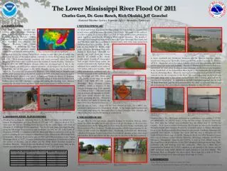
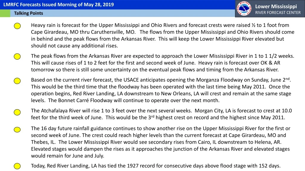
LMRFC Reference Slide For Crest Tables. LMRFC Forecasts Issued Morning of May 28, 2019. Lower Mississippi RIVER FORECAST CENTER. Talking Points.

E N D
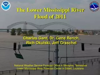
LMRFC Reference Slide For Crest Tables LMRFC Forecasts Issued Morning of May 28, 2019 Lower Mississippi RIVER FORECAST CENTER Talking Points Heavy rain is forecast for the Upper Mississippi and Ohio Rivers and forecast crests were raised ½ to 1 foot from Cape Girardeau, MO thru Caruthersville, MO. The flows from the Upper Mississippi and Ohio Rivers should come in behind and the peak flows from the Arkansas River. This will keep the Lower Mississippi River elevated but should not cause any additional rises. The peak flows from the Arkansas River are expected to approach the Lower Mississippi River in 1 to 1 1/2 weeks. This will cause rises of 1 to 2 feet for the first and second week of June. Heavy rain is forecast over OK & AR tomorrow so there is still some uncertainty on the eventual peak flows and timing from the Arkansas River. Based on the current river forecast, the USACE anticipates opening the Morganza Floodway on Sunday, June 2nd. This would be the third time that the floodway has been operated with the last time being May 2011. Once the operation begins, Red River Landing, LA downstream to New Orleans, LA will crest and remain at the same stage levels. The Bonnet Carré Floodway will continue to operate over the next month. The Atchafalaya River will rise 1 to 3 feet over the next several weeks. Morgan City, LA is forecast to crest at 10.0 feet for the third week of June. This would be the 3rd highest crest on record and the highest since May 2011. The 16 day future rainfall guidance continues to show another rise on the Upper Mississippi River for the first or second week of June. The crest could reach higher levels than the current forecast at Cape Girardeau, MO and Thebes, IL. The Lower Mississippi River would see secondary rises from Cairo, IL downstream to Helena, AR. Elevated stages would dampen the rises as it approaches the junction of the Arkansas River and elevated stages would remain for June and July. Today, Red River Landing, LA has tied the 1927 record for consecutive days above flood stage with 152 days.
Ohio/Mississippi River Crest Watch Created May 28 2019 @ 10:00am CDT Lower Mississippi River Forecast Center weather.gov/lmrfc OH River at Paducah OH River at Cairo MS River at Caruthersville Current: 31.9’ ACTION Current: 27.9’ Current: 42.6’ MINOR Crest in Minor at 45’ on Thursday 6/6 Falling and remain below flood stage Forecast: Forecast: Forecast: Crest in Minor at 33’ on Friday 6/7 2 Days 2 Days 2 Days 2 Days 1 Day 2 Days 0.5 Day 5 Days MS River at Greenville MS River at Natchez MS River at Ark City MS River at New Orleans MS River at Vicksburg MS River at Memphis MS River at Baton Rouge Current: 49.3’ MODERATE Current: 43.8’ MAJOR Current: 41.1’ MODERATE Current: 16.7’ Current: 57.0’ MAJOR Current: 53.4’ MODERATE Current: 28.7’ ACTION Steady with tidal fluctuations Crest in Moderate at 43.5’ on Friday 6/7 Crest in Moderate at 55.5’ on Saturday 6/8 Forecast Forecast: Forecast: Forecast: Forecast: Forecast: Crest in Major at 59’ on Friday 6/10 Crest in Major at 44.5’ on Wed 6/5 Remain in Action over the next 5 days Forecast: Crest in Moderate at 51.5’ on Sunday 6/9 Morganza Location Bonnet Carré Location NWSLMRFC @NWSLMRFC
Atchafalaya River Crest Watch Created May 28 2019 @ 10:00am CDT Lower Mississippi River Forecast Center weather.gov/lmrfc Atchafalaya River at Melville Black River at Jonesville Black River at Acme Current: 54’ MODERATE Current: 31.2’ Current: 49.8’ MINOR Remain in Moderate over the next 5 days Forecast: Forecast: Forecast: Remain in Minor over the next 5 days Crest in Action at 33’ on Sunday 6/9 0.5 Day 0.5 Day 1-2 Days 0.5 Day 1-2 Days Backwater from Morgan City Backwater Atchafalaya River at Butte La Rose Atchafalaya River at Morgan City Atchafalaya River at Krotz Springs Atchafalaya River at Simmesport Atchafalaya River at Bayou Sorrel Current: 8.3’ MODERATE Current: 12.5’ MINOR Current: 40.1’ Current: 27.8’ ACTION Current: 20’ MINOR Forecast: Forecast: Forecast: Forecast: Forecast: Crest at 42’ on on Sunday 6/9 Crest in Minor at 21’on Tuesday 6/11 Crest in Minor at 29.5’ on Monday 6/10 Crest in Minorat 16’ on Tuesday 6/18 Crest in Moderateat 10’ on Tuesday 6/18 Backwater - Water moving upstream from Old River Control Structure Old River Control Structure NWSLMRFC @NWSLMRFC
Consecutive Days Above Flood Stage Data provided by U.S. Army Corps of Engineers Lower Mississippi River Forecast Center Current data as of May 28th 2019 Numbers in Red are records for this year and numbers in Green will likely break records for this year