Download
1 / 39
450 likes | 783 Views
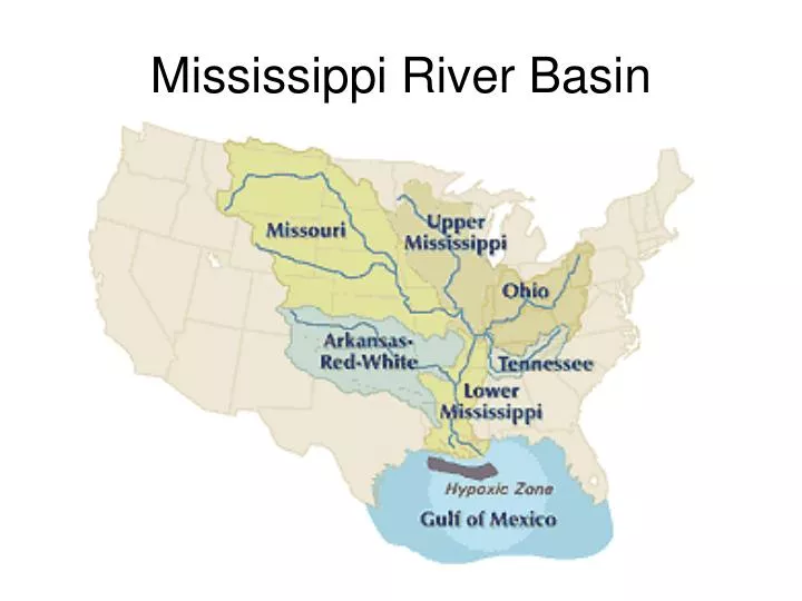
Mississippi River Basin. NC River Basins Map. Water Resources Aquifer Depletion NOAA: Water Cycle Water Cycle. The Water Cycle. Freshwater Sections 9.2 & 9.3 Stream Development, Lakes, Wetlands. Headwaters : Region where water first accumulates to supply a stream.

E N D
Water Resources • Aquifer Depletion • NOAA: Water Cycle • Water Cycle
Freshwater Sections 9.2 & 9.3 Stream Development, Lakes, Wetlands
Headwaters:Region where water first accumulates to supply a stream. Common to be high in the mountains where falling precipitation accumulates in small gullies and forms briskly moving streams
Stream Headwaters Tundra Lake headwaters of Stein River Lytton, 1983 August 07 (British Columbia, Canada) people.uleth.ca/~holzmann/photos/index.html
Stream Headwaters http://www.2steger.de/canada/40_Stein_Valley_Traverse.htm
Stream Channel:Narrow pathway carved into sediment or rock by the movement of surface water. Stream Bank:Ground bordering each side of a stream that keeps the moving water confined
Stream Banks Stream Banks Stream Channel http://www.littleriverbigfuture.org/images/In%20txt%20pics/Stream_erosion_1.jpg
Immature River:Young river erodes path through sediment or rock forming a V-shaped channel. V-shaped channels have steep sides and sometimes form canyons or gorges.
Inner gorge of the Grand Canyon, located in northwestern Arizona. Carved by the power of the Colorado River, the canyon stretches for 277 miles. http://www.scienceclarified.com/landforms/Basins-to-Dunes/Canyon.html
Mature River:As the river becomes more mature, the V-shaped valley will be eroded away forming a broader, wider river.
This bridge across the Danube River links Hungary with Slovakia http://en.wikipedia.org/wiki/Image:MariaValeriaBridge.jpg
Meander:A bend or curve in a stream channel caused by moving water Meanders of the Rio Cauto at , Cuba. http://en.wikipedia.org/wiki/Image:Rio-cauto-cuba.JPG
Water in the straight parts of a stream flows at different velocities depending on the location of the water in the channel. • Generally, water in the center is flowing faster at the maximum velocity while water along the bottom and sides flows more slowlybecause it experiences friction as it moves against the land.
The water moving along the outside of a meander curve experiences the greatest rate of flow within the meander. • The water that flows along this outside part of the curve continues to erode away the sides of the streambed, thus making the meander larger. • Along the inside of the meander, the water moves more slowly and deposition is dominant.
Oxbow Lake: A lake formed from a cut-off meander • After some degree of winding it is common for a stream to cut off a meander and once again flow along a straighter path. • The stream then deposits material along the adjoining meander and eventually blocks off its water supply. • The blocked-off meander becomes and oxbow lake, which eventually dries up. http://homepage.ntlworld.com/harry.wickens/borneo/borneo-070.jpg
Alluvial Fan:Sloping depositional features formed at the bases of slopes and composed mostly of sand and gravel. • Streams that lose velocity also lose their ability to carry sediment. • In dry regions mountain streams commonly flow down narrow valleys onto broad, flat, valley floors. As a stream flows from the mountain to the flat valley, the stream’s gradient** may suddenly decrease causing the stream to drop its sediment as a fan-shaped deposit. • **A stream’s gradient is the difference in elevation between two points on the stream divided by the distance along the stream(Essentially the slope of the stream)
Delta:When a stream enters a large body of water (example: an ocean), the stream looses its velocity and the stream’s load is deposited in a triangular shape. • Usually silt and clay particles • As a delta develops, sediments build up and slow the stream water, sometimes even blocking its movement. • Smaller distributary streams then form to carry the stream water through the developing delta.
http://www.sln.org.uk/geography/schools/blythebridge/delta.jpghttp://www.sln.org.uk/geography/schools/blythebridge/delta.jpg http://earth.usc.edu/~slund/systems/topic7pics/image9.gif
http://serc.carleton.edu/images/research_education/katrina/map_of_delta.v2.gifhttp://serc.carleton.edu/images/research_education/katrina/map_of_delta.v2.gif http://earthobservatory.nasa.gov/IOTD/view.php?id=2521
Lake: A depression in the surface materials of a landscape that collects and holds water • Lakes accumulate water from streams, runoff, precipitation, and springs. Reservoir: A man-made structure used for storing water for later use. 1st A sturdy dam is built. 2nd A stream is allowed to flow behind the dam and will eventually fill the area with water.
Wetland: A land area that is covered with water for a large part of the year. • Include bogs, marshes, and swamps • Serve as a filtering system and improve water quality • Provide vital habitats for and abundance of wildlife. http://www.iwla.org/index.php?id=416
http://i197.photobucket.com/albums/aa19/forjerz/Sunday-080.jpghttp://i197.photobucket.com/albums/aa19/forjerz/Sunday-080.jpg http://dcm2.enr.state.nc.us/ncwp/aerial.jpg http://h2o.enr.state.nc.us/ncwetlands/gbheron.JPG http://h2o.enr.state.nc.us/ncwetlands/swsms.html
Estuary: Where the lower end of a freshwater river or stream enters the ocean • The water in estuaries is a mix of freshwater and salt water called brackish. • Estuaries are nurseries to the young of many different species including ocean fish species.
Some large estuaries include the Chesapeake Bay in Maryland/Virginia and the Pamlico Sound in North Carolina.