Download
1 / 10
100 likes | 231 Views
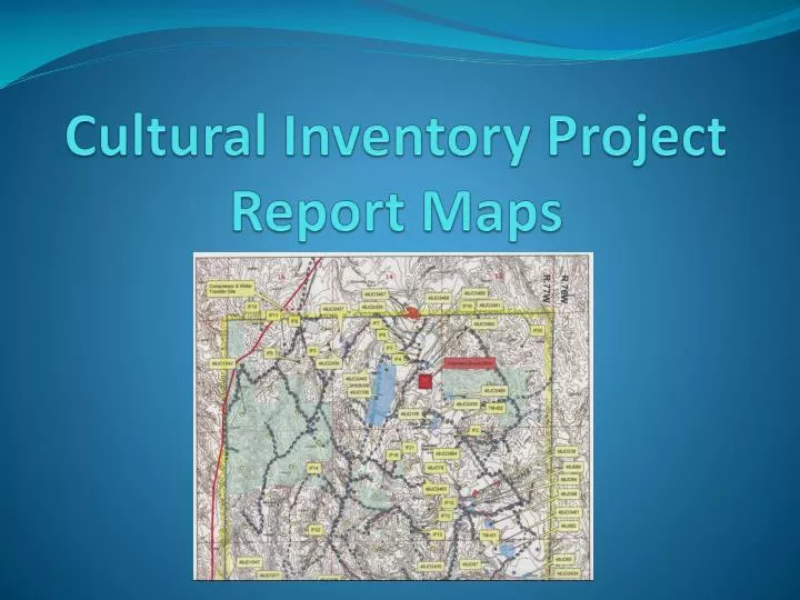
Cultural Inventory Project Report Maps. - How the maps are used - Suggestions for formatting - Options for submitting the maps. Map digitizing. Attributing. Updates sent to State Historic Preservation Office when requested May eventually update database on-line. Project maps.

E N D
- How the maps are used- Suggestions for formatting- Options for submitting the maps
Updates sent to State Historic Preservation Office when requestedMay eventually update database on-line
Project maps Should be 1:24000 scale and include proposed facilities Need Township, Range, & Section numbers Should clearly display survey areas - Distinguish between previously surveyed areas and area surveyed for report - Linear inventory areas should be obvious – buffer or outline Legend should match features on map and be specific to the cultural inventory
Site maps Suggestions for clarity: Show relative location of site to surroundings – include survey corners or other features from topographic map Mark contours that relate to topographic map contours Feature boundaries should match those on area map
Additional options for submitting maps - GPS files – waypoints or boundaries - Shapefiles or geodatabases For each feature, will need: - Report number and site number, if appropriate - Coordinate system or projection (prefer UTM Zone 13, NAD 1983)
Contact information: Diane Adams, GIS Specialist (307) 684-1061 diane_adams@blm.gov Paul Christian, GIS Specialist (307) 684-1139 paul_christian@blm.gov