Download
1 / 12
120 likes | 245 Views
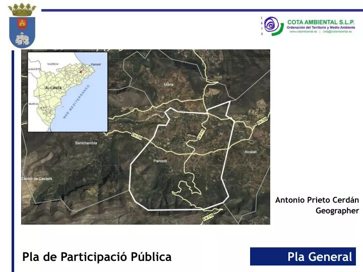
Antonio Prieto Cerdán Geographer. Cuestionario / Qüestionari / Questionnaire. June 2013. 2012 - Reference document (26 Administration, services and public organisms). (www.citma.gva.es). Biodiversity: SCI (Site of Community Importance) Gorgos River: conditions Priority species

E N D
Antonio Prieto Cerdán Geographer
2012 - Reference document (26 Administration, services and public organisms) (www.citma.gva.es) • Biodiversity: • SCI (Site of Community Importance) Gorgos River: conditions • Priority species • Natural hazards: • Flood Defense Director Plan (CHJ) • Gullies: • Conditions of ‘Rompuda’ and la Foia’ Gullies • Exclusion zone • Infraestructure: • Road to Alcalalí • EDAR: sufficiency of treated water / Housing in Non-Developable Land. • Water resources: sufficiency of supply • Non-Developable land: • Landslides hazards • Non-developable land zoning • Preservation of soils with agricultural value • Zoning of Protected Non-Developable Land • Protection of forest land (PATFOR)
Land use Planning - 2014 • Current situation • Territorial synthesis: • Land use • Hydrography • Legal conditions
Land use Planning - 2014 • Current situation • Environmental Synthesis: • Protected Areas • Forest soil • Hydrography • Legal conditions
Land use Planning - 2014 • Current situation • Landscape: • Units • Resources
Current situation • Views Land use Planning - 2014
NN.SS. 1991
Land use Planning - 2014 • Special Interest Areas • SCI: Gorgos River • Gullies conditions (100 m) • Springs conditions (300 m) • Road conditions
Land use Planning - 2014 Green Infraestructure • SCI Gorgos River • Mountain range • Gullies • Springs (3) • Monunmental trees (7) • Listed historic property (11) • Road • Path/Ways: Durmais, Solanes, Tornes, Costera de la Font, Orba, Molló i Barranquet. • Tracks: PRCV-158
ENVIRONMENTAL AUTHORITY CONSELLERIA INFRAESTRUCTURES, TERRITORI I MEDI AMBIENT PARCENT TOWN COUNCIL Consultation with affected administrations (26) Advisory Report Of Environmental Strategy Assessment. 2011 Reference Document Of Environmental Strategy Assessment. Land use Plan Environmental sustainability report Landscape study May 2014 2012 July 2014 PUBLIC EXHIBITION Of all the documents ENVIRONMENTAL REPORT (Initial Technical Proposal) (Final Technical Proposal) Provisional Approval Landuse Plan FINAL APPROVAL (Alicante Urban and Territorial Commission)