Download
1 / 28
280 likes | 392 Views
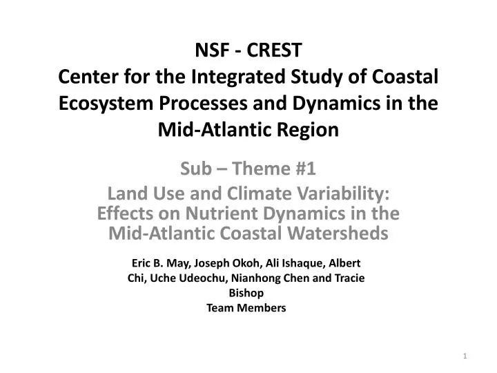
NSF - CREST Center for the Integrated Study of Coastal Ecosystem Processes and Dynamics in the Mid-Atlantic Region. Sub – Theme #1 Land Use and Climate Variability: Effects on Nutrient Dynamics in the Mid-Atlantic Coastal Watersheds.

E N D
NSF - CRESTCenter for the Integrated Study of Coastal Ecosystem Processes and Dynamics in the Mid-Atlantic Region Sub – Theme #1 Land Use and Climate Variability: Effects on Nutrient Dynamics in the Mid-Atlantic Coastal Watersheds Eric B. May, Joseph Okoh, Ali Ishaque, Albert Chi, Uche Udeochu, Nianhong Chen and Tracie Bishop Team Members
Goal and Objectives • To monitor and model spatial patterns in land use, precipitation, subsurface groundwater flow, and stream discharge, and examine their effects on water quality and nutrient dynamics in the shared coastal bays of Delaware, Maryland and Virginia • Objectives • 1. Analyze land use and land cover data for the coastal bays and compare them to historical data • 2. Determine the spatio-temporal patterns in water quality and nutrients in the coastal bays • 3. Evaluate spatial and temporal patterns in precipitation, sub-surface water movement, and riverine discharge into the coastal bays in relation to the El Nino Southern Oscillation • 4. Develop and validate empirical models and algorithms for predicting spatial nutrient dynamics in the coastal bays as a function of climate variability using historical and measured data generated from objectives 1 through 3
Objective 1 Analyze land use and land cover data for the coastal bays and compare them to historical data
Available Data Land Cover 1992 Land Cover 2001 Impervious Surface 2001 Tree Canopy 2001 MRLC - NLCD 1992-2001 Retrofit Change Product Gap Analysis Land Cover Data
Snapshots of NLCD 1992-2001 Retrofit Change Product from website
Available Image Data Orthoimagery True Color Image 2004 True Color Image 2007 USGS Elevation Data NED 1, NED 1/3, NED 1/9 –Not Available for VA Lidar – Not Available for VA EPA BASINS
Objective 2 Determine the spatio-temporal patterns in water quality and nutrients in the coastal bays
Objective 2: Data Sources • Historical • Maryland Department of Natural Resources • Ambient water quality data collected with trawl surveys • Ambient water quality data collected with plankton surveys • US National Park Service • Ambient water quality parameters • Nutrients • NOAA National Weather Service • Weather data • US Coast Guard (Ocean City Station) • Weather data Some of the data sets generated reflect 20 to 30 years of data collection
Objective 2: New Monitoring Data • Monitoring will be conducted at a sub-set of pre-existing sites established by MDNR and NPS • Monitoring will include: • Metals • Pharmaceutical compounds • Nutrients • The uniqueness of the program lies in: • Correlation of historical data with climatic data • Correlation of historical data with land use patterns as they have changed through time
Proposed Sites For Monitoring and Ecosystem Studies • Sites will be at pre-existing locations established by MDNR and NPS as, • These sites have significant historical data associated with them • A minimum of 12 sites are considered
Monitoring and Ecosystem Studies At each of the sites shown, samples will be taken for the following: • Ambient Water Quality (D.O., Temperature, pH, Salinity, Conductivity, Turbidity, Chlorophyll a) • Nutrients (Nitrogen, Phosphorus) • Metals (Routinely for water, twice during the project for sediments) • Plankton (Zoo and Phyto) • Fish • Macroalgae This is a unique feature that the collective set of samples are to be taken at the same locations arround the same time
Monitoring For Nutrients and Other Variables • Under Consideration are: • Total Nitrogen • Dissolved Organic and Inorganic Nitrogen • Total Organic and Inorganic Nitrogen • Particulate Nitrogen • Ammonia, Nitrite, Nitrate and Urea • Dissolved Organic and Inorganic Phosphorus • Organic and Inorganic Phosphorus • Particulate Phosphorus In addition sampling will be for: • Dissolved Organic Carbon • Total Organic Carbon • Particulate Carbon • Total Suspended Solids
Monitoring For Pharmaceuticals • A selected set of sites will be sampled reflecting discharges from wastewater plants and the St. Martins River • Pharmaceuticals of interest are: Bisphenol A, Triclosan and Phthalate esters • They are introduced on a continual basis to the aquatic environment as a complex mixture mostly via waste water treatment systems.
Monitoring For Metals • Metals will be routinely sampled for in the water as part of the monitoring program • Sediment concentrations of metals will be analyzed in year 1 and in year 4 of the project to see if any significant change occurs over the project period
Objective 3 Evaluate spatial and temporal patterns in precipitation, sub-surface water movement, and riverine discharge into the coastal bays in relation to climatic factors Precipitation Surface and Riverine Flow Subsurface Flow
For Nutrients and Flow Dynamics • Nutrients enter the system by: • Surface/Riverine • Subsurface • Atmospheric Deposition • Atmospheric deposition will be monitored at selected western shore locations (3 are proposed) and will be for both wet and dry deposition Atmospheric Deposition Surface and Riverine Flow Subsurface Flow
Surface Runoff • Surface runoff will be measured following rain events • Runoff boxes will be placed at 8 selected locations on the western shore and 2 on the western shore of Assateague Island • Prior to rain events collection containers will be emptied and following rain events volume measured
Sub-Surface Runoff A B • At the same sites as the runoff boxes, piezometers will be placed in the ground to determine lateral subsurface flow • Each peizometer is a 2 inch perforated PVC pipe of sufficient length to reach the mean low water table mark • Changes in water level in each succeeding peizometer provides the data required to calculate lateral water movement C Low Mean Water Table Level
Stream Flow • Some information on stream flows is available • Base flow information on some tributaries • USGS gauges in two streams • The current track is to measure advective flow across the mouth of each of the major tributaries entering into the coastal bays • Flow rates for each tributary • Base flow • Post rainfall event flow • Using the USGS stream gauges correlate rainfall with surface and subsurface flow and in turn relate that to advective flow at the mouth of the tributaries
Objective 4 Develop and validate empirical models and algorithms for predicting spatial nutrient dynamics in the coastal bays as a function of climate variability using historic and measured data generated from objectives 1 through 3
Overview of Model Components and Interactions Climate Weather Aerial Physical Nutrient Dynamics Ecological Processes Land Use
Inputs (Land Use, Climate and Weather) Climate Weather • Historical Data • Weather (US CG; NOAA) • Climate (ENSO and NAO) • Land Use • Real Time Data (Weather and Physical) • Surface and Subsurface flow • Stream flow • Nutrient analyses of flow water is being considered Physical Land Use
Linking Land Use, Physical and Aerial to Nutrient Dynamics • Physical movement of water into the watershed either through stream, subsurface of surface inputs should result in changes in the nutrients in the system which is affected by land use • This along with aerial deposition should provide a model linking nutrient dynamics to input sources and back to climate and weather Aerial Physical Nutrient Dynamics Land Use
Nutrients and Ecosystem • With additional sampling associated with each site the data generated should be able to be used by the other teams in determining how fluxes in nutrients affect coastal lagoon ecosystems Nutrient Dynamics Ecological Processes
Student Involvement • One Post-Doctoral Fellow • One Graduate Student • One Undergraduate Student • One High School Student
Finish • It is the ultimate goal of this sub-theme to: Develop a watershed model for the Maryland Coastal Bays