Download
1 / 69
690 likes | 715 Views
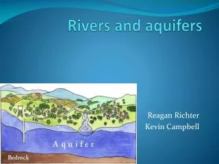
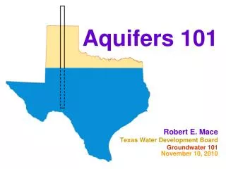
Aquifers 101. Robert E. Mace Texas Water Development Board Groundwater 101 August 12, 2015 Groundwater Summit Caldwell, Texas. Outline. Yay for aquifers! Definitions Flow through an aquifer Pumping an aquifer. Outline. Yay for aquifers! Definitions Flow through an aquifer

E N D
Aquifers 101 Robert E. Mace Texas Water Development Board Groundwater 101August 12, 2015 Groundwater Summit Caldwell, Texas
Outline • Yay for aquifers! • Definitions • Flow through an aquifer • Pumping an aquifer
Outline • Yay for aquifers! • Definitions • Flow through an aquifer • Pumping an aquifer
All numbers in acre-feet per year for Texas atmosphere 86% precip 379,000,000 ET 320,000,000 evap 7,200,000 surface water 47,200,000 into lakes and rivers from runoff 4,700,000 into lakes and rivers from rainfall recharge 5,100,000 baseflow 1,300,000 1.3% groundwater Texas coast: 35,000,000 data from Ward and Valdes (1995) Other states: 9,300,000 85%
All numbers in acre-feet per year for Texas atmosphere 86% precip 379,000,000 ET 320,000,000 evap 7,200,000 surface water 47,200,000 into lakes and rivers from runoff 4,700,000 into lakes and rivers from rainfall recharge 5,100,000 baseflow 1,300,000 1.3% groundwater Texas coast: 35,000,000 data from Ward and Valdes (1995) Other states: 9,300,000 85%
All numbers in acre-feet per year for Texas atmosphere 86% precip 379,000,000 ET 320,000,000 evap 7,200,000 surface water 47,200,000 into lakes and rivers from runoff 4,700,000 into lakes and rivers from rainfall recharge 5,100,000 baseflow 1,300,000 1.3% groundwater Texas coast: 35,000,000 data from Ward and Valdes (1995) Other states: 9,300,000 85%
World Water Balance From Freeze and Cherry (1979)
groundwaterandTexas • ~60 percent of the 16.6 million acre-feet of water used • ~80 percent of groundwater is used for irrigation • groundwater provides 39 percent of water to cities • tastes good when yer thirsty
catfish farm wellEdwards aquifer • flowing well at 40,000 gpm • 1/4 of San Antonio’s use • 9% of Annual Recharge • world’s largest artesian well National Geographic (1993)
Outline • Yay for Groundwater! • Definitions • Flow through an aquifer • Pumping an aquifer
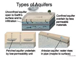
Definitions • Aquifer • Aquitard/confining layer • Vadose zone/unsaturated zone • Water table • Recharge • Water level • Unconfined aquifer • Confined aquifer
what is anaquifer? • an aquifer is geologic media that can yield economically usable amounts of water. Dirt and rocks Depends on who’s using it
what is anaquifer? Limestone (especially karstified), sandstone, sand, gravel, fractured rocks
what is anaquitard? • an aquitard is geologic media that can not yield economically usable amounts of water.
what is anaquitard? • clay, shale, unfractured dense rocks • Note: can still transmit water, but s l o w l y
what is aconfining layer? • A confining layer is an aquitard that bounds an aquifer.
what is a vadose zone? • The vadose zone is the unsaturated geologic media between the water table and the land surface. • Scientific side note: There is a saturated capillary zone between the vadose zone and the water table.
what is a water table? • A water table is where the aquifer meets the vadose (unsaturated) zone. • Scientific definition: surface on which the fluid pressure in the pores of a porous medium is exactly atmospheric.
what is recharge? • Recharge is water that infiltrates to the water table of an aquifer.
what is a water level? • A water level is the level at which water rests (or would rest) in a well.
2 rules of groundwater flow • water flows downhill ( to lower potential energy) • water flows uphill to money
water levels in 2000 from the GAM report
what is an unconfined aquifer? • An unconfined aquifer is an aquifer that is bounded by a confining layer at its bottom but not at its top.
what is a confined aquifer? • A confined aquifer is an aquifer that is bounded by confining layers at its bottom and top and where the water level rises above the top of the aquifer. • Scientific side note: This is also an artesian aquifer. “Artesian” does not require water to flow at land surface.
Outline • Yay for aquifers! • Definitions • Flow through an aquifer • Pumping an aquifer
Your aquifer as a bathtub Spring/ base flow Recharge Aquifer Pumping