Download
1 / 16
160 likes | 277 Views
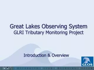
Implementation of the Great Lakes Observing System. Great Lakes Observing System 2009 Regional Coordination Workshop Seattle, WA August 25, 2009 PI: Jennifer Read Three Year Project (08-10). Project Status Report. Project Schedule and Milestones: Lake Huron to Lake Erie Corridor Modeling

E N D
Implementation of the Great Lakes Observing System Great Lakes Observing System 2009 Regional Coordination Workshop Seattle, WA August 25, 2009 PI: Jennifer Read Three Year Project (08-10)
Project Status Report • Project Schedule and Milestones: • Lake Huron to Lake Erie Corridor Modeling • Online access to real-time forecasts of levels and flows throughout the HEC; • A format compatible output from the HECWFS model system into the NOAA GNOME oil spill model used by first responders within the region; • An interactive modeling interface so that end users could run scenarios themselves; and • HECWFS output into Google Earth • Validation via St. Clair River dye study • Great Lakes HarborView • User assessments with Lake Ontario and St. Lawrence community • Great Lakes Modeling and Assessment Center • Online inventory of models, modeling tools and related resources • Five year work plan • Initial GLMAC web pages • Offshore Observation System Implementation Plan • Deployment of pilot network of near-shore buoys
Project Status Report • Project Schedule and Milestones – RA Planning Grant • Membership • Data Sharing Agreements • Business Plan Revisions/Annual Work Plan • User Needs Assessments • Subsystem Cost-Benefit Assessments • DMAC Development • Education/Outreach • Significant Accomplishments: • Huron-Erie Corridor • Nearshore Network • Membership
Keys to Success and Potential Challenges • Success: • Relationship with NOAA in the GL Region • Factors: • Organization: NOAA GL Regional Collaboration; • Individuals: Heather Stirratt, Marie Colton, GLRC Team • Support for GL Observing System in the Region • Factors: • University partners: leveraging other observing assets, private and local; Sea Grant • Other federal agencies • Challenges: • $$ • Resolving Challenges: • Ongoing internal support for GLOS in GLRI
GLOS Product Examples • Provide real-time and forecast (12 hr increments) 3d hydrodynamic outputs to General NOAA Operational Modeling Environment (GNOME) used by NOAA OR&R to provide spill response support to first responders and US Coast Guard related to spill events in the Lake Huron to Lake Erie Corridor • Provide recreational boaters with an integrated tool providing weather, cultural, infrastructure (e.g., marina, boat launch) and commercial information to support recreational safety and efficient decision-making
Current Status: Modeling and DMAC subsystems * See guidelines for definitions **Regionwide = entire RA
Part 2: Looking Forward: Future Plans Focus Areas: Ecosystem Integrity Climate Change Human Health Navigation
Funding Scenario Briefly describe the major CUTS to the subsystem under the reduced funding scenarios