Download
1 / 28
280 likes | 436 Views
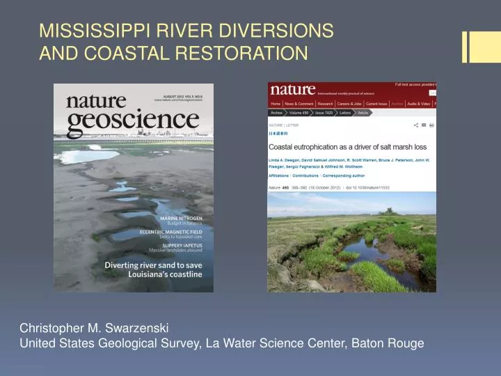
MISSISSIPPI RIVER DIVERSIONS AND COASTAL RESTORATION. Christopher M. Swarzenski United States Geological Survey, La Water Science Center, Baton Rouge. Some CONTEXT. SOIL IS THE PRIMARY METRIC TO EVALUATE EFFECTIVENESS OF ANY RESTORATION APPROACH

E N D
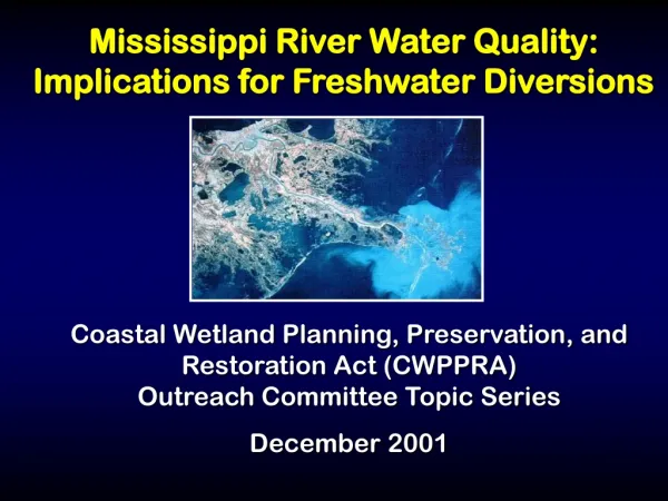
MISSISSIPPI RIVER DIVERSIONSAND COASTAL RESTORATION Christopher M. Swarzenski United States Geological Survey, La Water Science Center, Baton Rouge
Some CONTEXT SOIL IS THE PRIMARY METRIC TO EVALUATE EFFECTIVENESS OF ANY RESTORATION APPROACH - Quality: resists tendency to erode, such as from tides and storm surge - Quantity: accretes vertically fast enough to keep pace with relative sea level rise (subsidence+eustatic sea level rise) NUTRIENT REQUIREMENTS OF COASTAL MARSHES NO peer-reviewed science that an insufficient supply of nutrients has contributed to wetland loss in coastal Louisiana or anywhere else in the world NO peer-reviewed science that adding nutrients helps or has helped reduce rates of marsh loss in coastal Louisiana or anywhere else in the world
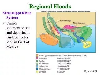
New Orleans Active Bird’s foot Delta Active Atchafalaya River Inactive MISSISSIPPI DELTA PLAIN CHENIER PLAIN
Building and Maintaining Delta Wetlands ACTIVE DEPOSITION WITHORGANIC MATERIAL Eroding shoreline, Lake Salvador highly organic, light, “living” WITH MINERALMATERIAL, Recently deposited mud West Bay, August 2011 inorganic, heavy, inanimate IN SITU ACCRETION
TYPES OF RIVER DIVERSIONSI. WATER-QUALITY a. “rejuvenation” e.g. Caernarvon b. “maintenance” e.g. Davis Pondexamples Caernarvon, Davis Pond, Terrebonne basinII. MINERAL SEDIMENT (land-building)examples include Wax Lake Outlet, West Bay, Bird’s Foot delta
“REJUVENATION” Purpose Transform a degraded (marsh) soil into somethingless degraded => higher-quality soilConstituents in River Water fresh water (reduces salinity) fertilizers (nitrate-N, orthophosphate) sulfate herbicides but very few clays and silts
What we might hope for when we “rejuvenate” a marsh Existing degraded S. patens marsh soil Soil of S. falcata marsh, typical of new salinity regime Water-quality diversion
SCIENTIFIC CONSENSUS “The diversion isn't filling the marsh with sediments on a grand scale”. But the effect of the added river water—loaded as it is with fertilizer from farm runoff—is plain to see. "It turns wetlands hanging on by the fingernails into something quite lush" “Those nutrients are necessary for nourishing the marsh environment” • “Two diversions on the Mississippi are already demonstrating how well diversions can work to restore wetlands. Although these are freshwater diversions (meaning they pull water off the top of the river rather than the bottom, where heavier sediment loads are) and thus do not provide a lot of sediment to the wetlands, they are still beneficial”
REALITY: Water quality diversions appear to compromise soils I. Swarzenski et al 2005, 2008, freshwater Panicum marshes Chronic passive inflow of Lower Atchafalaya River water since 1950s coincided with massive conversion of freshwater Panicummarsh to open water and degraded marsh, soils more decomposed than reference marshes, observation, linked to river water influx Biogeochemistry 90, p. 49-63. II. Kearney et al. 2011 brackish S.patens marshes Caernarvon, White Ditch and Pte a la Hache Post Katrina, areas within outfall were more eroded than adjacent reference marshes at all three controlled diversions; no data on causes, remote sensing, correlation Geophysical Research Letters 38 L16405 III. Deegan et al, 2012, New England S. alterniflorasalt marsh 9 years of nutrient additions: plants produced fewer roots, organic matter decomposed more rapidly and creek banks collapsed, experimental, causative Nature 490, p 388-392.
I. Demise of Penchant Panicum marshes (1955-1998) pre 1955 1998 • River is primary source • of fresh water • Flow west to east • Loss of > 60% of P. hemitomon marsh • Rain is primary source • of fresh water • Flow east to west • Solid expanse of • P. hemitomon Swarzenski et al Biogeochemistry 2008
Three to six months of passive river water influx for 40+ years (Lower Atchafalaya River example)
Soil Quality: with long-term (40+ years) river water influx decomposition appears enhanced (same plant community, Panicumhemitomon) • -No difference in year-end standing biomass • No difference in accretion rates • More organic matter in marsh receiving river water • BUT: • - Soil is much more decomposed • links to river water include sulfate, nitrate, alkalinity, pH Reference River water subsidy Swarzenski et al Biogeochemistry 2008
OBJECTION: NUTRIENTS GOODNUTRIA BAD Nutria are the problem, herbivory is stimulated by nutrient enriched plant material, nutria multiply out of control and marsh dies off Photo from Holm et al 2011, LPBF
River Reference/Rain SEPTEMBER ABOVE-GROUND STANDING BIOMASS (n=4) grams m2 504(30) Total 538(31) 337(27) Panicum 441(31) SOIL (n=3) Stock (kg C, .5 m by 1 by 1 m) 12.8 14.5 Accretion, (g C Per m2 per year) 225 187 Swarzenski et al Biogeochemistry 2008
II. Controlled diversion at Caernarvon, post Katrina Caernarvon Hydrologic barrier Outfall Kearney et al 2011, Geophysical Letters
Outfall Marsh MARSHES POST KATRINA WITHIN OUTFALL AND ON EAST SIDE OF DELACROIX RD East Control in direct path of Katrina Kearney et al 2011, Geophysical Letters
OBJECTION: Pattern of loss is random, or energy was concentrated on west side, but not on east side of Delacroix Road PRE KATRINA POST KATRINA Kearney et al 2011, Geophysical Letters
III. DEEGAN ET AL, 2012, Nature “ By contrast, when nutrients were added, the authors observed that plants produced fewer roots, organic matter decomposed more rapidly and creek banks collapsed, leading to wider creeks and less vegetated marsh, with narrower bands of S.alterniflora”
OBJECTION: • New England salt marshes are different • Macrotidalenvironment (5-7 ft tides) • Ice formation (erosion) Deegan et al 2012, Nature
Conclusions (Water-quality diversions) 1. WEAKENED SOILS ARE THE COMMON THREAD - Correlational (field observations, remote sensing) and experimental studies in different marsh types from Atlantic and Gulf Coasts point to similar outcomes, weakening of soils: in areas with nutrient enrichment, soils are more decomposed and erode more readily during daily tides and during storm events - excessive flooding could also contribute to weakening of soil 2. ABSENCE OF EVEN A SINGLE STUDY SUGGESTING SOIL IS GAINING SHEAR STRENGTH WITH RIVER WATER SUBSIDIES
TYPES OF RIVER DIVERSIONSI. WATER-QUALITY a. “rejuvenation” b. salinity controlexamples Caernarvon, Davis Pond, Terrebonne basinII. MINERAL SEDIMENT (land-building)examples include Wax Lake Outlet, West Bay, Bird’s Foot delta
Scientific consensus is that massive sediment diversions off of mainstem river, in mid-Barataria Basin, are key to restoring coast What is a massive sediment diversion? 50,000-80,000 cfs controlled ? 1-2 months per year?? 3-4 months per year?? >250,000 cfs uncontrolled?? Is mid-Barataria Basin a suitable location for massive sediment diversions in terms of initiating processes for a sustainable coast?
EVIDENCE THAT SEDIMENT DIVERSIONS OFF THE MAIN STEM WILL WORK: WAX LAKE OUTLET "To say that there's not thriving vegetation there with the exact same water that's in the Mississippi River is just a fundamentally flawed statement," Wax Lake Delta: a diversion that works NAS, NWF, EDF, http://www.youtube.com/h?v=i-sJFoM-Lsc
Significantly more mineral sediment is deposited in the Bird’s foot delta wetlands than in the Wax Lake/Lower Atchafalaya River wetlands 250 Birds Foot 200 Mineral sediments, kg in top 24 cm per m2 150 100 50 LAR/WLO 0 0 1 2 3 4 5 accretion (cm/year)
WAX LAKE OUTLET IS NOT A GOOD ANALOG FOR SEDIMENT DIVERSIONS OFF OF THE MAIN STEM MISSISSIPPI RIVER SYNERGY Combined 1/3 of the Mississippi River flow and about ¼ of the sediment load PLATFORM previous delta building occurred several thousand years ago, many years of marine reworking has built a firm platform to support weight of new mineral deposits SUBSIDENCE AND COMPACTION Rates are probably much lower than in Barataria and Breton; Holocene layer is much thicker in latter area
ConclusionsI. WATER-QUALITY a. as “rejuvenation” problematic, appears to exacerbate marsh loss; adaptive management calls for refinement of approach, detailed studies before being implementedb. as “maintenance” works in short term, but only needed occasionallyII. MINERAL SEDIMENT (land-building)- specifics are needed: size, location, key uncertainty is a better understanding of weight bearing capacity of underlying strata
SHOULD DIVERSIONS PLAY A ROLE IN COASTAL RESTORATIONEmphatic yes, QUESTION IS HOW?Clarity is needed on what the expectations are for main-stem river diversions as proposed in Master Plan and then a transparent scientific debate whether these expectations are reasonable given our geological and ecological knowledge.