Download

1 / 27
270 likes | 494 Views
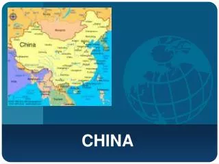
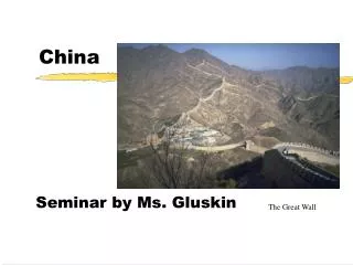
China. China’s physical geography. Question 1-Where is China? Five facts about its location. In the northern hemisphere In Asia With an east coast on the Pacific Ocean To the south of Russia To the west of Japan Sharing borders with Russia, North Korea, Mongolia, India etc.

E N D
China China’s physical geography
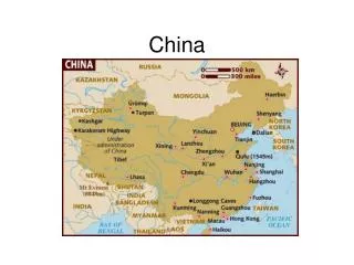
Question 1-Where is China?Five facts about its location • In the northern hemisphere • In Asia • With an east coast on the Pacific Ocean • To the south of Russia • To the west of Japan • Sharing borders with Russia, North Korea, Mongolia, India etc.
Question 2-Relief • Relief describe how the land varies in height. • Describe the pattern of relief in China The land steps up in height as you go west from the coast. The lowest areas are along the coast. The next step up has mountain ranges and large deserts The top step has the vast Plateau of Tibet, about 4000m above sea level.
Rivers Three main rivers 1- The Yellow River is the world’s sixth longest river. It is named after the yellow silt (small particles of soil) it carries. 2- The River Yangtze is the world’s third longest river. 3- The River Xi flows to the Pearl Delta, which is one of China’s top industrial area.
The climate Read page 31
Question 3 Explain why a-It is cold at A:It is very high land- and the higher the land, the cooler it is. b-it is much warmer at B than at C B is much further south, closer to the equator.
c- the temperature difference between summer and winter is greater at B than D. D is near the sea and B is inland. The sea keeps places cooler in summer and warmer in winter so it reduces the temperature difference between summer and winter.Inland, however, land heats up fast in summer and cools fast in winter, giving a big temperature difference at B.
d- you’ll find palm-fringed tropical beaches at E (Hainan island) Hainan is located on the Tropic of Cancer.
What is the monsoon? Between May and October, the land heats up. The air above it warms up and rises. Moist winds are drawn from the south east to replace it.The moist air is forced to rise where it meets high land. As the moist air rises and cools, it rains.
Question 5 a- Which region gets most rain?South east b- Explain why it gets the most rain.Due to the monsoon. The relief in the south east causes the moist air to rise, giving heavy rain there. c- Which is the driest region? North west.Why?Since it is so far inland, winds that reach it will have lost their moisture.
d- Where might you expect snow rather than rain? Plateau of Tibet as it is 4000 m high
Question 6 a- What makes it a desert? It gets very little rain. b- It is a cold desert.
The earthquake risk The Himalayas were formed by two plates pushing into each other. Both are made of continental crust.
Continental-to-continental boundary 1- When two continental plates meet at a destructive boundary, a slow collision takes place as both plates have a low density. 2- This results in intense folding and uplift and leads to the formation of fold mountains. 4- However, earthquakes occur due to the collision of the plates. 3- There is no subduction. Therefore, there are no volcanoes.
Figure 15 The formation of the Himalayas Sequence of the formation of the Himalayas 1-About 100 million years ago the Indian Plate Started to converge with the Eurasian Plate. 2- Gradually, the ocean between them narrowed Until the two continental land masses collided. 3- The thick layers of sediments between the two continents 4- As the plates collides. These sediments were squeezed and folded to form the Himalayas. 5- The continent of India is still pushing into Asia at a rate of 1cm/year. This movement accounts for major earthquakes in India.
p34 The World’s largest population:Over 1.3 billion people
Where do they live? Use of a Choropleth map-a map which uses colours to present data- to show the density of population. Population density: number of people per square kilometre: Total population divided by the total land. Population density (people per sq. km) in Cyprus was last measured at 120.83 in 2011,
95% of the population lives in less than half of China’s area. Large parts of the country are empty, or very sparsely populated. Overall density: 144
Question 2 Which parts of China are: A- the most heavily populated? (i)The eastern half of China is the most densely populated, in particular the area starting half way up and stretching north. (ii)Also all along the coast.
B- the least heavily populated (i)Most of the western half of China and along most of the northern border. (ii) The driest regions
Density and high densities are found • where land is flat • especially along rivers • Where the climate is not cold
3 Incentives and 3 disincentives from handout • Is it a success? Textbook p37 • Skill: line graph • Question 5