Download
1 / 60
600 likes | 750 Views
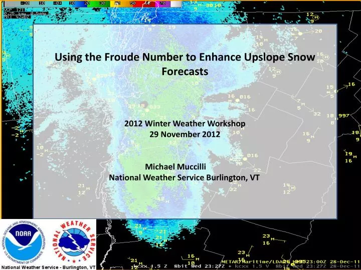
Using the Froude Number to Enhance Upslope Snow Forecasts 2012 Winter Weather Workshop 29 November 2012 Michael Muccilli National Weather Service Burlington, VT. Objective. Make it easier to identify significant upslope events & placement/orientation of heavy snow using:

E N D
Using the Froude Number to Enhance Upslope Snow Forecasts 2012 Winter Weather Workshop 29 November 2012 Michael Muccilli National Weather Service Burlington, VT
Objective • Make it easier to identify significant upslope events & placement/orientation of heavy snow using: • Froude Number • Low/Mid level humidity • Wind Direction and Vertical Profile • Stability • Snow Ratios • Identify sets of “Best-Case” conditions for heavy upslope snow in the Champlain Valley, along the Western Slopes, and at the Eastern Sites
Overview • Froude Number and Upslope Snow Study • Define Froude Number • Study Results • Real-World Examples • Wind Direction and Profile Study • Best Case Scenarios • Snow Ratios • Summary
Froude Number • Represents the Flow of Air when it comes in contact with a barrier (Green Mountains) • Subcritical (Blocked), < 1 • Precip likely to fall upwind of barrier • Critical (>= 1) • Precip likely to fall along barrier • Supercritical (Unblocked), >> 1 • Precip likely to fall on lee side of barrier
Froude Number Calculation • Potential Temperature • Surface and Mountain Top • Mountain Height • Speed of Wind Perpendicular to Barrier Brunt-Vaisala Equation Froude Number Equation
Froude Number & Upslope Snow Study • 25 Cases (2007-2012) • 12 were “Blocked” w/ Froude Numbers < 1 • 13 were “Unblocked” w/ Froude Numbers > 1
11 Stations CHAMPLAIN VALLEY SITES • BTV (Burlington International Airport)- 15 Miles West of Spine of Greens • EXJV1 (Essex Junction)- 13 Miles West of Spine of Greens • ENOV1 (Enosburg Falls)- 7 Miles West of Spine of Greens • NUNV1 (North Underhill)- 6 Miles West of Spine of Greens • VTCH13 (Richmond)- 5 Miles West of Spine of Greens • VTCH15 (Huntington)- 5 Miles West of Spine of Greens • SLNV1 (South Lincoln)- 3 Miles West of Spine of Greens • JAYV1 (Jay Peak)- Mountain Peak in Western Orleans County • EDNV1 (Eden)- Eastern Lamoille County • VTWS18 (Waterbury)- Eastern Slopes in Washington County • MNPV1 (Montpelier)- Eastern Valley WESTERN SLOPES SITES EASTERN MOUNTAIN SITES EASTERN VALLEY SITES
“Heaviest” Snow Eastern Peaks Very Little to None Elsewhere
Heaviest Snow Eastern Peaks Minimal Snow Western Slopes, Very Little to None Champlain Valley
Heaviest Snow Eastern Peaks Minimal Snow Western Slopes, Very Little to None Champlain Valley
Heaviest Snow Eastern Peaks Minimal Snow Western Slopes, Very Little to None Champlain Valley
Significant Snow Eastern Peaks Heaviest Snow Western Slopes, Minimal Champlain Valley
Moderate Snow Eastern Peaks Heaviest Snow Western Slopes but Snow Backs up into Champlain Valley
Minimal Snow Eastern Peaks Heaviest Snow Essex-Western Slopes, but Significant Snow Champlain Valley
Minimal Snow Eastern Peaks Heaviest Snow Backed up into Champlain Valley
BTV Warning Criteria Snow • Froude Numbers > 1 • 0% met Warning Criteria • 0% met Advisory Criteria • 8% had 1” or Greater • Of Froude Numbers < 1 • 42% met Warning Criteria • 58% met Advisory Criteria • 75% had 1” or Greater • Of Froude Numbers < 0.5 • 75% met Warning Criteria • 100% met Advisory Criteria • 100% had 1” or Greater
NUNV1 Warning Criteria Snow • Of Froude Numbers > 1 • 15% met Warning Criteria • 15% met Advisory Criteria • 85% had 1” or Greater • Of Froude Numbers < 1 • 100% met Warning Criteria • 100% met Advisory Criteria • 100% had 1” or Greater • Of Froude Numbers < 0.5 • 100% met Warning Criteria • 100% met Advisory Criteria • 100% had 1” or Greater
JAYV1 Warning Criteria Snow • Of Froude Numbers > 1 • 54% met Warning Criteria • 85% met Advisory Criteria • 100% had 1” or Greater • Of Froude Numbers < 1 • 42% met Warning Criteria • 67% met Advisory Criteria • 92% had 1” or Greater • Of Froude Numbers < 0.5 • 0% met Warning Criteria • 25% met Advisory Criteria • 100% had 1” or Greater
Example- Froude < 0.25 January 9th, 2010 *Froude- 0.19
Example- Froude 0.25-0.49 December 14th, 2010 *Froude- 0.37
Example- Froude 0.50-0.84 January 10th, 2011 *Froude- 0.64
Example- Froude 0.85-0.99 December 7th, 2010 *Froude- 0.98
Example- Froude 1.00-1.33 February 4th, 2010 *Froude- 1.03
Example- Froude 1.34-1.75 February 21st, 2009 *Froude- 1.43
Example- Froude 1.76-2.00 February 20th, 2008 *Froude- 1.90
Example- Froude > 2.00 January 3rd, 2012 *Froude- 4.40
Where to get Froude Number? • ALBFROUDE (Forecast) • Calculated in GFE using the BTV4
Where to get Froude Number? • ALBPROFIL (Real-Time) • Calculated using Observations at BTV and MMN
Relative Humidity • Blocked (Froude < 1) • 850 mb Average: 98.7% • 925 mb Average: 95.8% • Surface Average: 85.9% • Unblocked (Froude > 1) • 850 mb Average: 89.6% • 925 mb Average: 88.9% • Surface Average: 81.8%
Wind Direction- BLOCKED AT KBTV--- • 4000 FEET • Average: 333 Degrees (NNW) at 28 kts • 2000 FEET • Average: 312 Degrees (NW) at 25 kts • SURFACE • Average: 304 Degrees (WNW) *Veering Wind Profile (WAA)
Wind Direction- Unblocked AT KBTV--- • 4000 FEET • Average: 291 Degrees (WNW) at 29 kts • 2000 FEET • Average: 286 Degrees (WNW) at 23 kts • SURFACE • Average: 286 Degrees (WNW) *Very Little Directional Shear
Wind Direction & Snow at KBTV • Events > 6 inches • 100% of Cases had 4K Winds > 300 deg (NW) • 100% of Cases had 2K Winds > 270 deg (WNW) • 0% of Cases had SFC Winds with southerly component • AVG 4K 342 deg (NNW) • AVG 2K 316 deg (NW) • AVG SUR 298 deg (WNW) *Favorable Wind Profile WNW veering to NNW
Wind Direction & Snow at NUNV1 • Events > 6 inches • 100% of Cases had 4K Winds >= 270 deg (W) • 93% of Cases had 2K Winds >= 270 deg (W) • 93% of Cases had SFC Winds >= 270 deg (W) • AVG 4K 327 deg (NW) • AVG 2K 306 deg (WNW) • AVG SUR 303 deg (WNW) *Favorable Wind Profile WNW veering to NW
Wind Direction & Snow at JAYV1 • Events > 6 inches • Surface Winds b/w 220 & 320 degrees (SW-NW) • AVG 4K 305 deg (WNW) • AVG 2K 285 deg (W) • AVG SUR 280 deg (W) • 0% of Cases had a North Wind (> 340 deg) at ANY Level *Favorable Wind Profile W veering to WNW
Importance of Veering (> 0 Deg) Winds in CVLY • KBTV • 67% of Strong Veering Blocked Flow (> 40 deg from Surface4000 FT) produce > 6” • 100% of all Warning Criteria Snow occurs with Veering (> 0 deg) Blocked Flow • 100% of Strong Veering Blocked Flow produce > 5”
Best Case BTV/EXJV1 • Froude Number • < 1 • Especially < 0.5 • Winds • > 40 degrees of Veering from Surface to 4000 FT • WNW at Surface Veering to NW/NNW at 4000 FT • Relative Humidity on KBTV sounding • Surface > 85% • 925 mb > 95% • 850 mb > 95%
Best Case Western Slopes • Froude Number • < 1 • Most Favorable 0.5 – 0.99 • Winds • > 0 degrees of Veering from Surface to 4000 FT • WNW at Surface Veering to NW at 4000 FT • Relative Humidity on KBTV sounding • Surface > 85% • 925 mb > 90% • 850 mb > 90%
Best Case Eastern Peaks • Froude Number • Near 1 • Most Favorable 0.85-1.75 • Winds • > 0 degrees of Veering from Surface to 4000 FT • W at Surface Veering to WNW at 4000 FT • No Presence of Due North Wind at ANY Level • Relative Humidity on KBTV sounding • Surface > 80% • 925 mb > 85% • 850 mb > 85%
Snow To Liquid Ratios • SLNV1 • Average… 31:1 • Highest… 45:1 • Lowest… 10:1 • VTCH15 (Huntington) • Average… 22:1 • Highest… 42:1 • Lowest… 8:1 • VTCH13 (Richmond) • Average… 28:1 • Highest… 67:1 • Lowest… 7:1 • NUNV1 • Average… 33:1 • Highest… 71:1 • Lowest… 9:1