Download
1 / 61
610 likes | 738 Views
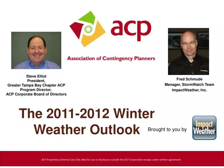
Steve Elliot President, Greater Tampa Bay Chapter ACP Program Director, ACP Corporate Board of Directors. Fred Schmude Manager, StormWatch Team ImpactWeather, Inc. The 2011-2012 Winter Weather Outlook. Brought to you by.

E N D
Steve Elliot President,Greater Tampa Bay Chapter ACP Program Director, ACP Corporate Board of Directors • Fred Schmude • Manager, StormWatch Team • ImpactWeather, Inc. The 2011-2012 WinterWeather Outlook Brought to you by ACP Proprietary (Internal Use Only )Not for use or disclosure outside the ACP Corporation except under written agreement
The 2011-2012 WinterWeather Outlook Fred SchmudeStormWatch ManagerImpactWeather, Inc. fschmude@impactweather.com Fred specializes in hurricane forecasting, severe thunderstorms, winter weather monitoring and forecasting and long-range monthly and seasonal forecasting. He holds a BS in Geology from Texas Tech and a BS in Meteorology from Texas A&M. Fred joined ImpactWeather’s parent company as a meteorologist in 1990.
Agenda • Detailed analysis of the ocean water trends and projected La Niña • Brief summary of late October Snowstorm over Rockies & Northeast • Forecast temperature & precipitation trends for late November and December • Forecast temperature and precipitation trends for this winter season • Main hazard weather trends projected for this winter season • Drought outlook for Texas and Deep South • Current soil moisture profiles signal another flood risk for the Ohio Valley and Northeast
IOD (Indian Ocean Dipole) Warm Phase
PDO (Pacific Decadal Oscillation) Cold Phase IOD (Indian Ocean Dipole) Warm Phase
PDO (Pacific Decadal Oscillation) Cold Phase IOD (Indian Ocean Dipole) Warm Phase ENSO (La Niña) Cold Phase
PDO (Pacific Decadal Oscillation) Cold Phase IOD (Indian Ocean Dipole) Warm Phase AMO (Atlantic- Multi-Decadal Oscillation) Warm Phase ENSO (La Niña) Cold Phase
El Niño La Niña
El Niño La Niña November forecast -1.4C
El Niño La Niña Winter 2011-12 forecast Moderate La Nina -1 to -1.4C November forecast -1.4C
Historic Late October NE U.S. Snowstorm Record snowstorm struck the northeast U.S. October 29-30
Denver 8.5” Amarillo 3.1”
Early Season Snowstorm Oct 29-30th 12-24”...Peak at Peru, MA (32”) Denver 8.5” Amarillo 3.1”
Early Season Snowstorm Oct 29-30th 12-24”...Peak at Peru, MA (32”) Denver 8.5” • 26 deaths • 3-4 million without power • Earliest heavy snow in • many areas Amarillo 3.1”
Weather Trends for the 3rd week of November 2011 Colder Than Normal Warmer Than Normal Near Normal Warmer Than Normal Colder Than Normal Warmer Than Normal
Weather Trends for the 3rd week of November 2011 Colder Than Normal Warmer Than Normal Near Normal Warmer Than Normal Colder Than Normal STORMY Nov 14-15 Warmer Than Normal
Weather Trends for the 3rd week of November 2011 Colder Than Normal Warmer Than Normal Near Normal Unsettled Nov 15-16 Warmer Than Normal Nov 16-17 Colder Than Normal STORMY Nov 14-15 Warmer Than Normal
Weather Trends for the 3rd week of November 2011 Colder Than Normal Warmer Than Normal Unsettled Nov 16-20 Near Normal Unsettled Nov 15-16 Warmer Than Normal Nov 16-17 Colder Than Normal STORMY Nov 14-15 Warmer Than Normal
L Lower Pressure Trend + NAO & AO phase L Weather Trends for the 4th week of November 2011
L L Lower Pressure Trend + NAO & AO phase L Lower Pressure Trend +EPO Weather Trends for the 4th week of November 2011
L L Lower Pressure Trend + NAO & AO phase L Lower Pressure Trend +EPO Lower Pressure L -PNA Higher Pressure H Weather Trends for the 4th week of November 2011
L L Lower Pressure Trend + NAO & AO phase L Lower Pressure Trend +EPO Lower Pressure L -PNA Higher Pressure H Weather Trends for the 4th week of November 2011
Weather Trends for the 4th week of November 2011 Milder than normal Cooler than normal Milder than normal
Weather Trends for the 4th week of November 2011 UNSETTLED UNSETTLED Milder than normal Cooler than normal UNSETTLED UNSETTLED Milder than normal Milder than normal
Weather Trends for the 4th week of November 2011 UNSETTLED UNSETTLED Milder than normal Cooler than normal UNSETTLED UNSETTLED Milder than normal MOSTLY DRY DRIER Milder than normal
Projected Flow Pattern For December 2011 L Lower Pressure Colder & More Stormy H L Higher Pressure Milder & Less Stormy H Higher Pressure
Projected Flow Pattern For December 2011 L Lower Pressure Colder & More Stormy H L UNSETTLED Higher Pressure Milder & Less Stormy UNSETTLED H Higher Pressure
Projected Flow Pattern For December 2011 L Lower Pressure Colder & More Stormy H L UNSETTLED Higher Pressure Milder & Less Stormy UNSETTLED H Higher Pressure D R IE R
Temperature Outlook for December 2011 Colder Than Normal -3 to -6 F Near Normal Near Normal Colder Than Normal -2 to -4 F Near Normal Colder Than Normal -1 to -3 F
Temperature Outlook for December 2011 Colder Than Normal -3 to -6 F Near Normal Near Normal Colder Than Normal -2 to -4 F Near Normal ? Colder Than Normal -1 to -3 F Colder Than Normal -1 to -3 F ? NAO Dependent Trend Definitely Negative ?
Precipitation Outlook for December 2011 Near Normal Near Normal Above Normal Above Normal Near Normal Near Normal Above Normal Below Normal Below Normal Near Normal
Projected Flow Pattern For Dec 2011-Feb 2012 L H Lower Pressure Colder & More Stormy Higher Pressure Milder & Less Stormy H L H Higher Pressure Milder & Less Stormy
Projected Flow Pattern For Dec 2011-Feb 2012 L H Lower Pressure Colder & More Stormy Higher Pressure Milder & Less Stormy H L H UNSETTLED UNSETTLED Higher Pressure Milder & Less Stormy
Projected Flow Pattern For Dec 2011-Feb 2012 L H Lower Pressure Colder & More Stormy Higher Pressure Milder & Less Stormy H ARCTIC AIR L H UNSETTLED UNSETTLED Higher Pressure Milder & Less Stormy Drier & Extreme Milder
Temperature Outlook for Dec 2011 through Feb 2012 Near Normal Colder Than Normal -4 to -8 F Warmer Than Normal +2 to +4 F Colder Than Normal -2 to -4 F Near Normal Near Normal Warmer Than Normal +1 to +3 F Colder Than Normal -1 to -3 F
Precipitation Outlook for Dec 2011 through Feb 2012 Near Normal Near Normal Near Normal Below Normal Near Normal Near Normal Above Normal Above Normal Near Normal Below Normal
Hazard Concerns for the 2011-2012 Winter Seattle Portland San Francisco Stormy...Higher than normal rainfall and coastal gales!
Hazard Concerns for the 2011-2012 Winter Higher than normal snowfall likely Spokane Boise Billings Salt Lake City Reno Seattle Portland San Francisco Stormy...Higher than normal rainfall and coastal gales!
Hazard Concerns for the 2011-2012 Winter Higher than normal snowfall likely Spokane Boise Billings Salt Lake City Reno Seattle Portland San Francisco Stormy...Higher than normal rainfall and coastal gales! Some Drought Relief...still drier than normal!
Hazard Concerns for the 2011-2012 Winter Higher than normal snowfall likely Spokane Boise Billings Salt Lake City Reno Seattle Portland San Francisco Stormy...Higher than normal rainfall and coastal gales! Houston Corpus Christi New Orleans Baton Rouge Tampa Jacksonville Some Drought Relief...still drier than normal! Elevated risk of a hard freeze near the coast
Hazard Concerns for the 2011-2012 Winter Higher than normal snowfall likely Spokane Boise Billings Salt Lake City Reno Seattle Portland San Francisco Stormy...Higher than normal rainfall and coastal gales! Washington D.C. Baltimore Philadelphia Wilmington Lower than normal snowfall Houston Corpus Christi New Orleans Baton Rouge Tampa Jacksonville Some Drought Relief...still drier than normal! Elevated risk of a hard freeze near the coast
Hazard Concerns for the 2011-2012 Winter Minneapolis Chicago Detroit Cleveland Buffalo Boston New York City Higher than normal snowfall likely Spokane Boise Billings Salt Lake City Reno Elevated risk of heavier than normal snowfall Seattle Portland San Francisco Best Chance Stormy...Higher than normal rainfall and coastal gales! Best Chance Washington D.C. Baltimore Philadelphia Wilmington Lower than normal snowfall Houston Corpus Christi New Orleans Baton Rouge Tampa Jacksonville Some Drought Relief...still drier than normal! Elevated risk of a hard freeze near the coast
Hazard Concerns for the 2011-2012 Winter Minneapolis Chicago Detroit Cleveland Buffalo Boston New York City Higher than normal snowfall likely Spokane Boise Billings Salt Lake City Reno Elevated risk of heavier than normal snowfall Seattle Portland San Francisco Best Chance Stormy...Higher than normal rainfall and coastal gales! Best Chance Washington D.C. Baltimore Philadelphia Wilmington Dallas Oklahoma City Little Rock St. Louis Kansas City Memphis Nashville Indianapolis Columbus Pittsburgh Philadelphia Lower than normal snowfall Elevated freezing Rain risk Houston Corpus Christi New Orleans Baton Rouge Tampa Jacksonville Some Drought Relief...still drier than normal! Elevated risk of a hard freeze near the coast
Moderate Drought (tan) Abnormally Dry (yellow) Severe Drought (red)