Download
1 / 36
360 likes | 367 Views
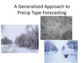
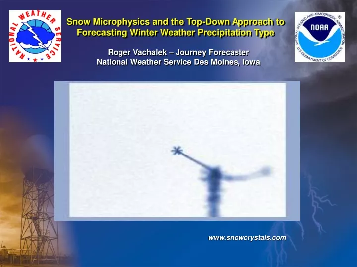
Snow Microphysics and the Top-Down Approach to Forecasting Winter Weather Precipitation Type. Roger Vachalek – Journey Forecaster National Weather Service Des Moines, Iowa. www.snowcrystals.com. Snow Microphysics and the Top-Down Approach to Forecasting Winter Weather Precipitation Type.

E N D
Snow Microphysics and the Top-Down Approach to Forecasting Winter Weather Precipitation Type Roger Vachalek – Journey Forecaster National Weather Service Des Moines, Iowa www.snowcrystals.com
Snow Microphysics and the Top-Down Approach to Forecasting Winter Weather Precipitation Type Why is Snow Microphysics Important? • During big snowfalls, much of the heavy snow falls in a short time frame. Forecasting these brief periods of snowfall is very important for both short term considerations and total storm snowfall. Numerical Prediction Models better forecast areas of large scale forcing which lead to precipitation, then they can forecast actual “quantitative precipitation amounts” over a given area. • There is considerable variability to the character of snow from event to event and during an event. • Snowflake size and type has considerable impact on overall snow accumulation rate and visibility… which then greatly affects travel and safety.
Snow Microphysics and the Top-Down Approach to Forecasting Winter Weather Precipitation Type Why is Snow Microphysics Important? • Put it all together and you’ll find that: • The relationship between vertical motion and snow microphysics greatly impacts snowfall efficiency – or how much snow can fall from a given moisture and temperature environment! The character of snowfall is also related to variations in lift, moisture content, and vertical temperature profile.
Snow Microphysics and the Top-Down Approach to Forecasting Winter Weather Precipitation Type Cloud Droplets and Ice Nucleation - 40 F Common Ice Nuclei include the following: • Silver Iodide used for cloud seeding: -4 C All “sub-freezing” clouds contain “super-cooled” waterdroplets that can exist at temperatures as cold as – 40 C ( - 40 F ) without freezing, when in the absence of “ice nuclei”. • Volcanic Ash: -13C • Kaolinite (clay family): -9C • Vermiculite (most prevalent clay): -15C Work done by various cloud physicists suggests that about 80-90% of all ice nuclei over the upper Midwest consist of some type of clay material with vermiculite leading the charge.
Snow Microphysics and the Top-Down Approach to Forecasting Winter Weather Precipitation Type Cloud Droplets and Ice Nucleation Heterogeneous Nucleation Three Possible Processes of Heterogeneous Nucleation • Growth by diffusion deposition( depositing upon ) When “particles” introduced into the atmosphere initiate ice crystal formation… like vermiculite. • Growth by contact • Growth by freezing( ice nuclei initiate spontaneous process ) Turns out that the most common growth process is: Growth by diffusion deposition
Snow Microphysics and the Top-Down Approach to Forecasting Winter Weather Precipitation Type The Bergeron-Findeisen Process • It has been experimentally verified that the saturation vapor pressure over ice is less than the saturation vapor pressure over water at the same temperature. This saturation vapor pressure deficit ( about 0.25 mb at -12.5 C ) means that when ice crystals and cloud droplets exist in the same cloud, the ice tends to grow at the expense of the cloud droplets. . . . . . . Super-cooled water droplets are pulled towards the ice crystals !!
Snow Microphysics and the Top-Down Approach to Forecasting Winter Weather Precipitation Type The Bergeron-Findeisen Process 600 mb Ice growth rate also depends on atmospheric pressure with the growth rate greater at lower pressure ! 700 mb Growth rate is maximized around -15 C
Snow Microphysics and the Top-Down Approach to Forecasting Winter Weather Precipitation Type What Temperature is Cold Enough ? • -4C NO ICE in clouds with this temperature or warmer • -10C 60% chance ice is in the cloud - warm cutoff • Operationally -12C 70% chance ICE is in the cloud • -15C 90% chance ICE is in the cloud • -20C ICE is there! • -4C NO ICE in clouds with this temperature or warmer • -10C 60% chance ice is in the cloud - warm cutoff • Operationally -12C 70% chance ICE is in the cloud • -15C 90% chance ICE is in the cloud • -20C ICE is there! • -4C NO ICE in clouds with this temperature or warmer • -10C 60% chance ice is in the cloud - warm cutoff • Operationally -12C 70% chance ICE is in the cloud • -15C 90% chance ICE is in the cloud • -20C ICE is there!
Snow Microphysics and the Top-Down Approach to Forecasting Winter Weather Precipitation Type Which Snowflake is Favored at -15 C ? The Holy Grail of snowflakes … 2-5 mm in diameter and contains plenty of “air space” in and around the flake. High Snow:Water Ratio! The Dendrite ! www.snowcrystals.com
Snow Microphysics and the Top-Down Approach to Forecasting Winter Weather Precipitation Type Other Snow Growth Mechanisms Growth by accretion… within entire cloud • Fast falling ice crystals collect super-cooled water vapor as they fall and get larger with time. Graupel, needles, and finely dendritic flakes can grow by accretion. Growth by aggregation… nearer cloud base • Multiple ice crystals come together to form one main flake. • Happens most often when cloud temperatures are warmer than -10 C ( 14 F ). • The largest flakes occur when the temperature of the cloud and near surface temperature is near 0 C ( 32 F ) and the air is saturated down to the surface.
Snow Microphysics and the Top-Down Approach to Forecasting Winter Weather Precipitation Type Size of Flake by Temperature Aggregation Dendrites • Snowflakes can approach sizes of 40 mm … nearly 10 times the size of a fat dendrite flake !!
Snow Microphysics and the Top-Down Approach to Forecasting Winter Weather Precipitation Type Two Snow Nucleation Processes Seeder Feeder Mechanism – cirrus over stratus • Pruppacher and Klett proposed a mechanism where an upper layer clouds “seeds” a lower super-saturated cloud deck with ice crystals – causing the feeder cloud to produce precipitation. Seeder Clouds 5000 feet max Feeder Clouds
Snow Microphysics and the Top-Down Approach to Forecasting Winter Weather Precipitation Type Two Snow Nucleation Processes Rime Splintering – nearer cloud base • Accretive snow crystals shatter or splinter as they fall. This produces additional ice nuclei for the cloud to develop more snow flakes • Normally occurs as temperatures approach -5 C when flakes have grown in size significantly. Rime splintering will enhance snowfall efficiency as it adds more nuclei to the cloud…however at the same time snowfall amountsmay diminish due to the riming process which removes “super-cooled water vapor” from the cloud. Doh!
Snow Microphysics and the Top-Down Approach to Forecasting Winter Weather Precipitation Type What About Atmospheric Lift ? • Maximizing snowfall efficiency involves three things: • Snow production in the “dendritic layer” from -12 C to -18 C centered around – 15 C. 2. Sufficient moisture within the layer with relative humidity greater than 90% 3. Sufficient and sustained lift within the column cutting through the dendritic layer. One easy way to view these processes is though BUFKIT which is available at the following address: http://www.wbuf.noaa.gov/bufkit/bufkit.html or simply search “BUFKIT” on Yahoo! Or Google. BUFKIT is a program which displays atmospheric soundings … and time cross sections of moisture, temperature, and lift.
BUFKIT Home Page Des Moines BUFKIT Data Page Snow Microphysics and the Top-Down Approach to Forecasting Winter Weather Precipitation Type
BUFKIT Applications Snow Microphysics and the Top-Down Approach to Forecasting Winter Weather Precipitation Type January 5, 2003 Central PA Snow Event Time Cross Section Area of Upward Lift Dendritic Layer: -12C to -18C
Snow Microphysics and the Top-Down Approach to Forecasting Winter Weather Precipitation Type Let’s Summarize Snow Microphysics • Vertical motion and snow microphysics greatly impacts snowfall efficiency. • Turns out that the most common growth process is: • Growth by diffusion deposition • -10 C 60% chance ice is in the cloud - warm cutoff • Operationally -12 C 70% chance ICE is in the cloud
Snow Microphysics and the Top-Down Approach to Forecasting Winter Weather Precipitation Type Let’s Summarize Snow Microphysics • Dendrites are the favored type of snowflakes for high efficiency snowfall events and occur in the – 12 C to -18 C “dendritic layer”. • Other snow growth processes include aggregation and accretion. • Other ice nucleation processes include the seeder-feeder effect and rime splintering. • BUFKIT cross sections can be utilized to locate periods of maximum snowfall efficiency at a given location – provided the numerical forecast models accurately depict the evolution of the snow event in your area !!
Snow Microphysics and the Top-Down Approach to Forecasting Winter Weather Precipitation Type Top-Down Approach to Precipitation Type Previous methods focused on “thickness of layer” or “warmth of a layer” in question to decide between frozen, mixed, or liquid precipitation at a location. Common snow benchmark values for various pressure layers: • 1000 – 500 mb thickness: less than 5400 meters : snow • 1000 – 850 mb thickness: less than 1300 meters: snow • 1000 - 700 mb thickness: less than 2840 meters: snow Average Temperature Thickness equation: Related to thickness
Snow Microphysics and the Top-Down Approach to Forecasting Winter Weather Precipitation Type Top-Down Approach to Precipitation Type Today’s preferred method examines the temperature profile of the atmosphere at the location(s) of expected precipitation … Three Considerations for the Top-Down Approach: • Does the cloud column have ice nuclei available for the production of frozen precipitation ? • Are there any warm or dry layers above the surface layer ? • What is the temperature and moisture content of the surface layer ? There may be a need to consider the Tw temperature at the surface!
Snow Microphysics and the Top-Down Approach to Forecasting Winter Weather Precipitation Type Top-Down Approach to Precipitation Type Ice crystal nucleation and growth Cold, midlevel air mass Ice Producing Layer Elevated, warm tropical air mass Warming, melting Warm Layer Surface Arctic or modified air mass Refreezing/contact freezing Cold Surface Layer
Snow Microphysics and the Top-Down Approach to Forecasting Winter Weather Precipitation Type Top-Down Approach to Precipitation Type 1 2 3 Here is our sample “winter” sounding with the three layers of consideration in the Top-Down method !
Snow Microphysics and the Top-Down Approach to Forecasting Winter Weather Precipitation Type Top-Down Approach to Precipitation Type Elevated Warm Layer Let’s also assume that the surface layer is colder than 0 C. < 10 C snow freezing rain or drizzle snow/ice pellet mix (10 C) freezing rain or drizzle 1 to 30 C to ice pellets (30 C) > 30 C freezing rain or drizzle freezing rain or drizzle Assessing a cold and dry surface layer for precipitation type is much more difficult … see the flow chart handout for details.
Snow Microphysics and the Top-Down Approach to Forecasting Winter Weather Precipitation Type Top-Down Approach to Precipitation Type A typical snow profile ….
Snow Microphysics and the Top-Down Approach to Forecasting Winter Weather Precipitation Type Top-Down Approach to Precipitation Type A typical mixed precipitation profile ….
Snow Microphysics and the Top-Down Approach to Forecasting Winter Weather Precipitation Type Top-Down Approach to Precipitation Type A typical freezing rain profile ….
Top-Down Approach to Precipitation Type Snow Microphysics and the Top-Down Approach to Forecasting Winter Weather Precipitation Type Interactive Java Applet which allows you to create a “profile” and see how changes in conditions affect precipitation type using the Top-Down approach !! …http://profhorn.meteor.wisc.edu/wxwise/precip/precip.html
Snow Microphysics and the Top-Down Approach to Forecasting Winter Weather Precipitation Type Let’s Try a Few Examples !! 0 0 0 -10 We have ice at -10 C … we have a weak elevated warm layer. We also have a rather dry surface layer … mainly sleet fell here ! 0
Snow Microphysics and the Top-Down Approach to Forecasting Winter Weather Precipitation Type Let’s Try a Few Examples !! 0 0 -10 0 We have no ice at -10 C … we have an elevated warm layer. We also have a cold surface layer which is below 0 C … freezing drizzle fell here ! 0 0
Snow Microphysics and the Top-Down Approach to Forecasting Winter Weather Precipitation Type Let’s Try a Few Examples !! Omaha, NE Oct 21, 2006 At 7 am 0 0 -10 0 snow refreezing melting melting We have ice at -10 C and colder … we have a very small elevated warm layer. We also have a warm surface layer which is above 0 C just above ground… rain and light snow fell here ! 0 0
Snow Microphysics and the Top-Down Approach to Forecasting Winter Weather Precipitation Type Let’s Try a Few Examples !! Dubuque, IA Nov 09, 2000 At 7 am 0 0 0 -10 snow refreezing melting We have ice at -10 C … we have a 50 mb elevated +0.5 C layer. We are cold at the surface which some dry air at the surface … mainly snow and some sleet fell here ! 0 0
Snow Microphysics and the Top-Down Approach to Forecasting Winter Weather Precipitation Type A Brief Guideline for Snowfall Ratios Common Snowfall Aggregates and Snow Ratios Snow Aggregate Snow|Water Ratio Dendrite aggregate Stellar dendrites > 25:1 > 16 to 1 Needle assemblages Mixed crystals Plates, columns, needles, and spatial dendrites 9 – 16 to 1 ice pellets/rain rain/drizzle Lightly rimed stellar crystals or needle assemblages ice pellets Moderate to heavily rimed crystals and/or partially melted 3 – 8 to 1 2 – 5 to 1 Ice pellets and graupel
Snow Microphysics and the Top-Down Approach to Forecasting Winter Weather Precipitation Type A Brief Guideline for Snowfall Ratios Marty Baxter – St. Louis University
Snow Microphysics and the Top-Down Approach to Forecasting Winter Weather Precipitation Type Let’s Summarize The Top-Down Approach • Consider the ice production layer; any elevated warm layers; and the surface layer when deciding on type. • Examine warm layers for degree of temperature rise; examine cold layers for temperature and degree of dryness ( Tw ) which may lead to cooling with evaporation. • Consider elevated precipitation processes such as the seeder-feeder effect and possible convection … both which may seed a lower cloud with ice nuclei. • Utilize forecast soundings (BUFKIT) once again to examine the layers during an event not only changes in precipitation type over a forecast area … but also for changes in precipitation type over time !! No Questions … OK Questions ??
Final Exam !! Answer at: http://www.crh.noaa.gov/arx/micro/ptypea.gif
Thanks for attending !! Saylorville Lake, Iowa … 2005