Download
1 / 14
370 likes | 1.43k Views
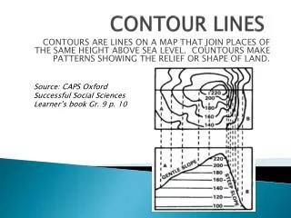
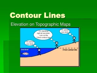
RULES of Contour Mapping. TOPOGRAPHY. The study of the shapes and features of the Earth’s surface. TOPOGRAPHIC MAPS. Map showing 3-dimensional shape and elevation of land in 2-dimensions. ELEVATION. Height above sea level. #1. A contour line represents a single equal elevation.

E N D
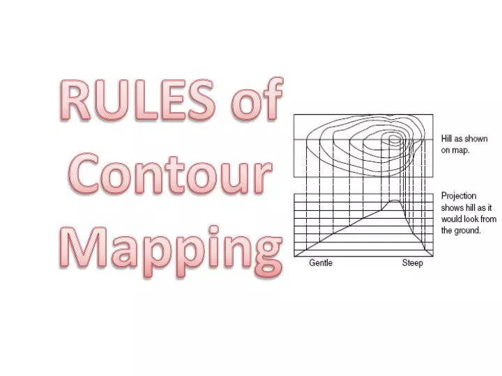
RULES of Contour Mapping
TOPOGRAPHY • The study of the shapes and features of the Earth’s surface. TOPOGRAPHIC MAPS • Map showing 3-dimensional shape and elevation of land in 2-dimensions ELEVATION • Height above sea level
#1. A contour line represents a single equal elevation. • All points on the same contour line have the same elevation. C D A B
Commonly, every 5th line is darker and the elevation shown. This is the index contour.
#2. Where one closed contour line surrounds another, the inner contour line represents the higher elevation.
#3. Elevation is determined by the contour line interval. Question: What is the contour line interval here?
#4.Closely spaced contour lines =steep slope.Widely spaced contour lines =gentleslope.
#5. Where a contour line crosses a stream or river, the contour line bends to form a “V” that points upstream.This is called the Rule of V’s
The hachures point into the depression. (Hachures = short dashes)
Contour Elevation Repeats A hachured contour line, lying between two different contour lines, is the same elevation as the lower contour line. Count up Count down