Download
1 / 6
530 likes | 1.77k Views
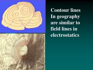
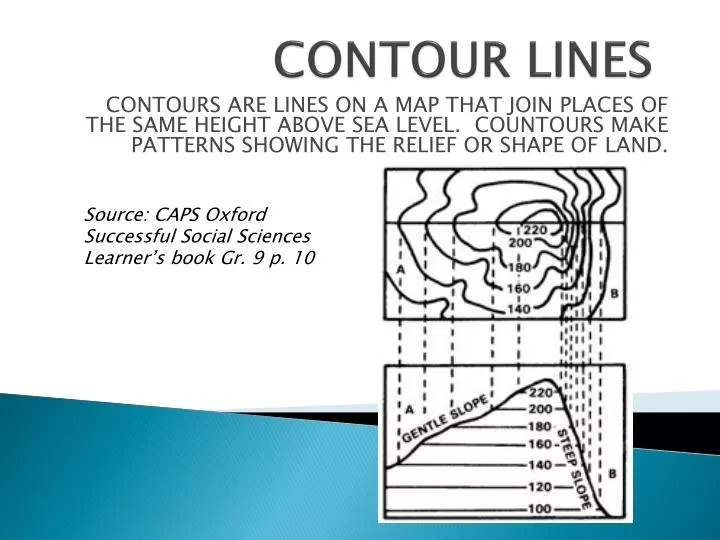
CONTOUR LINES. Source: CAPS Oxford Successful Social Sciences Learner’s book Gr. 9 p. 10. CONTOURS ARE LINES ON A MAP THAT JOIN PLACES OF THE SAME HEIGHT ABOVE SEA LEVEL. COUNTOURS MAKE PATTERNS SHOWING THE RELIEF OR SHAPE OF LAND. FACTS ABOUT CONTOURS:. Contour lines never cross one another.

E N D
CONTOUR LINES Source: CAPS Oxford Successful Social Sciences Learner’s book Gr. 9 p. 10 CONTOURS ARE LINES ON A MAP THAT JOIN PLACES OF THE SAME HEIGHT ABOVE SEA LEVEL. COUNTOURS MAKE PATTERNS SHOWING THE RELIEF OR SHAPE OF LAND.
FACTS ABOUT CONTOURS: • Contour lines never cross one another. • Contour lines can join to form a single contour line only where there is a vertical cliff • Contour lines never split. • When contour lines are far apart the slope is gentle. • When contour lines are close together the slope is steep. • When contours are evenly space the slope is uniform. • The difference in altitude between successive contours is know as the contour interval or the vertical interval. • Source: CAPS Spot On Social Sciences Learner’s Book Gr. 9 p. 2
STEEP AND GENTLE SLOPES: Contours on maps shows many different landscape features. These are illustrated by the way contours are arranged and spaced: • Contours that are close together indicate a steep slope and contours that are far apart indicate a gentle slope. • When contours are close at the top of the hill and gentle at the bottom, this indicates a concave slope. • When the contours are gentle at the top of the hill and close together at the bottom, this indicates a convex slope. • Source: CAPS Spot On Social Sciences Learner’s Book Gr. 9 p. 3
How height/altitude can be indicated on a map: • Contour lines are brown lines on a map joining points at the same height above sea level. Source: National Curriculum FOCUS on Map Skills Grades 10 – 12 p. 38
Spot heights are precise points whose altitudes are shown on maps • Bench marks are fixed points or a specific height above sea level that are marked on the ground. Source: National Curriculum FOCUS on Map Skills Grades 10 – 12 p. 38
Trigonometrical stations are survey points whose location and altitude have been precisely recorded The Beacon number is: TTP 303 The altitude (in meters) is: 1257m Source: National Curriculum FOCUS on Map Skills Grades 10 – 12 p. 38