Download

1 / 25
250 likes | 439 Views
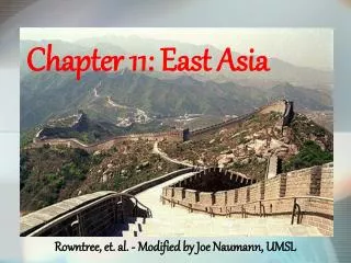
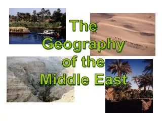
The Jewel of East Asia: China. A Look at Physical Features, Weather and Climate. China makes up approx 80% of the total land area of East Asia. Satellite Image of China. Vocabulary. ( He ) or ( Jiang )- both are Chinese words for river ( Shan )- Chinese for mountain

E N D
The Jewel of East Asia: China A Look at Physical Features, Weather and Climate
China makes up approx 80% of the total land area of East Asia Satellite Image of China
Vocabulary • (He) or (Jiang)- both are Chinese words for river • (Shan)- Chinese for mountain • Topography- Graphic representation of the surface features of a place or region on a map, indicating their relative positions and elevations • Tsunami- Seismic sea waves; usually occurs after earthquakes • Typhoon- Tropical cyclones (Eastern Hemisphere’s version of a hurricane)
Basic Geography Facts • Also known as the People’s Republic of China • Total surface area: 9,596,961 sq km • Capital: Beijing • Language: Mandarin Chinese • Religion: There is no national religion, but Buddhism and Taoism are very popular • Population: 1,273,300,000- China, including other East Asian countries, have a combined population of about 1.3 billion people. That is approx 25% of the world’s total population • Government: Communist • Major Imports/Exports: Machinery and Textiles • Currency: Yuan
Land size The image shows a superimposed picture of China’s landmass over that of the United States’. China is roughly one and a half times larger than the US. -US: 7,700,000 sq km -China: 9,596,961 sq km
Natural resources • China includes sizeable reserves of iron ore, tin, tungsten and gold • Large oil deposits lie in the South China Sea and the Taklimakan Desert • Coal deposits lie in northeastern China • Southern “Rice Bowl”- yields 2 harvests per year, making China the world’s largest producer of rice • Seafood farming- China harvests about 18 million tons of fish each year
The great wall of china First constructed in 221 BC during the Qin Dynasty, it helped to stop invaders from the North. Built entirely by hand, it is the longest structure ever built, spanning 5,500 miles. Other purposes of the Great Wall have included allowing for border control practices, such as check points allowing for the various imperial governments of China to tariff goods transported along the Silk Road, to regulate or encourage trade, as well as to control immigration and emigration. The defensive characteristics of the Great Wall were enhanced by the construction of watch towers, troop barracks, garrison stations, signaling capabilities through the means of smoke or fire, and the fact that the path of the Great Wall also served as a transportation corridor.
Topography • Moving from west to east, China is comprised of 4 descending land steps • Step 1: Plateau of Tibet (Highest point of steps) • Step 2: Basins and mountains • Step 3: Coastal plains and major rivers • Step 4: Continental Shelf (includes Hong Kong and Taiwan)
Renown Landforms • Himalayan Mts- Created by the slow motion collision of the Indian subcontinent with the southern edge of Eurasia over a total of 60 million years. The tremendous force also lifted up the Plateau of Tibet. Tallest mountain in the range is Mt. Everest at 29,029 ft above sea level. • Plateau of Tibet- A vast, elevated plateau covering most of Tibet which has an average elevation of over 4,500 meters. It is the highest and biggest plateau in the world with an area of 2.5 million square kilometers. The plateau is also known as the "Roof of the World”.
Landforms • The Himalayas • Plateau of Tibet
Mountains • Many mountain ranges fan out from an area in western China called the Pamirs. Ranges include the Kunlun Shan and the Tian Shan. The Kunlun Shan bend to become the Qin (Chihn) Ling Mtscrossing central China from west to east. • Farther north, the Altay Mts form a natural barrier between China and Mongolia • To the south and west, the Himalaya, separates China from South Asia
Terrace Farming • Even though China is a huge country, only 10% of the land can be used for growing crops. • Terraces allow farmers to grow rice in places that are fertile, but sloping • Terraced fields decrease erosion and surface runoff
Rivers • The Plateau of Tibet and the mountains give rise to all the principal rivers. China has 50,000 rivers, most of which flow from west to east and empty into the Pacific Ocean. • Northern China- The second longest river in China is the Huang He (Yellow River), which also rises in Tibet and travels through North China. It is one of the most polluted rivers in the world. • Central China- The Yangzi (Chang Jiang or Yangtze River), which rises in Tibet, flows through Central China, entering the Yellow Sea near Shanghai. The Yangzi is the third longest river in the world after the Amazon and the Nile spanning 3,965mi. • Southern China- The longest river in South China is the Zhu Jiang (Pearl River), which is 1376 miles long.
Three Gorges Dam Largest dam in the world Constructed to combat the dangerous over-flooding of the Yangtze River World’s second largest hydroelectric plant; can generate 18 million kilowatts of electricity= output of 18 nuclear plants (China needs clean, renewable energy)
The Gobi Desert 戈壁 • A large desert region in Asia. It covers parts of northern and northwestern China and southern Mongolia. • The Gobi is most notable in history as part of the great Mongol Empire and as the location of several important cities along the Silk Roads. • Much of the Gobi is not sandy but is covered with bare rock • The Gobi is a cold desert, and it is not uncommon to see frost and occasional snow on the dunes. Besides being quite far north, it is also located on a plateau roughly 3,000–5,000 ft above sea level, which further contributes to its low temperatures. • An average of approximately 7.6 in of rain falls per year in the Gobi. Gobi temp ranges from -40°F in winter to 122°F in summer.
戈壁 Gobi Satellite view Physical view
Vegetation by climate • East Asia’s natural vegetation tends to parallel the region’s climatic zones. • Mid-Latitude- needle leafed evergreens and broad leafed deciduous trees, bamboo, mulberry trees and the tea brush • Desert & Steppe- grasses and sparse trees • Highlands- grasses, flowers, trees, mosses and lichens • Tropical/Rainforest- palms, tropical hardwoods, broad leafed evergreens and tropical fruit trees
Bamboo Bamboo is a tough, versatile plant that has many uses ranging from medicine and food, to decoration and construction. Bamboo also serves as the only food source for two of East Asia’s rarest animals, the giant panda and the raccoon-like red panda.
Climate • East Asia has two contrasting climate zones; the dry interior west and the monsoon east. • Monsoon winds, caused by differences in the heat-absorbing capacity of the continent and the ocean, dominate the climate. • Alternating seasonal air-mass movements and accompanying winds are moist in summer and dry in winter. • Typhoons form in the Pacific and blow across coastal East Asia. They are most severe between late August and October.
Climate con’t • Because land heats up and cools off more than water, the interiors of large landmasses tend to experience intense cold in the winter and powerful heat in the summer. (ex: Gobi Desert) • During the dry winter monsoon, frigid (cold) air sweeps south and east through East Asia, producing bitter winters. (Nov-Mar) • In the summer, as the continent warms, the air above it rises, pulling in wet, tropical air from adjacent seas. Brings about 80% of the region’s rainfall. (Apr-Oct) Dry Interior West Monsoon East
Annual Precipitation Depicts the average rainfall amount in China. Most rain occurs in the south-southeast portion of the country. Information is from 2011.
Global Warming & its Affects on Weather Patterns • Global warming is a growing concern in East Asia. China now rivals the US as the world’s largest producer of greenhouse gases. • Glacial melting- The Huang He and Chang Jiang rivers are partially fed by glaciers in the Himalayas. As a result of the melting, there are lower flows in the rivers • Droughts- Triggered by periods of abnormal low rainfall and abnormally high temperatures • Flooding- Flooding already naturally occurs by the annual summer monsoons, but global warming can contribute to more severe and devastating floods. • Acid Rain- As East Asia/China continue to emit high levels of CO2 (Carbon Dioxide) and other greenhouse gases, as well as sulfur from the burning of coal, the pollution from these gases contribute to acid rain which is carried by the prevailing winds of the east.
Effects of Acid Rain Fish in a fishery are dead due to exposure of acid rain Stains caused by acid rain mark the ancient Leshan Buddha in China’s Sichuan province.