Download
1 / 17
190 likes | 562 Views
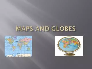
Globes and Maps. Globes. Globes are three dimensional representations of the earth. Maps. Maps are two dimensional representations of the earth. Map Projections.

E N D
Globes • Globes are three dimensional representations of the earth
Maps • Maps are two dimensional representations of the earth
Map Projections • Map projections are a way to draw maps in order to lessen distortion. There are different types of projections because people use maps for different reasons.
Mercator • The Mercator is used by ship navigators How do you identify it? • It is square • The latitude and longitude lines are at right angles • The top and bottom of the map are heavily distorted (Greenland is ginormous!)
Polar • The Polar projection is used by airline pilots because it shows the shortest distance between two points How do you identify it? • It is a circle • It only shows one hemisphere • The latitude lines are circles • The longitude lines radiate from the center
Robinson • The Robinson projection is used to compare data. How do you identify it? • It has curved sides • The longitude lines curve towards the north and south pole
Different Types of Maps • Political Maps • Physical Maps • Topographic Maps • Thematic Maps • Cartograms
Political Maps • Political maps show man-made features such as cities, states, provinces, territories, or countries (Page 21)
Physical Maps • Physical maps help you see the type of landforms and bodies of water in a specific area (Page 20)
Thematic Maps • Other types of thematic maps: • Population distribution and density • Economic activity • Resource • Language • Ethnicity
Thematic Maps • Other types of thematic maps: • Climate • Precipitation • Vegetation
Small Scale Maps • Maps can be large or small scale • A small scale map shows a large area but without much detail. • A small scale is used to see relative location in a region or between regions
Large Scale Maps • A large scale map shows a small area with much more detail • A large scale is used to see relative location within a region