Download
1 / 20
200 likes | 202 Views
This policy review examines the status and modernization program of the U.S. space-based positioning, navigation, and timing (PNT) system, with a focus on GPS. It highlights the objectives of the policy, implementation strategies, and improvements in system capabilities.

E N D
Global Positioning System:A Policy and Modernization Review June 13, 2006 ADS-B Working Group 13 Jun 2006 Michael E. ShawDirectorNational Space-Based PNT Coordination Office
Overview • U.S. Space-Based PNT Policy – Dec 2004 • GPS Status and Modernization Program • Summary
U.S. Policy • U.S. Space-Based Positioning, Navigation, and Timing (PNT) Policy • Signed on 8 Dec 04; publicly released on 15 Dec 04 • Updated U.S. policy while retaining prior GPS policy principles • Previous National Policy was “U.S. GPS Policy”– 1996
Need for Updated U.S. Policy • In past decade, GPS has grown into global utility • Integral to economic growth, transportation safety, homeland security, and critical infrastructure • Essential element of worldwide economic infrastructure • GPS is critical to U.S. national security • Integrated into virtually every facet of U.S. military ops • Number of GNSS systems and augmentations is expanding • Desire to improve existing USG management mechanisms for GPS and its augmentations
Policy: Objectives • Provide uninterrupted access to U.S. space-based PNT services for U.S./allied national security purposes • Improve the performance of space-based PNT • Ensure civil services exceed, or are at least equivalent to, those of foreign civil space-based PNT services • Includes robust resistance to interference for civil, commercial, homeland security, and scientific users worldwide • Provide space-based civil PNT services free of direct user fees on a continuous, worldwide basis • Civil, commercial, homeland security and scientific use
Policy: Objectives (cont’d) • Provide open, free access to information necessary to use these civil services • Improve capabilities to deny hostile use of any space-based PNT services • Without unduly disrupting civil and commercial access • Maintain the GPS as a component of multiple sectors of the U.S. Critical Infrastructure • Ensure that foreign PNT systems are interoperable with GPS • Or, at a minimum, are compatible
Policy Implementation • Established a stronger National Space-Based PNT Executive Committee; IGEB disestablished • Chaired by Deputy Secretaries of Defense and Transportation • Membership includes: State, Commerce, Homeland Security, JCS, and NASA • Supported by a new National Coordination Office • National Space-Based PNT Coordination Office established on 1 Nov 05 • Director, Deputy Director, and 6 staff
Policy Implementation (cont’d) • Major actions: • 5-Year National Space-Based PNT Plan in draft • International Strategy in final coordination • DHS Interference Detection and Mitigation Plan in final coordination • National Space-Based PNT Advisory Board being established • Nominations solicited; selection underway • Board will conduct studies and provide advice as directed by Executive Committee • Executive Committee has met three times – next meeting on 22 Jun
U.S. Policy Summary • Demonstrates U.S. Government commitment to space-based PNT for all stakeholders • Provides framework for public/private decision makers • Improves ability to coordinate efforts across the various agencies of the U.S. Government • Creates basis for meaningful dialogue between service providers and end users • Promotes common standards for worldwide interoperability
Overview • U.S. Space-Based PNT Policy – Dec 2004 • GPS Status and Modernization Program • Summary
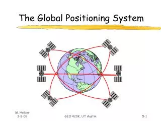
GPS Constellation Status 29 Operating Satellites (nominal constellation: 24) • 16 Block II/IIA satellites operational • 13 Block IIR satellites operational • Modernizing 8 Block IIR satellites • 1st Block IIR-M in orbit (25 Sep 05) • Set operational on 16 Dec 05 • Continuously assessing constellation health to determine launch need • Next launch: NET 14 Sep 06 • Global GPS civil service performance commitment met continuously since Dec 03
GPS Modernization Increasing System Capabilities w Increasing Defense / Civil Benefit Block IIA/IIR Block IIR-M, IIF Block III • Basic GPS • SPS Performance Standard • Single frequency (L1) • Coarse acquisition (C/A) code navigation • Precise Service (16m SEP) • Y-Code (L1Y & L2Y) • Y-Code navigation • Backward compatibility • 4th civil signal (L1C) • Increased accuracy • Increased anti-jam power • Assured availability • Navigation surety • Controlled integrity • Increased security • System survivability • IIR-M: IIA/IIR capabilities plus • 2nd civil signal (L2C) • M-Code (L1M & L2M) • IIF: IIR-M capability plus • 3rd civil signal (L5) • Anti-jam flex power
L2C code Second Civil Signal (L2C) • Improves service for ~ 50,000 current scientific/ commercial dual-frequency users • Will enable higher civilian accuracy when combined with existing civil GPS signal (L1 C/A) • Overcomes some limitations of L1 C/A • Improved data structure will reduce interference • First L2C capable satellite (IIR-M) operational • Signal defined in ICD-GPS-200D Begins with IIR-M sats First launch: Sep 2005 24 Satellites: ~2014
Third Civil Signal (L5) • New signal structure for enhanced performance • Higher power than other GPS civil signals • Higher power (no less than -154.9 dBW) • Wider bandwidth (1176.45 MHz +/- 10 MHz) • Improves resistance to interference • Co-primary allocation with Aeronautical Radionavigation Services (1164-1215MHz) • Signal defined in IS-GPS-705 Begins with IIF sats First launch: ~2007* 24 Satellites: ~2016 L5 code * Currently Reassessing Date
GPS III Civil Benefits • Backward compatibility with existing receivers • Operational capability for L2C and L5 • In combination with GPS IIR-M and IIF satellites • Opportunity to converge with Galileo Open Service – GPS L1C • Significant increase in system accuracy • Improved availability of accuracy with integrity • Flexibility to respond to evolving requirements with limited programmatic impacts
Fourth Civil Signal (L1C) • Modernized L1 civil signal • In addition to C/A code for backward compatibility • Binary Offset Carrier [BOC] (1,1) modulation • Increased robustness and potentially accuracy for civil users • Establishes a common baseline L1 open service signal for GPS and Galileo Begins with GPS III sats First launch: ~ 2013 L1C For additional information: L1C_GPS@USGS.gov
Today’s Civil GPS Performance • GPS SPS Performance Standard – October 2001 • Defines performance the U.S. Gov’tcommits to provide to civil GPS users • Identifies standards U.S. Gov’t uses to manage GPS • 24 operational satellites must be available on orbit with 0.95 • probability • At least 21 satellites in the 24 nominal plane/slot positions must be set healthy and transmitting a navigation signal with 0.98 probability
Overview • U.S. Space-Based PNT Policy – Dec 2004 • GPS Status and Modernization Program • Summary
Summary • Implementing U.S. National Space-Based PNT Policy • Coordination Office activated on 1 Nov 05 • First new civil/military GPS signals operational • Further enhancements continuing through GPS III • Fielding of GPS augmentations continuing • Other GNSS systems are being implemented • US-EC GPS-Galileo Working Groups • Compatibility and interoperability are critical
Michael E. Shaw, Director National Space-Based PNT Coordination Office Herbert C. Hoover Bldg., Rm. 6822 1401 Constitution Avenue, NW Washington, D.C. 20230 Ph: (202) 482-5809 Fax: (202) 482-4429 michael.shaw@PNT.gov Presentation available: PNT.gov/public Contact Information