Download
1 / 11
110 likes | 113 Views
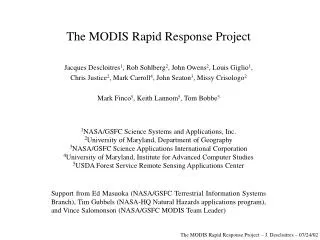
The MODIS Rapid Response Project: Near-Real-Time Processing for Fire Monitoring and Other Applications. Jacques Descloitres 1 (jack@ltpmail.gsfc.nasa.gov), Jeff Schmaltz 1 , John Seaton 3 , Holli Riebeek 1 , Jack O’Bannon 2 Collaborators:

E N D
The MODIS Rapid Response Project: Near-Real-Time Processing for Fire Monitoring and Other Applications Jacques Descloitres1 (jack@ltpmail.gsfc.nasa.gov), Jeff Schmaltz1, John Seaton3, Holli Riebeek1, Jack O’Bannon2 Collaborators: Louis Giglio1, Chris Justice2, Rob Sohlberg2, Diane Davies2, Ana Pinheiro1, Assaf Anyamba4, Matt Hansen2, Jim Tucker5, Suresh Kumar2, Mark Sullivan2 1NASA/GSFC Science Systems and Applications, Inc. 2University of Maryland College Park, Department of Geography 3NASA/GSFC Science Applications International Corporation 4NASA/GSFC University of Maryland Baltimore County 5NASA/GSFC Biospheric Branch Supported by NASA’s Earth Science Applications Program, the MODIS Team Leader, and the USDA Foreign Agricultural Service Start-up support from USDA Forest Service Remote Sensing Applications Center and Fire Sciences Lab, and NASA/GSFC Terrestrial Information Systems Branch The MODIS Rapid Response Project – J. Descloitres – MODIS Science Team Meeting, 07/13/04
MODIS Rapid Response System Overview (1/2) • A few months after Terra was launched in December 1999, the Earth Observing System Data and Information System (EOSDIS) faced a number of system contingencies and was not able to meet most users requirements with respect to data production and distribution • In mid-2000 the MODIS fire detection product and other MODIS science products were generated approximately 2 months after acquisition, which did not meet the needs of users such as the USDA Forest Service and the fire community (12-24 hours data turnaround requirement) • In August-September 2000 the MODIS Science Team at NASA/GSFC and University of Maryland developed manual workarounds to provide MODIS fire data to the USDA Forest Service during the intense burning episode in Montana and Idaho, laying the foundations of the MODIS Rapid Response Project • Proposed solution: develop an alternate processing and distribution system capable to meet the needs of a small user community (Forest Service), with a small number of products (fire detection), and a limited geographic coverage (United States) The MODIS Rapid Response Project – J. Descloitres – MODIS Science Team Meeting, 07/13/04
MODIS Rapid Response System Overview (2/2) • Approach: create a new model of user-driven processing system, flexible enough to conciliate users requirements and production constraints. In particular this model proposes to address some shortcomings of the EOSDIS: • data turnaround (need for near-real-time data) • format and size of the products (too challenging) • product specifications (need for tailored products & DB products) • data distribution (too complicated) • The MODIS Rapid Response System was rapidly developed in 2001 using NOAA’s “bent pipe” data feed to generate fire products within 2-3 hours after data acquisition, and immediately received a lot of positive feedback from the Forest Service and the international fire community • The MODIS Rapid Response System rapidly grew and developed new products and new partnerships, including several federal agencies (USDA Forest Service, National Interagency Fire Center, USDA Foreign Agricultural Service, Environmental Protection Agency, U.S. Air Force, U.S. Navy) • The RR staff is building on the MODIS Science Team expertise to guarantee product quality and product consistency while developing alternate products to meet special users requirements • Sciences codes developed in the Rapid response System are packaged and distributed to the Direct Broadcast users community The MODIS Rapid Response Project – J. Descloitres – MODIS Science Team Meeting, 07/13/04
Active Fire Detection (Thermal Anomalies) Product • Same code as the “offical” MOD14 thermal anomalies product • Exploits strong emission of mid-infrared radiation from fires • Contextual algorithm (Giglio et al., 2003), using the neighboring pixels to characterize the backgroung, and determine fire pixels that stand out significantly from the background • The natural variability of the surrounding background is taken into account • Absolute threshold (360K) used for extremely obvious fires • Fewer false detections than traditional threshold-based algorithms • Sensitive enough to detect small fires California – 10/26/03 The MODIS Rapid Response Project – J. Descloitres – MODIS Science Team Meeting, 07/13/04
Corrected Reflectance Product • Performs a simple atmospheric correction with MODIS visible and near-infrared bands (1 to 7) • Correction for molecular (Rayleigh) scattering and gaseous absorption (water vapor, ozone) • No real-time input or ancillary data necessary • Uses climatological values for gas contents • No aerosol correction • Science algorithm very similar to MOD09 surface reflectance in clear atmospheric conditions (based on 5S/6S radiative transfer model) - Departs from MOD09 in presence of aerosols Hurricane Isabel (09/18/03) The MODIS Rapid Response Project – J. Descloitres – MODIS Science Team Meeting, 07/13/04
Vegetation Indices Product • Straightforward implementation of NDVI and EVI derived from the corrected reflectance product • The RR NDVI/EVI product can be generated for a single swath (compared to MOD13 16-day composite) • The RR NDVI/EVI currently performs no correction for directional effect (opposed to MOD13) • Quality may be degraded in presence of aerosols The MODIS Rapid Response Project – J. Descloitres – MODIS Science Team Meeting, 07/13/04
Surface Temperature Australia, 09/01/03 (Aqua) • Based on the split-window algorithm developed by Wan et al., 1996 for the standard Land Surface Temperature product • New implementation for near-real-time applications by Ana Pinheiro • No real-time ancillary datasets are needed • Monthly climatological data sets are used for surface air temperature and water vapor climatology (TOVS, 1 deg. x 1 deg.) • Land-cover-based emissivity • Typical RMS difference with standard LST product: 0.5K The MODIS Rapid Response Project – J. Descloitres – MODIS Science Team Meeting, 07/13/04
MODIS Rapid Response Distribution Automatic subsets • Browse-and-click interface • Thumbnail available for each image • Multiple spatial resolutions, multiple band combinations, multiple products • Gallery images are georeferenced (“world file” available for GIS users) • Link to actual data at the DAAC (WHOM and Data Pool), link to ECHO client planned • Over 160 application-specific automatic subsets Web Fire Mapper at Univ. of Maryland Flash-based interactive viewer Near-real-time “browse” imagery The MODIS Rapid Response Project – J. Descloitres – MODIS Science Team Meeting, 07/13/04
Current Status in Numbers • Level 0 received: 150G/day (Terra and Aqua) • Approximately 450 granules processed each day • Level 1 generated: 600G/day • Level 2 generated: 200G/day • Over 4,000,000 files downloaded from the Rapid Response web site in the past 12 months alone by over 350,000 unique visitors (traffic increase rate 2x each year) • The RR imagery was featured in hundreds of TV, web, and print news stories • The RR System is the main contributor to MODIS PR and outreach: as of July 1, 2004 nearly 4,000 gallery images are available on the MODIS RR web site (also archived by NASA’s Visible Earth) The MODIS Rapid Response Project – J. Descloitres – MODIS Science Team Meeting, 07/13/04
Monitoring of volcanic eruptions Crop monitoring and forecasting Flood mapping Burned area mapping MODIS Rapid Response applications Dust storm monitoring Oil well fires monitoring Coastal waters monitoring Fire detection Sea-ice monitoring The MODIS Rapid Response Project – J. Descloitres – MODIS Science Team Meeting, 07/13/04
Summary • The MODIS Rapid Response Project has developed a new model for providing near-real-time value-added products to application users • The RR System offers a reliable alternate source of MODIS near-real-time science products, bridging some of the gaps left by the EOSDIS - The MODIS RR data is now operationally used by the national and international users community • The RR System builds a link between the applications users and the science team, the data production system, and missions operations • The MODIS Rapid Response Project is a major outreach vehicle, and brings visibility to MODIS and particularly the land products For more information and more images http://rapidfire.sci.gsfc.nasa.gov The MODIS Rapid Response Project – J. Descloitres – MODIS Science Team Meeting, 07/13/04