Download
1 / 8
80 likes | 198 Views
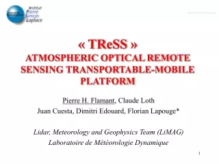
TReSS (Transportable Remote Sensing Station) in Tamanrasset. Overview of TReSS Status of implementation on April 1 st 2006 Operations in the framework of the AMMA lidar network. TReSS science objectives and teams. Main objective: Improved knowledge of heat low dynamics and

E N D
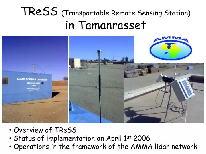
TReSS (Transportable Remote Sensing Station) in Tamanrasset • Overview of TReSS • Status of implementation on April 1st 2006 • Operations in the framework of the AMMA lidar network
TReSS science objectives and teams Main objective: Improved knowledge of heat low dynamics and aerosolradiativeproperties in the heat low region Ancillary objective: CAL/VAL for CALIPSO and the A-Train Funded by API & CNES & IPSL • TReSS team: • Cyrille Flamant (IPSL/SA, CNRS, Paris, France) • Juan Cuesta (IPSL/LMD, CNRS, Palaiseau, France) • Pierre Flamant (IPSL/LMD, Palaiseau, France) • Dimitri Edouart (IPSL/LMD, Palaiseau, France) • Claude Loth (IPSL/LMD, Palaiseau, France) • Jacques Pelon (IPSL/SA, CNRS, Paris, France) • Support teams: gratefully acknowledged ! • Algéria:OMN in Algers and Tamanrasset • France: L. Gomes (CNRM) & K. Desboeufs (LISA) & M. Legrand (LOA)
What is TReSS? • TReSS is an autonomous and high-performance system designedto • observe radiative and structural properties of clouds and aerosol layers, • as well as atmospheric boudary layer dynamics. • The standard payload is made of the following instruments: • 1) a multi-wavelength elastic backscatter Mini-Lidaroperating at 532 and • 1064 nm (with diverse polarization capabilityat 532 nm), • 2) a sun-photometer, • 3) an IR radiometer, • 3) a full sky visible channel web-type camera. • For the AMMA SOP period, the platform capability will be enhancedwith: • an Optical Depth Sensor (for daytime and nighttime measurements), • a CLIMAT radiometer • a sonic anemometer • aGRIMM for size distribution measurements • a nephelometer operating at 880 nm • filters for chemical speciation (in collaboration with LISA) The above instrumentation will also be enhanced by the measurements conducted routinely by the Météo Algérienne: balloon soundings (x4 during the SOP), surface Meteorological measurements, radiative measurements, ozone integrated column
TReSS measurements • Aerosol and molecular extinction coefficient profiles (30 mvertical • resolution, 10 s temporal resolution) km-1 • Aerosol layers optical and geometrical depths unitless and m • ABL depth m • Thick cloud base altitude m • Thin cloud optical and geometrical depths (15 m res) unitless and m • Total aerosol optical depth at 8 wavelengths from the sunphotometer • (340, 380, 440, 500, 670, 870, 936 and 1020 nm) and 2 wavelengths • (330-400 and 780-1100 nm) for the ODS unitless • Integrated water vapor content kg m-2 • IR irradiance in the 8-13µm, 11.5-12.5 µm, 10.5-11.5 µm, 8.2-9.2 µm • and 9.5-11.5 µm ranges W m-2 • Full-sky visible images (10 s temporal resolution) • Surface sensible heat flux (5 min. temporal resolution) W m-2 • Aerosol size distribution between 0.1 and 5 µm (3-6 hourly) µm3 µm-2 • Aerosol phase fonction in the 45°-90° ranges (5 min. res) sr-1
Schedule of AMMA SOP operation SOP 1a SOP 0 (almost) Installation & first measurements SOP 2a2 SOP 2a1
Status of implementation Failure • The multi-wavelength backscatter Mini-Lidar seriously damaged during • transportation between Algers and Tamanrasset • New laser and new telescope are needed!! • Replacement scheduled for SOP 1a Operational • Sun-photometer operational since 16/02/06 (data transmitted to • AERONET and available on the web) • CLIMAT radiometer operational since 17/02/06 (data transmitted to • M. Legrand at LOA via internet) • Sonic anemometer operational since 18/02/06 (installed on 10 m mast) • Size distribution measurements operational since 18/02/06
Status of implementation Tested / will be running during lidar operations • Full sky visible channel web-type camera • IR radiometer • Nephelometer To be installed / tested (before SOP 1a) • Optical Depth Sensor (for daytime and nighttime measurements) • Filters for chemical speciation
TReSS-lidar measurements in the framework of the lidar network • IOPs: • Day J: continuous • Days J-1 & J+1: continuous ?? • Outside IOPs: • 4 h around 12 z (flexible) • Important issues associated with networking: • to document the diurnal cycle of relevant variables in the heat low • region (ABL structure, aerosol content and properties, etc..), • to document diurnal cycle of relevant variables NORTH and SOUTH • of the ITF, • to document the diurnal cycle of relevant variables before and after • the passage of MCSs (not really relevant for TReSS, but….), • validation CALIPSO products over the Sahara, which will in turn be • used to analyze the mesoscale/large scale variability of the PBL/SAL • and aerosol properties.