Download
1 / 23
230 likes | 378 Views
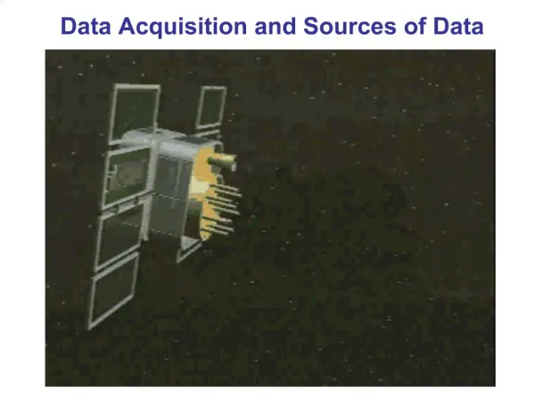
Data Acquisition and Sources of Data. 1. Photogrammetry. Photogrammetry is the art and science of determining the position and shape of objects from photographs. object interpretation (What is it? Type? Quality? Quantity) and object measurement (Where is it? Form? Size?).

E N D
1. Photogrammetry • Photogrammetry is the art and science of determining the position and shape of objects from photographs. • object interpretation (What is it? Type? Quality? Quantity) and object measurement (Where is it? Form? Size?). • The result of photo-interpretation is the classification of objects by various features • The main use of photogrammetry is in the production of topographic maps. • From topomaps, one can create DTM • Data can be processed in various ways in GIS • Photogrammetry can be used to create dense fields of fixed point which can serve as basis for further ground surveys and cadastral surveys like determination of coordinates of boundary points.
Aerial photogrammetry is mainly used to produce topographic or thematic maps and digital terrain models. • Among the users of close-range photogrammetry are architects and civil engineers (to supervise buildings, document their current state, deformations or damages), archaeologists, surgeons (plastic surgery) or police departments (documentation of traffic accidents and crime scenes), just to mention a few.
Photogrammetry • Close-range photogrammetry has a range of 1m to 100m, with special cameras developed for such use, particularly stereo cameras.
Principally, photogrammetry can be divided into: • Depending on the lens-setting: • Far range photogrammetry • Close range photogrammetry • Another grouping can be • Aerial photogrammetry (which is mostly far range photogrammetry), and • Terrestrial Photogrammetry (mostly close range photogrammetry).
Photogrammetry versus Remote Sensing • Remote sensing seems to replace the terms air-photo and photography. • RS was formally used in 1962 at a symposium on Environmental Remote Sensing by the American Society of Geography. Space technology and spectral technology were already available that time • In 1972, with the American LANDSAT, RS received gains and support from NASA and other international organizations, and it came in full speed.
Photogrammetry versus Remote Sensing • Remote sensing is defined in broad sense as the “acquisition of information about an object without physical contact”. • By Shupeng (1990): “RS refers to the various types of non-contact and distant detecting technology. It employs electromagnetic waves to recognize the qualities and dynamic status of land objects from platforms in distance, at high altitude or even from outer space.” • In comparison, there is no fundamental difference between “photogrammetry” and “remote sensing”.
Photogrammetry versus Remote Sensing • Where the Difference Lies? • It lies in the changes in the discipline brought about by the progress made in technological means. • The technological means make the two look like one discipline in two different ages. • Around 1960 – photogrammetry is the best term and then gradually becoming as RS.
Photogrammetry versus Remote Sensing Changes in the Technological means: • The availability of space technology • The rapid development of computer technology • The addition of multi-waveband data acquisition methods
Photogrammetry versus Remote Sensing • Thus, Remote Sensing is the further development of photogrammetry!
2. Terrestrial Acquisition • Classic Surveying • Surveying is the art of making measurements of the relative positions of natural and man-made features on the earth’s surface. • Geodetic surveying – takes into account large areas and the earth’s curvature. • Plane Surveying – relatively small areas are involved and the earth taken as flat.
Terrestrial Acquisition Branches of Surveying: • Topographic Survey – produce maps and plans of the natural and man-made features. spot heights are shown on plans, also the height information. • Engineering Survey – this embrace all the survey work. • Cadastral Survey – Undertaken to produce plans of property for legal purposes. In many countries the registration of ownership of land is based on such plans.
Terrestrial Acquisition Surveying Equipment: - engineer’s level - engineer’s transit - electronic distance measurement (EDM) - Total station
Terrestrial Acquisition • The Global Positioning System (GPS) • It is a space-based navigation and positioning system that was designed by the U.S. military to allow a single soldier or group of soldiers to determine their position to within 10 to 20 meters of truth.
Terrestrial Acquisition • Who are using GPS? • Almost anyone who needs to know where they are and where they are going. • Three major segments of GPS • Space segment (the constellation of satellites) • Control segment (how the integrity of both the data and the satellites are maintained and transmitted) • User segment (all end users who have the GPS receivers)
Terrestrial Acquisition • How the GPS work? • GPS is a distance ranging system. It operates on the principle of trilateration. • It determines the position of an unknown point by measuring the lengths of the sides of a triangle between the unknown point and two or more unknown points.
How Does GPS Work? 5 Steps to GPS 3 To measure speed of light you need good clocks and some tricks. 4 Once you know distance, you need to know satellite’s position. 2 To triangulate GPS measures distance using speed of light. Then correct for ionospheric and atmospheric delays. 5 1 Triangulation from satellites is basis of system.
Satellite-based Uses trilateration from satellites • 24 satellites in final constellation • 21 operational, 3 spares • Satellites in very high orbit (11,000 miles) • for accuracy and less interference • survivability • coverage • Only possible with today’s technology • computers and clocks
Differential GPS the ultimate in accuracy • Uses two GPS receivers together, one moving, the other stationary • Stationary receiver is at known location • Stationary receiver compares calculated position with known location to get error • Transmits error to moving receivers
GPS Stations The Coast and Geodetic Surveys Department of the National Mapping Resources Information Authority (CGSD/NAMRIA) has established five (5) new GPS stations within the campus of the University of San Carlos - Technological Center at Talamban, Cebu City, Philippines upon request and through the efforts of the Water Resources Center (WRC) and the USC GIS Center. With DENR A.O. 22 (1994), the new GPS stations are CBU-117, CBU-118, CBU-119, CBU-120 and CBU-121 adding to the Philippines Geodetic Network of GPS Stations. ...”In case there are no PRS-92 reference points, CGSD/NAMRIA shall be requested to establish and observe at least a pair of intervisible reference monuments within or near the area pursuant to Sections 486–487 of the Manual of Land Surveys of the Philippines (MLSP) and in accordance with this Order. These PRS-92 reference points shall be part of the traverse of the new survey.” “The densification of the first order PRS-92 National Network shall be a 2nd and 3rd Order accuracy. CGSD/NAMRIA is responsible for the establishment of 2nd and 3rd Order control stations throughout the country.” Therefore, these new GPS stations are established on the 3rd Order accuracy (that is, the positioning accuracy is 50 parts per million - 1/20,000 - 5 cm /km, and with vertical accuracy of 12.0 mm. times square root of the distance).
Examples of Sources of Data • Socio-economic Data • Field surveys • - much data used in marketing is gathered by door-to- door or street interview • - field surveys require careful sampling design • how to obtain a representative sample • how to avoid bias toward certain groups in street interviews • Government statistics • - statistics collected and reported by government as part of required activities, e.g. Bureau of the Census • - usually based on entire population, except sampling is used for some Census questions • Government administrative records • - records are collected by government as part of administrative functions, e.g. tax records, auto registrations, property taxes • - these are useful sources of data provided confidentiality can be preserved • - usually available only to government or for research purposes
Examples of Sources of Data • Socio-economic Data • Secondary data collected by another group, often for different purposes • - e.g. the original mandated purpose of the Census was to provide data for congressional districting • Increasingly socio-economic data is available in digital form from private sector companies • - retailers and direct-mail companies are major clients for these companies • - includes data originally from census augmented from other sources and surveys • - data can be customized for clients (special sets of variables, special geographical coverage or aggregation) • - customizing justifies costs, which are often higher than for "raw" census data