Download
1 / 5
50 likes | 178 Views
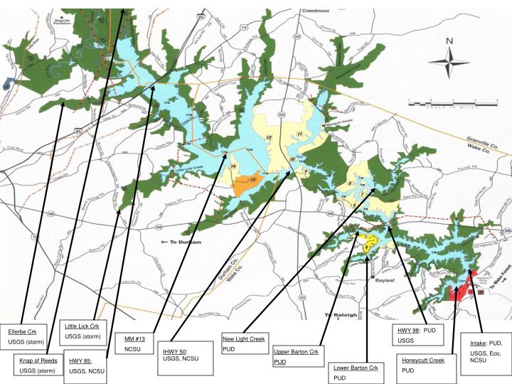
Little Lick Crk USGS (storm). HWY 98 : PUD USGS. Ellerbe Crk USGS (storm). MM #13 NCSU. New Light Creek PUD. Intake : PUD, USGS, Eco, NCSU. IHWY 50 : USGS, NCSU. Upper Barton Crk PUD. Honeycutt Creek PUD. Knap of Reeds USGS (storm). HWY 85: USGS, NCSU. Lower Barton Crk PUD.

E N D
Little Lick Crk USGS (storm) HWY 98: PUD USGS Ellerbe Crk USGS (storm) MM #13 NCSU New Light Creek PUD Intake: PUD, USGS, Eco, NCSU IHWY 50: USGS, NCSU Upper Barton Crk PUD Honeycutt Creek PUD Knap of Reeds USGS (storm) HWY 85: USGS, NCSU Lower Barton Crk PUD
City of Raleigh’s network of automated RTRM platforms to track environmental conditions in the upper, middle, and lower Falls Lake water supply (temp., pH, DO, turbidity, chla, phycocyanin…) 2009-10