Download
1 / 24
240 likes | 395 Views
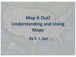
Understanding Maps and Diagrams. The connected body of salt water covering the greater part of Earth’s surface. A. Ocean. B. Sea. A large body of salt water completely or partially surrounded by land. Man floating on the Dead Sea in Israel. C. Gulf. A portion of the sea narrower

E N D
The connected body of salt water covering the greater part of Earth’s surface A. Ocean
B. Sea • A large body of salt water completely or partially surrounded by land Man floating on the Dead Sea in Israel
C. Gulf • A portion of the sea narrower at the mouth than a bay Satellite image of the Gulf of Mexico
D. Lake • A body of water completely surrounded by land Lake Nasser located in southeast Egypt
E. Reservoir • A natural or artificial lake used to store water Gelmersee, a reservoir located in Switzerland
F. River • A stream of water that flows across the land and empties into another body of water Thames River located in London, England
G. Mouth • The place where a river empties into a larger body of water Orange River located in South Africa, typically flows into the Atlantic Ocean, however at times is blocked by sand bars.
H. Glacier • A slowly moving mass or river of ice formed by the accumulation of snow Glacier in the mountains of Argentina Thames River located in London, England
I. Island • A body of land completely surrounded by water Small island in the Adriatic Sea (located on the western side of Italy)
J. Peninsula • A body of land surrounded on three sides by water Peninsula in an unknown location
K. Continent • A large land mass surrounded by water • Europe is accepted as a continent even though it is not completely surrounded by water Satellite picture of South America
L. Hill • A rounded raised landform; not as high as a mountain “Rolling” hills in Ireland
M. Mountain • A high landform with steep sides; higher than a hill Rocky Mountains in Colorado
N. Mountain Range • A row or chain of mountains The Himalaya Mountains as seen from the International Space Station
O. Mesa (Spanish for Table) • A hill with a flat top; smaller than a plateau Mesa located outside of Los Alamos, New Mexico
P. Plateau • An area of high land between hills or mountains Mount Roraima in Venezuela
Q. Valley • An area of low land between hills or mountains Picture from a boat in the Rhine River located in Germany
R. Desert • A dry environment with few plants and animals Thar Desert near Jaisalmer, India
S. Plain • A large area of nearly flat land The Nullarbor Plain in Australia, close to the Indian and Pacific Oceans
T. Basin • A bowl shaped landform surrounded by higher land Pyramid Lake, Nevada
U. Delta • Land made of silt left behind as a river drains into a larger body of water Danube Delta between Romania and Ukraine
V. Region • An area on the earth’s surface (defined by certain characteristics) • can change over time Coastal Plains in the United States
W. Culture • Attributes, behavior, and characteristics of a group of people Initiation ritual in Malawi for the Yao tribe.